One of the highlights of my Iceland trip was the Thorsmork Super Jeep Tour. Þórsmörk (Thorsmork) is a nature reserve in the southern Icelandic highlands. It is one of Iceland’s most popular hiking destinations and an amazing location for photography and sightseeing. Thorsmork was named after Thor, the Norse god of thunder, and translates to “Valley of Thor” in English. Thorsmork is defined by a central valley surrounded by three glaciers: Eyjafjallajökull in the South, Tindafjallajökull in the North, and the largest Mýrdalsjökull in the West. The three glaciers feed three rivers, Krossa, Thronga, and Markarfljot which flow together through the valley and create the amazing scenery of the valley. Since Thorsmork is protected on its sides by the glaciers it has a warmer climate than the rest of Southern Iceland, allowing moss, ferns, birchwoods, and other small shrubs to grow more easily than other parts of the island.
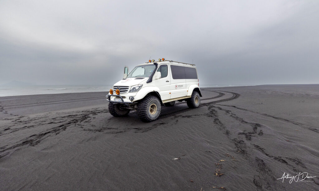
The drive into Thorsmork is long and challenging, and involves several river crossings. There are several signs along the way discouraging tourists from trying to make their way in, but we saw quite a few who drove as far as they could and hiked the rest of the way. The two most common ways to visit Thorsmork are by private Super Jeep Tour or public bus. Either way works, but I felt like we were able to see a lot more of the interesting sights inside the reserve in our Super Jeep. Here’s a link to the tour company I used: Midgard Adventures Super Jeep Tour. Very highly recommended. Their base camp in Hvolsvöllur even included a place to stay and a very nice restaurant.
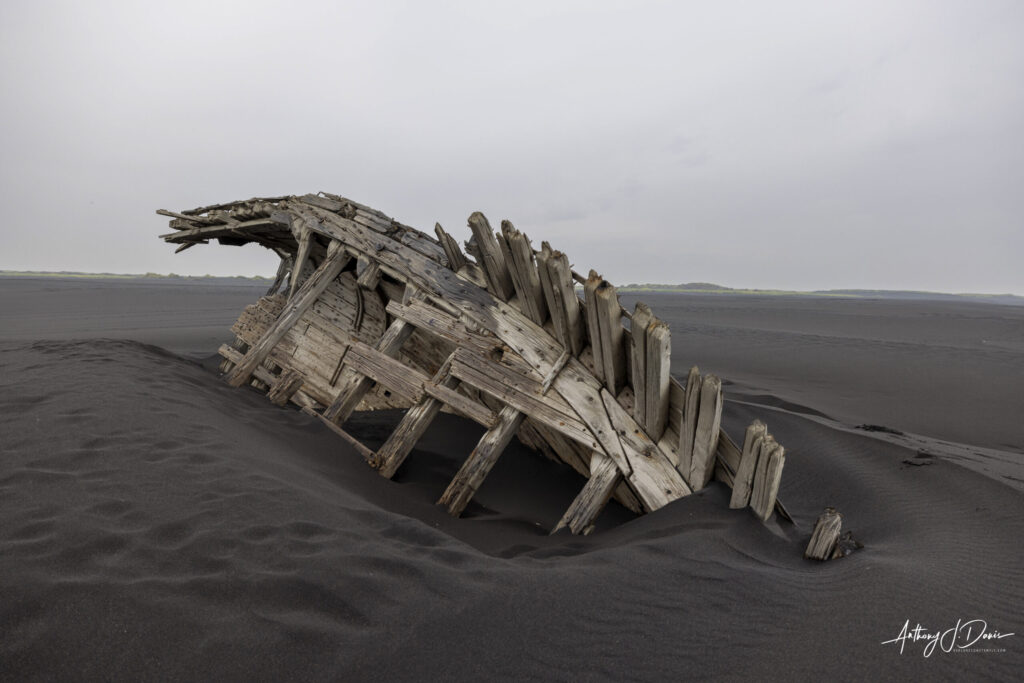
It’s not part of the nature reserve, but the first stop on our Thorsmork Super Jeep Tour was at Landeyjahöfn black sand beach. Landeyjahöfn beach is located on the southern coast of Iceland, about 150 km southeast of Reykjavik and right next to the Landeyjahöfn harbour where ferries to Westman Islands depart. While it’s not as well known as some of the other black sand beaches on Iceland, Landeyjahöfn is the longest beach and seemingly the least visited by tourists. It also has the benefits of a nice ship wreck on the beach and a view across the channel of the Westman Islands.
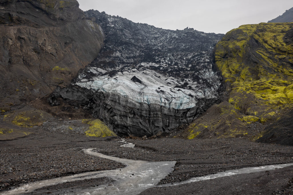
Next we stopped at Gígjökull glacier. Gígjökull is the largest outlet glacier of Eyjafjallajökull, an ice-capped volcano that became famous when it erupted in 2010. Gígjökull was undermined by lava flows during the eruption, causing massive floods down the Thorsmork valley. The glacier has recovered well from the eruption, although it is still mostly covered with volcanic ash. You can read more about the evolution of this glacier on the Glacier Change website. This was one of the times on the trip I wished I would have had time to fly my drone. We could just see the edge of the glacier from the view point, but I could imagine the sweeping view of Eyjafjallajökull that was hiding right on the other side.
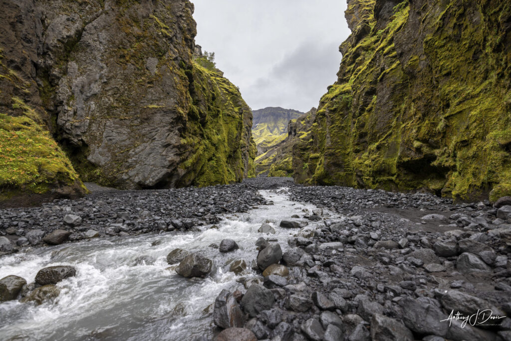
Our next amazing stop was a hike up Stakkholtsgjá canyon. Stakkholtsgjá is approximately 100 metres deep and two kilometres long. Several small streams run through the canyon, and though it is relatively wide at its entrance, it narrows towards its end.
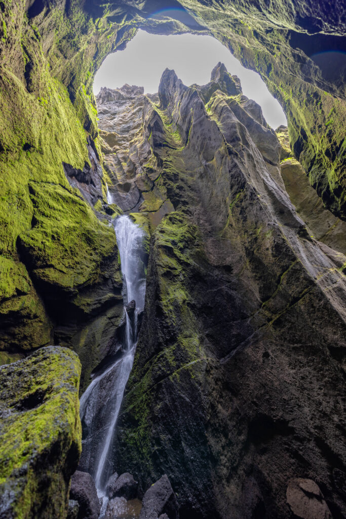
As you approach the end of the canyon it narrows and turns to the right where a very pretty waterfall is hidden in a cave.
The hike through Stakkholtsgjá and back takes approximately an hour and a half. Though the trail is not paved, it is relatively flat and should be comfortable for most, including children. The main concern on the hike is the fact that it is intersected by many streams; while they are shallow, the rocks beneath can be slippery. Visitors are recommended to bring sturdy sandals or waterproof boots to change into when fording. Care should also be taken around the waterfall, which is also very damp.
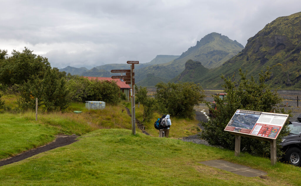
Another great stop on our Thorsmork Super Jeep tour was at Langidalur, a beautiful valley in the central Thorsmork area. Langidalur is a popular destination for hikers and nature enthusiasts due to its stunning landscapes, hiking trails, and proximity to glaciers and mountains.
Thorsmork is also famous for being one end of the world-renowned Laugavegur hiking trail, which connects Thorsmork’s Langidalur valley to the Landmannalaugar area through the Highlands. This is the most popular multi-day highland hike in the country, taking between four to six days to complete. Landmannalaugar is a stunning region in Iceland’s highlands, renowned for its vibrant, multi-colored rhyolite mountains and geothermal hot springs. Langidalur is the other end of the trail and is a popular camping area near the center of Thorsmork.
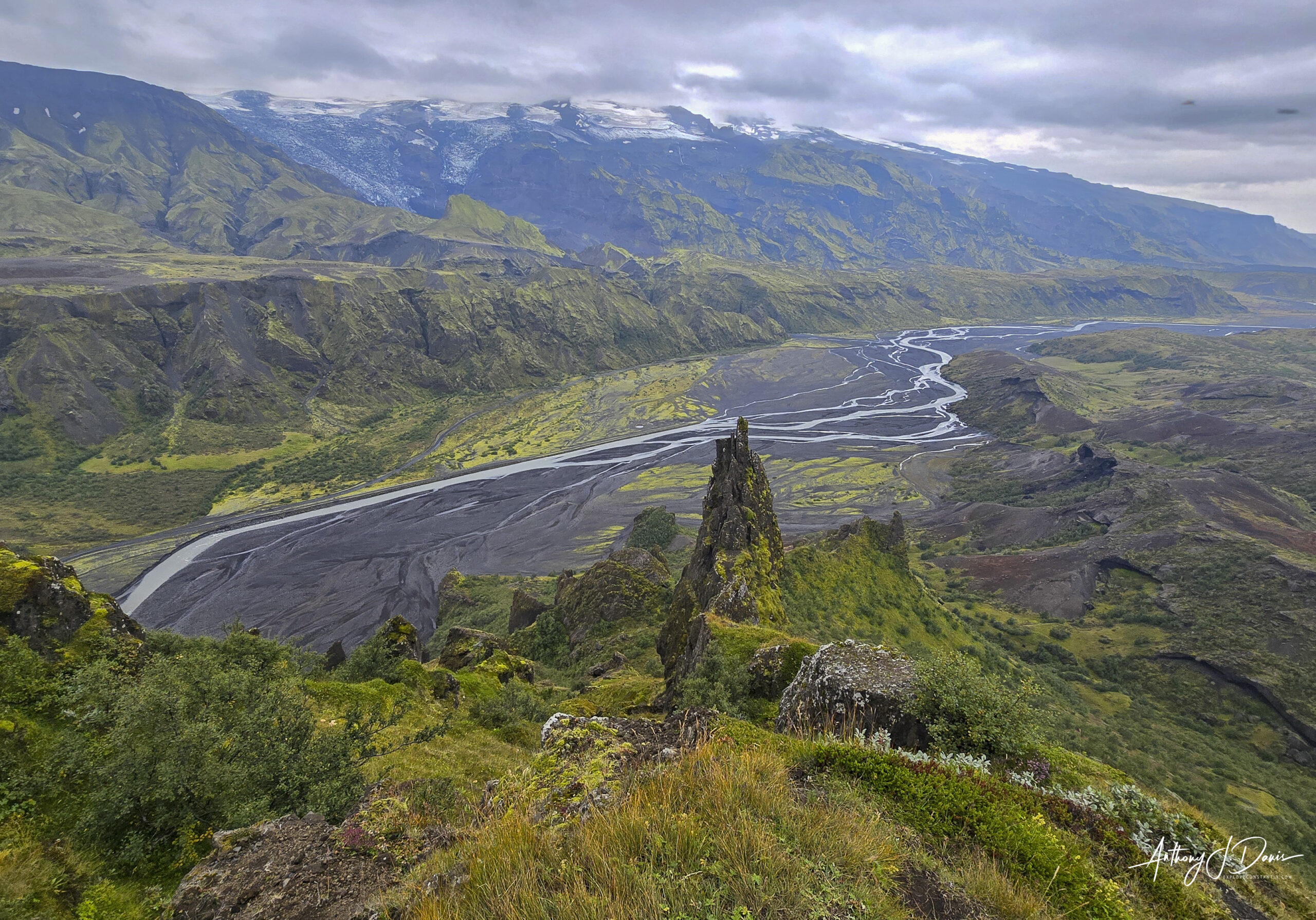
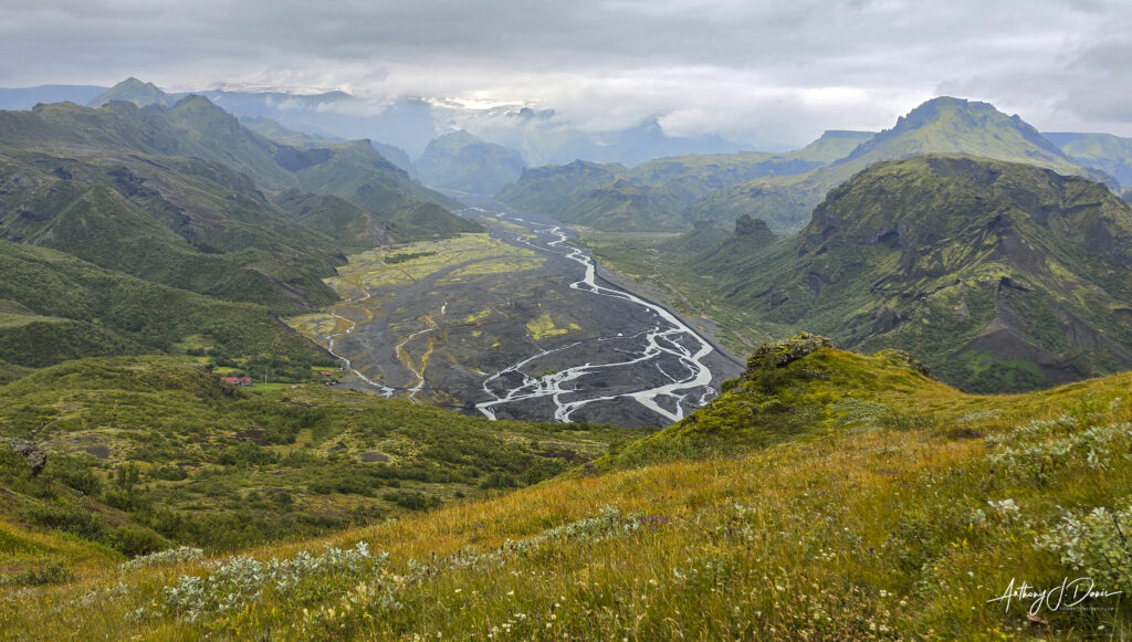
Langidalur camping area is also the home of the trail to the Valahnúkur mountain summit. The Valahnúkur trail from Langidalur is a 1.4 mile (each way) hike up 1,500 ft (458 meters) to the summit of Valahnúkur. While the hike is fairly steep and rocky, it rewards you with possibly the best panoramic views in Iceland, a 360 degree view over Þórsmörk Valley and the surrounding rivers and glaciers. It was truly one of the highlights of my entire trip.

0 Comments