

Bryce Canyon National Park, located near Tropic, Utah, is home to the world’s largest grouping of hoodoos. Hoodoos are the distinctive rock formations found throughout Bryce Canyon. The hoodoos are are pillars of sandstone and other fine-grained sedimentary rock created by the processes of uneven weathering and erosion. Hoodoos are amazing natural features and Bryce Canyon contains literally hundreds of hoodoos in a relatively small, reasonably accessible area. Bryce Canyon National Park is the third largest of Utah’s national parks, and at more than 147 thousand acres is less than half the size of the largest (Canyonlands National Park).
Bryce Canyon Hoodoos
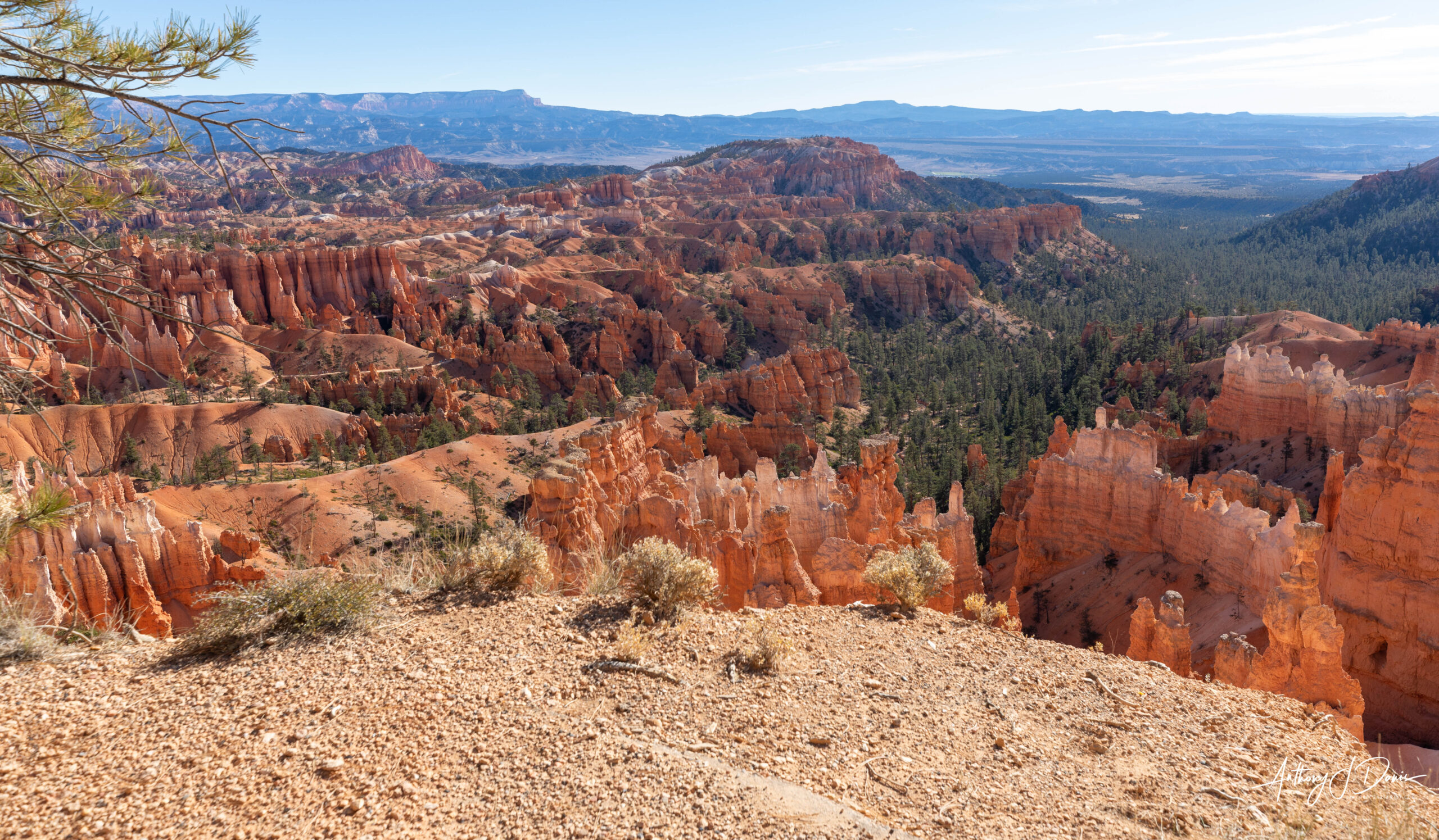
The rim area of Bryce Canyon National Park is easily accessible by the Rim Trail. The Rim Trail features several beautiful scenic overlooks, as well as trailheads for numerous trails down into the canyon. Bryce’s Rim Trail is 5.5 miles from one end to the other and follows the rim from Bryce Point to Inspiration Point, Sunset Point, Sunrise Point and then to Fairyland Point.
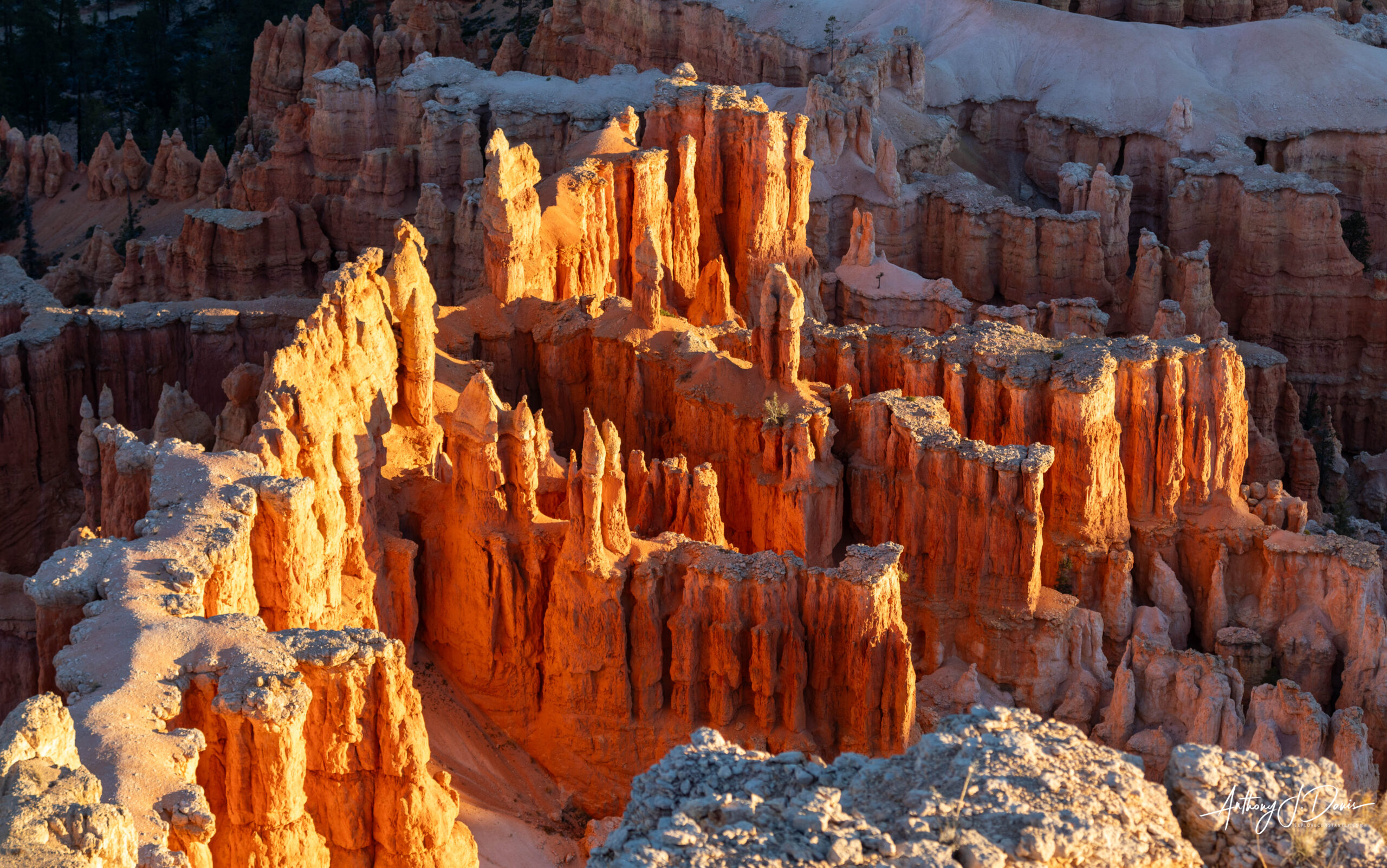
The rim trail observation points provide some of the most amazing views in the park. The viewpoint at Inspiration Point has viewing stations on three levels that provide varied spectacular perspectives of the main Bryce Canyon amphitheater. These viewpoints look toward Silent City (near Sunset Point) with its many rows of hoodoos set against the backdrop of Boat Mesa. In our case we enjoyed the view from Inspiration Point at Sunset.
View from Inspiration Point
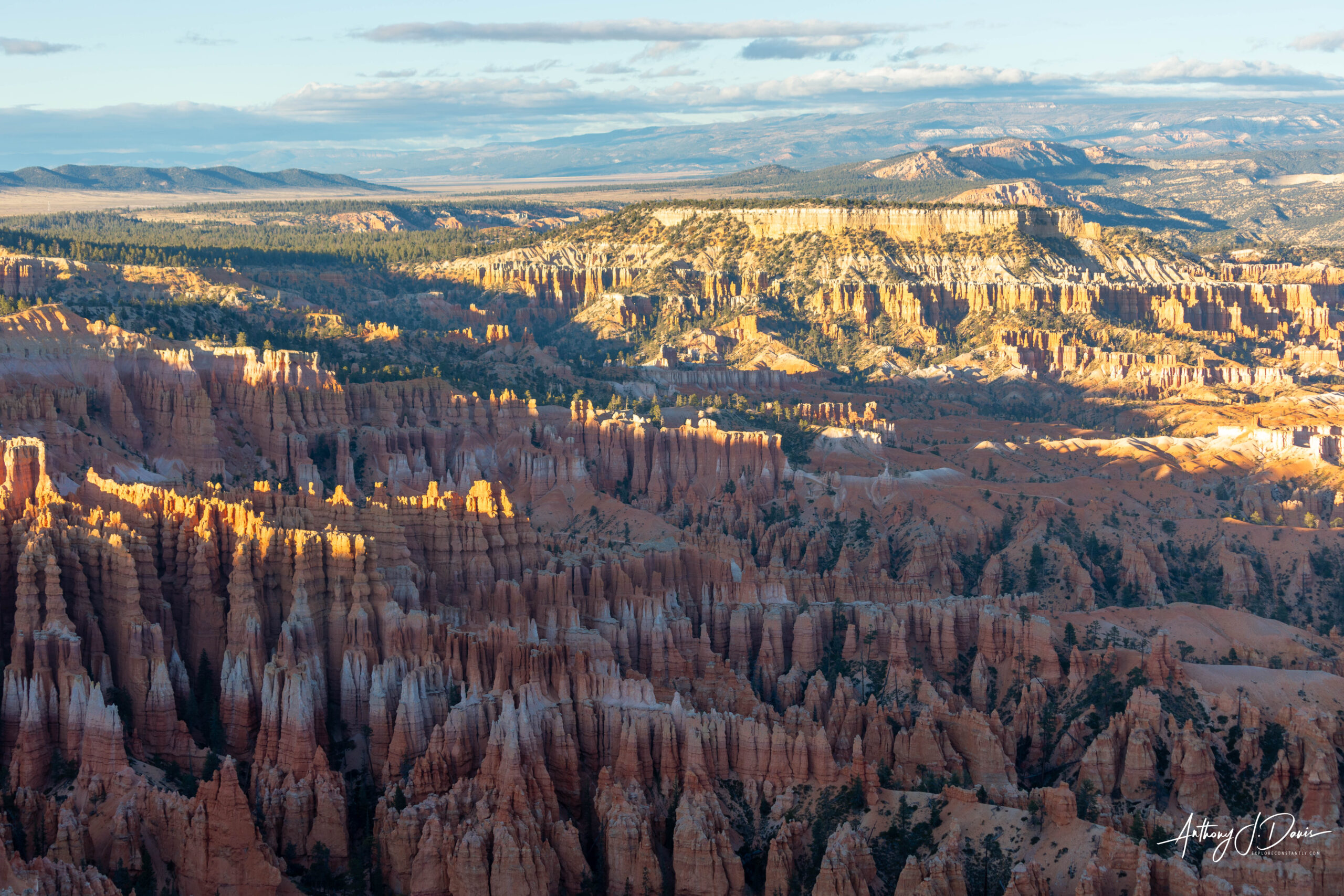
Bryce Point is famous for its view to the north, across the full scope of the Bryce Amphitheater. Inspiration, Sunset, and Sunrise Points can all be seen along the forested edge nearby. Famous geologic features visible from here include the Wall of Windows near Inspiration Point, dense rows of hoodoos forming Silent City beside Sunset Point, and the flat top of Boat Mesa seen north of Sunrise Point.
Sunrise light at Bryce Point
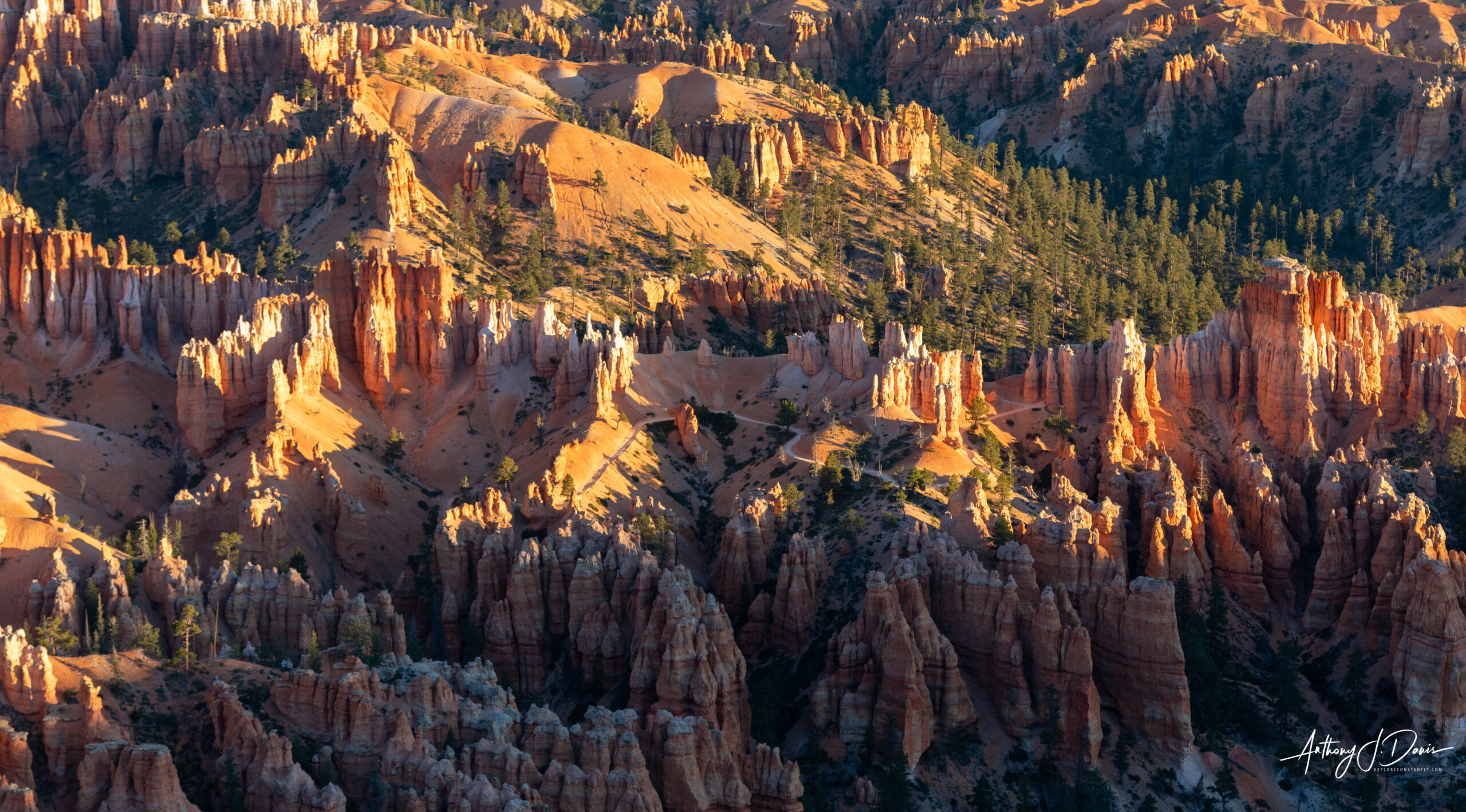
Sunset Point offers different views of the Silent City and overlooks Thor’s Hammer directly below.
View from Sunset Point
The view to the northeast from Sunrise Point captures Boat Mesa and the Sinking Ship, set against the stark Pink Cliffs of the Aquarius Plateau. Boat Mesa rises above the hoodoos of Fairyland Canyon to an elevation of 8073 feet. We didn’t take any photos from Sunrise Point.
Two of the most popular trails in Bryce Canyon are Navajo Loop and Queen’s Garden trails. Together the two are a 3.1 mile loop with interesting switchbacks down into the Bryce Canyon Amphitheater and provides close up views of Thor’s Hammer and Queen Victoria.
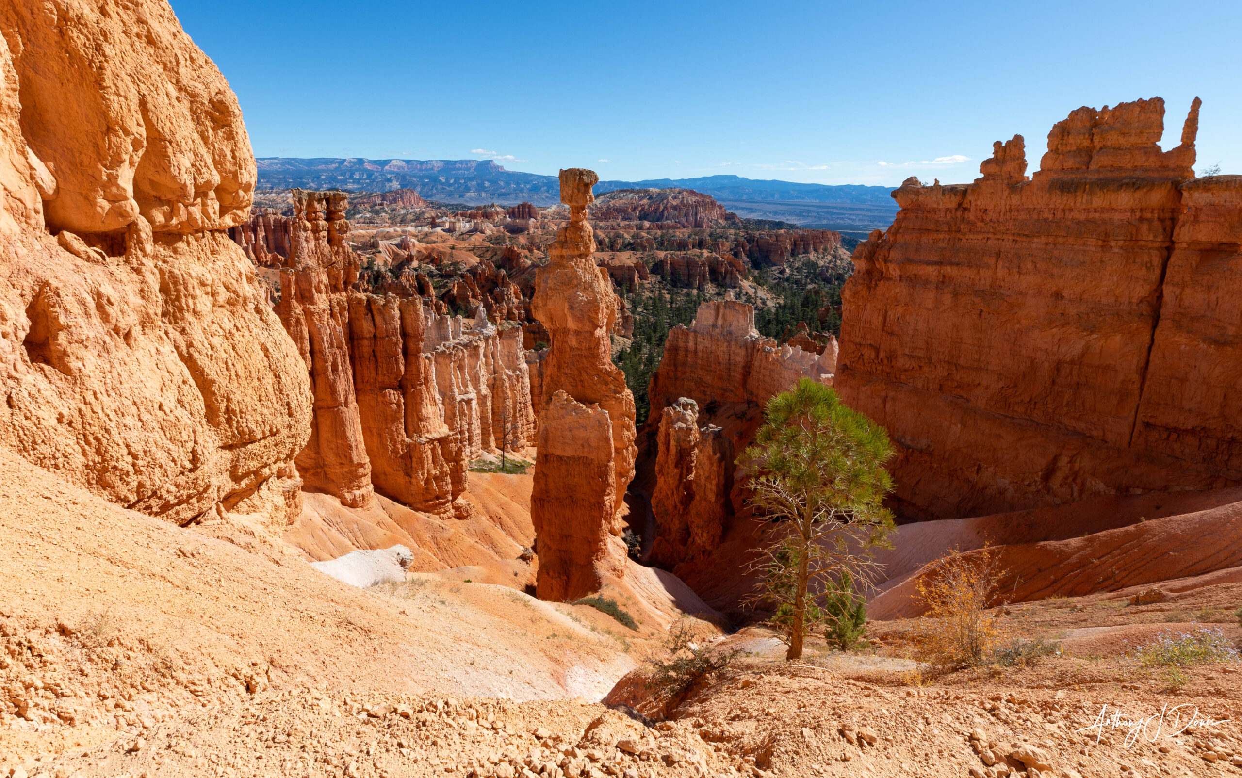
Thor’s Hammer in Navajo Loop Trail


0 Comments