

October proved to be a great time to visit Fairbanks, Alaska. Fairbanks is located approximately 350 miles North of Anchorage and 500 miles South of Prudhoe Bay, on the Northern Coast of Alaska. Fairbanks is also located approximately 200 road miles (140 air miles) from the Arctic Circle. Fairbanks is one of the best places in the world to see the Northern Lights, because of it’s location within the auroral zone (a radius of approximately 1550 miles around the North Pole) and it’s large amount of nighttime skies (up to more than 20 hours of darkness during the December solstice season. The main limiting factor is the combination of auroral activity and clear nighttime skies, making February/March and September/October the most likely times for viewing.
Fairbanks is the second largest city in Alaska, with a population of just over 32,000 in the 2020 census. You can read more about our stay in downtown Fairbanks in this post: Downtown Fairbanks Sightseeing.
We visited Fairbanks on a photography trip with Backcountry Journeys, a well-established photography tourism company that offers lodge-based Photography Tours as well as wilderness camping trips in the most pristine and remote mountains, deserts, and wildlife-rich areas of the world. Learn more about Backcountry at: Backcountry Journeys Home. We were extremely lucky to have a very knowledgeable and experienced photographer and arctic guide leading our group. Alex Joseph Hansen is a very talented young photographer whose work seeks to blend the lines between wilderness and adventure photography. Read more about Alex and see some of his outstanding work here: Alex Joseph Hansen.
We did a LOT of driving around the Fairbanks area at night looking for clear skies and Auroral activity. We basically drove around from 9:00 pm or so until 3:00 or 4:00 in the morning most of the nights and slept during the day. We were successful on three out of the six nights we looked for the lights and found them at several different locations. It was very interesting to learn that while the Northern Lights are visible in a dark sky to the naked eye, they aren’t nearly as bright as pictures and videos lead you to believe. Even in the very dark skies outside Fairbanks we used long exposures, high ISOs, and wide open aperatures (most of us around f/2.8) to capture the images we saw with our minds eye.
Here is a list of some of the locations we visited, and some more information about each.
Night 1: We traveled north on the Elliott Highway towards Livengood and the start of the Dalton Highway. This night was very cloudy, and we didn’t see any Northern Lights.
Night 2: Alex had a nice cabin rented for us with a fire pit outside and a pit toilet close by. Quartz Lake State Recreation Area is a 600 acre park that features two lakes, several hiking trails, great fishing and boating, and more than 100 campsites. Since it was winter and it was fairly cold, we had the campground pretty much to ourselves. There were a lot of great photo foreground settings available here, but most of us gravitated towards the edge of the lake and the resulting reflections. The Lights came out for us around midnight, after we’d settled in around the fire, and continued dancing until well after 4:00 am.
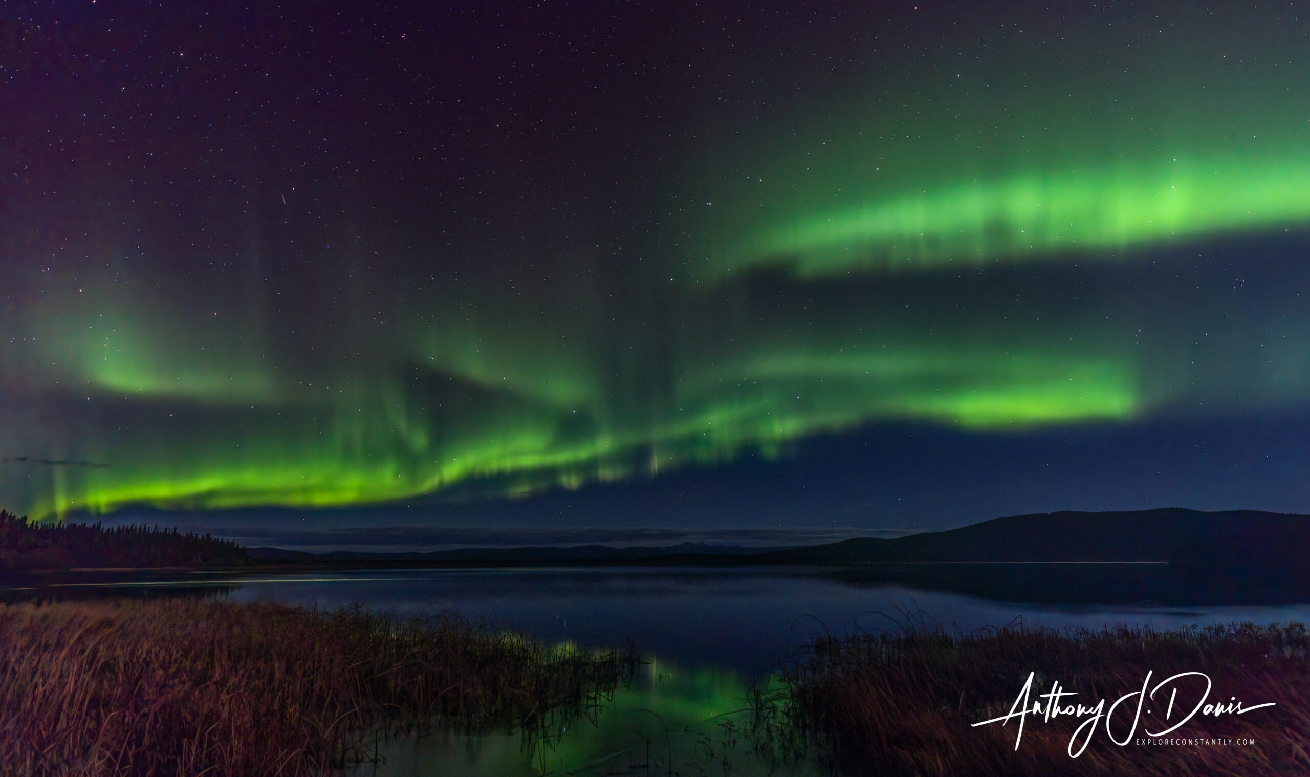
Quartz Lake Northern Lights
Night 3: This night we once again headed north on the Elliott, where we found a faint show of Northern Lights along the highway. We liked the setting though, with the road, trees, and Big Dipper all there to support the lights.
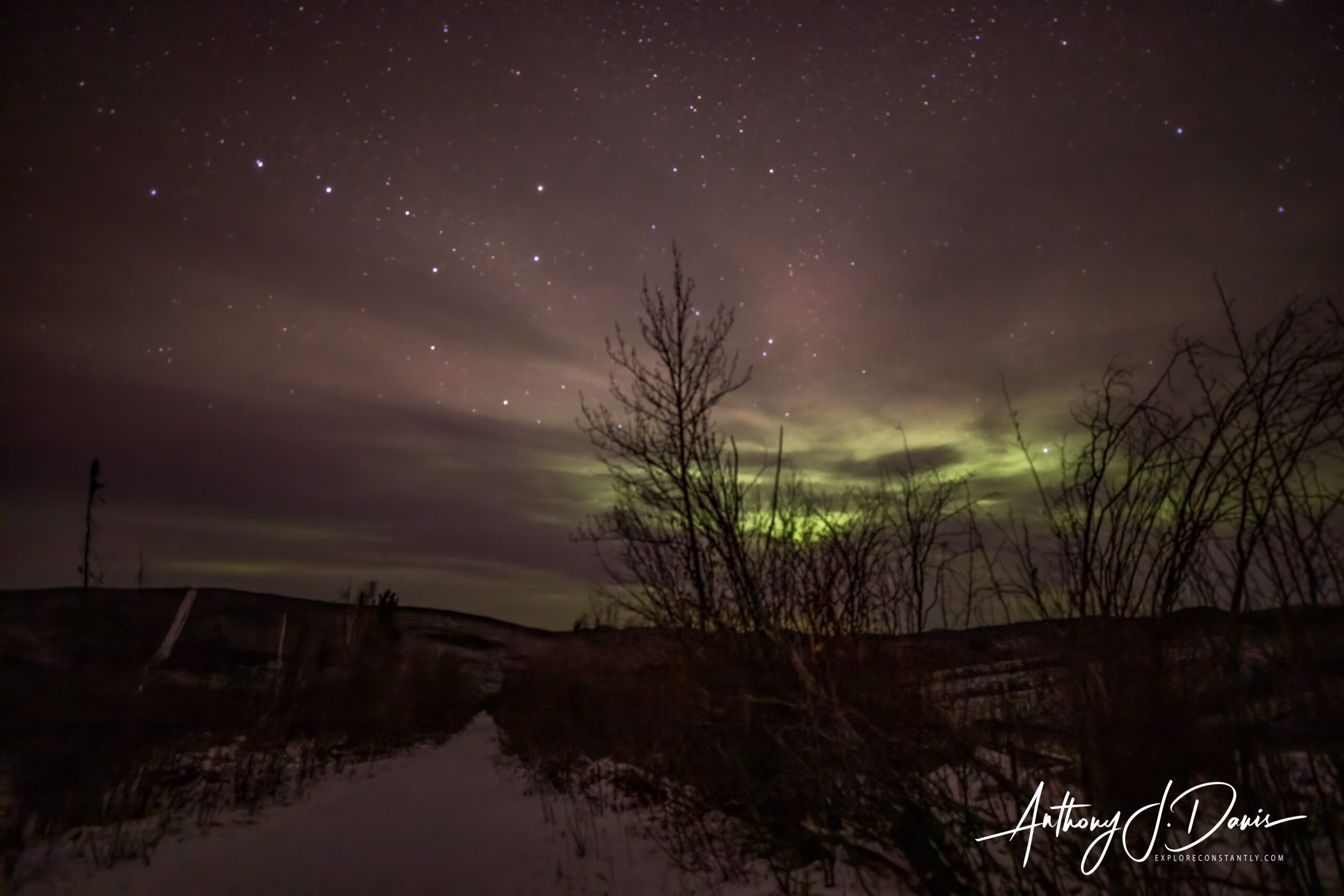
Northern Lights with Big Dipper
After a time we continued Northeast on the Steese Highway, but didn’t find any more photo ops that night.
Night 4: Another night driving up and down the Elliott highway looking for a break in the clouds. We found an open spot near Olnes Pond to stop for some photos. The Northern Lights at this location looked like a laser beam shooting across the sky.
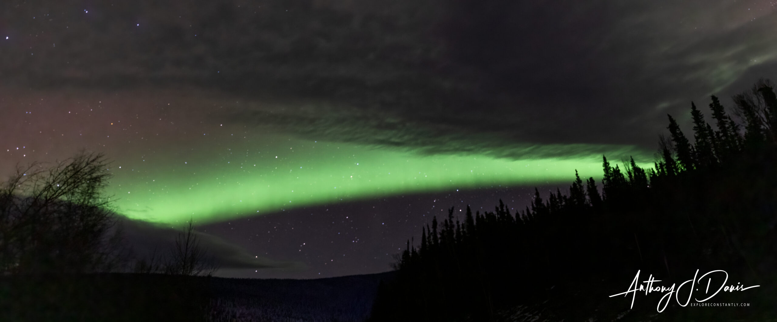
Elliot Highway Laser Beam
After the first stop, we stopped again at a highway pullout to view and photograph more lights on the way back towards Fairbanks. These were our most impressive lights of the trip, it truly looked like the sky was exploding with light.
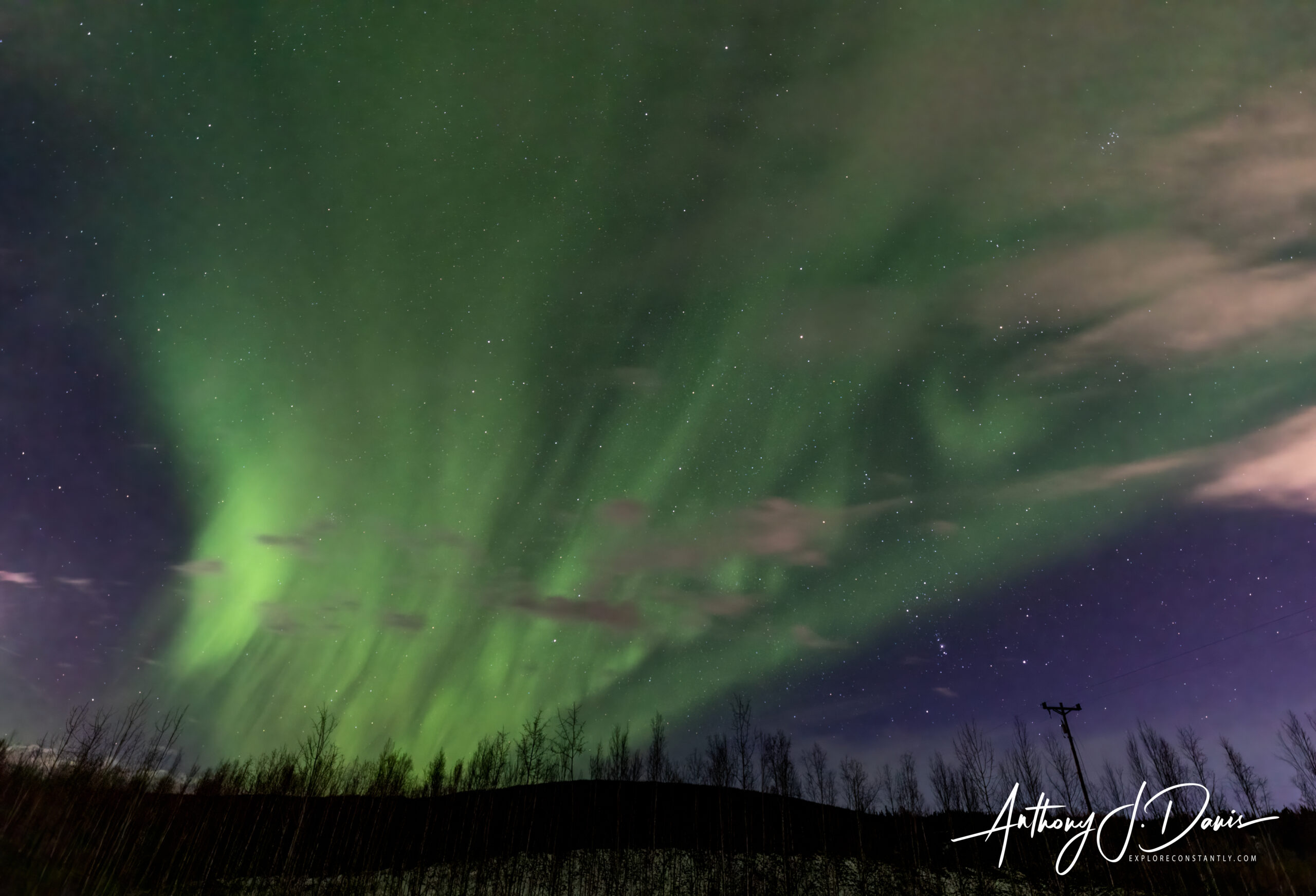
Elliot Highway Explosion
Night 5: The 5th night was forecast to remain cloudy most of the night. So, we left a little early and visited the Chena Hot Springs Resort. The Resort is located about 60 miles East/Northeast up the Chena Hot Springs Road, and is the first major right turn off the Steese Highway as you head North from Fairbanks. The Resort is a large facility with a lodge, restaurant and bar, ice museum, and of course the hot springs. The hot springs building features large changing and shower rooms, indoor hot tub and heated pool, and a boulder lined outdoor lake that’s really the center of activity. The lake has a flat and solid sand bottom that’s easy to navigate, stone and concrete benches to sit on in the water, and a handicap accessible ramp leading into the water. The hot springs come out at 165 degrees Fahrenheit, but there is plenty of room in the lake to move around and find the perfect temperature for everyone.
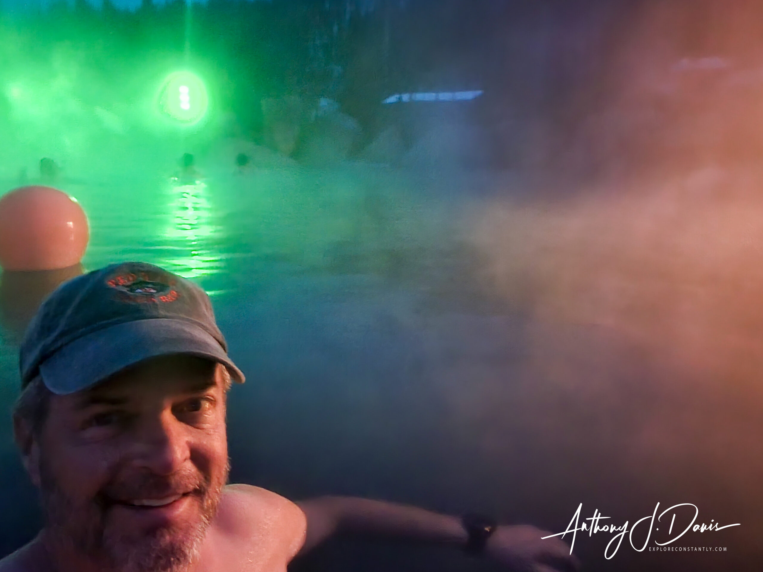
Tony in Chena Hot Springs
Night 6: The last night looking for lights found us traveling South again toward Quartz Lake. We had blizzard conditions and very poor visibility this night, so we turned around near Birch Lake and headed back to the hotel early. Birch Lake is a smaller lake than Quartz at 48 acres. But, it features both a State Recreation Site and a military Recreation Area that are basically next door neighbors. The State Site offers camping, swimming, fishing, jet skiing, and water skiing in summer and ice fishing and snowmachining in the winter. It also has a nice public use cabin that sleeps six, has a wood burning stove, and has a nearby pit toilet. This is where we had our special end of trip dinner, hand prepared for us by our talented guide Alex. The military Recreation Area has similar facilities, including a lodge, cabins, camper pads, showers and a picnic area. There is also a playground and sandy beach in the common area. A picnic pavilion with sand volleyball pit is available for reservation, and several types of boats are available for rent at the lake.
We also made several separate scenery stops to shoot photos in the daytime as well as at night. Those stops are listed below.
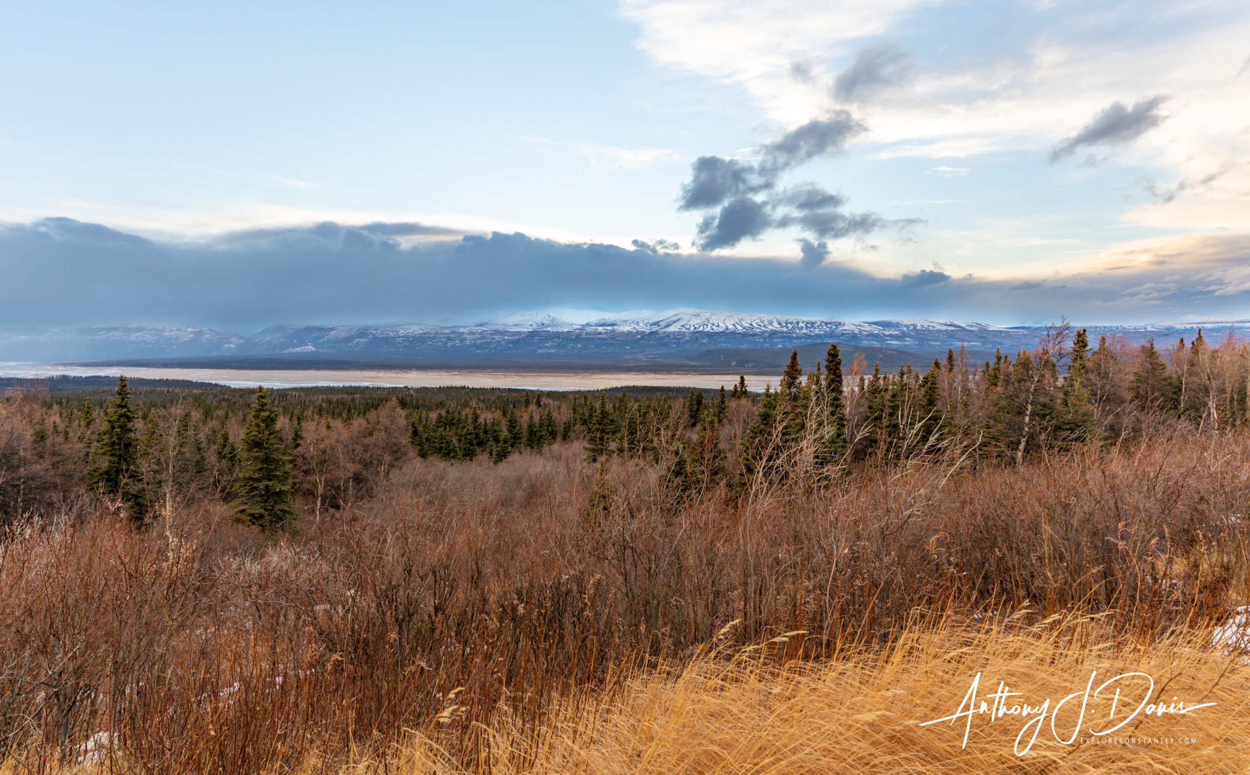
We stopped at several scenic overlooks along the highway South towards Delta Junction where we photographed the Delta Range, Eastern Alaska Range, and various spots along the Tanana River. While we were in Delta Junction, we had dinner at the Pump House (https://www.pumphouse.com/) a nearly 100 year old restaurant on the Chena River featuring great aged steaks, fresh Alaska Salmon, and a large deck for Summer dining.
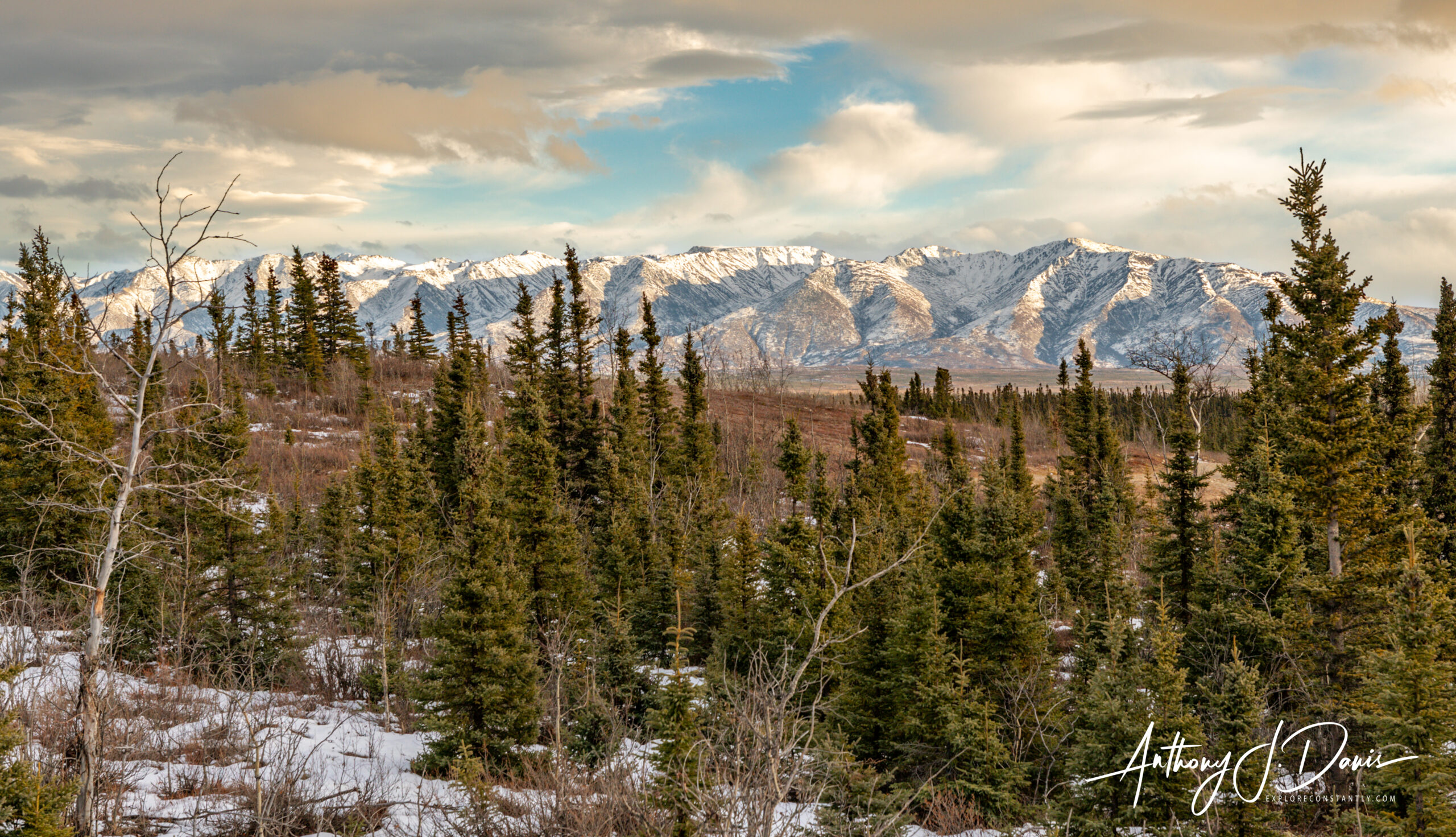
Delta Mountains
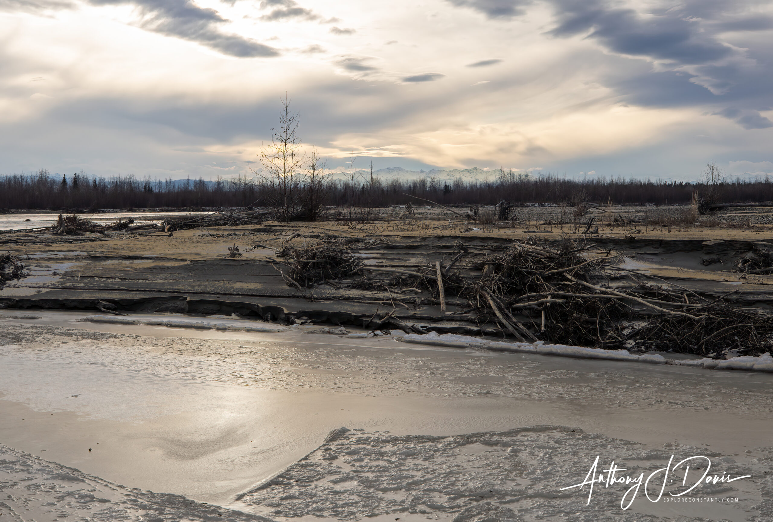
Winter Tanana River
On the 5th night on our way to Chena Hot Springs we made a few nice stops along the Hot Springs Highway, including in Chena River State Recreation Area. Chena River State Recreation Area is a large park with 397 square miles of forests, rivers, and alpine tundra. It includes numerous trails, great fishing in the river and in three stocked ponds, and three developed campgrounds. We stopped at the pullout for the Granite Tors Trail, a strenuous 15 mile round trip hike with 3,400 ft of elevation gain that offers numerous scenic overlooks of the nearby mountains and several large granite tors, conspicuous rock masses that rise above the surrounding ground surfaces. We made note of the Tors trailhead as a place to check out in more detail on a future summer visit.
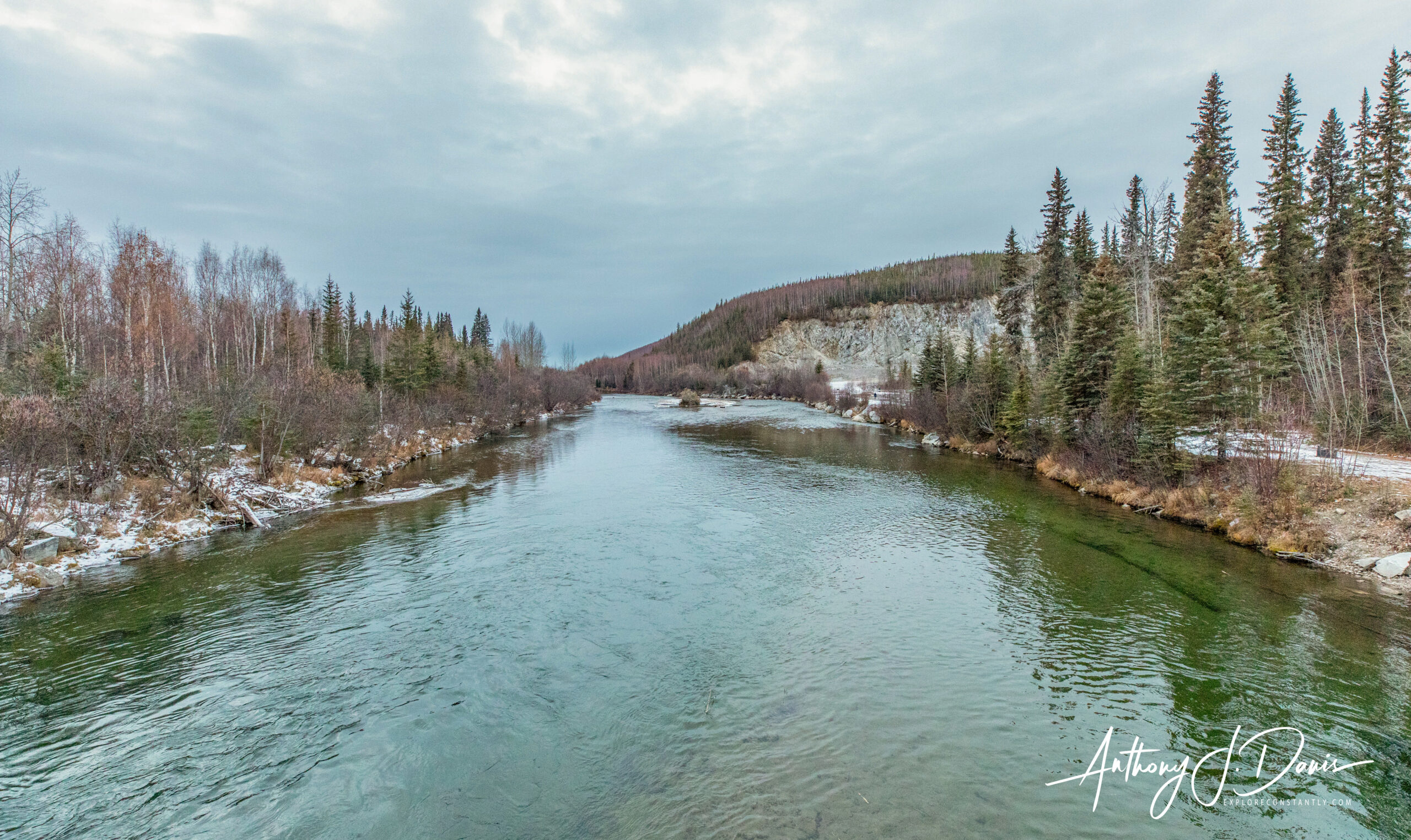
Chena River
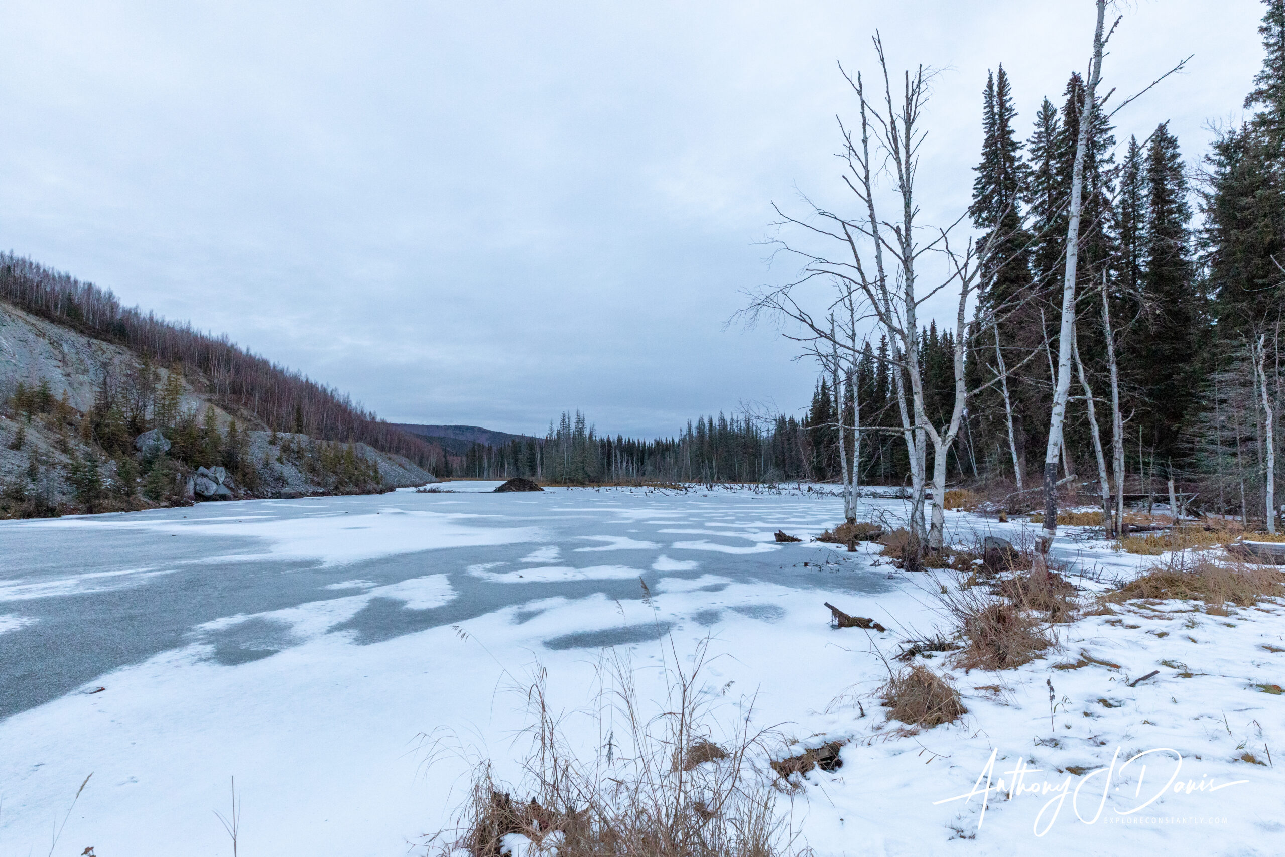
Chena State Recreation Area Pond with Beaver Dam
Another great stop was at Cleary Summit, for great views from 2,233 ft. On a clear day, you can catch a good look at the Tanana Valley and Denali (Mt. McKinley) to the south and the White Mountains to the north.
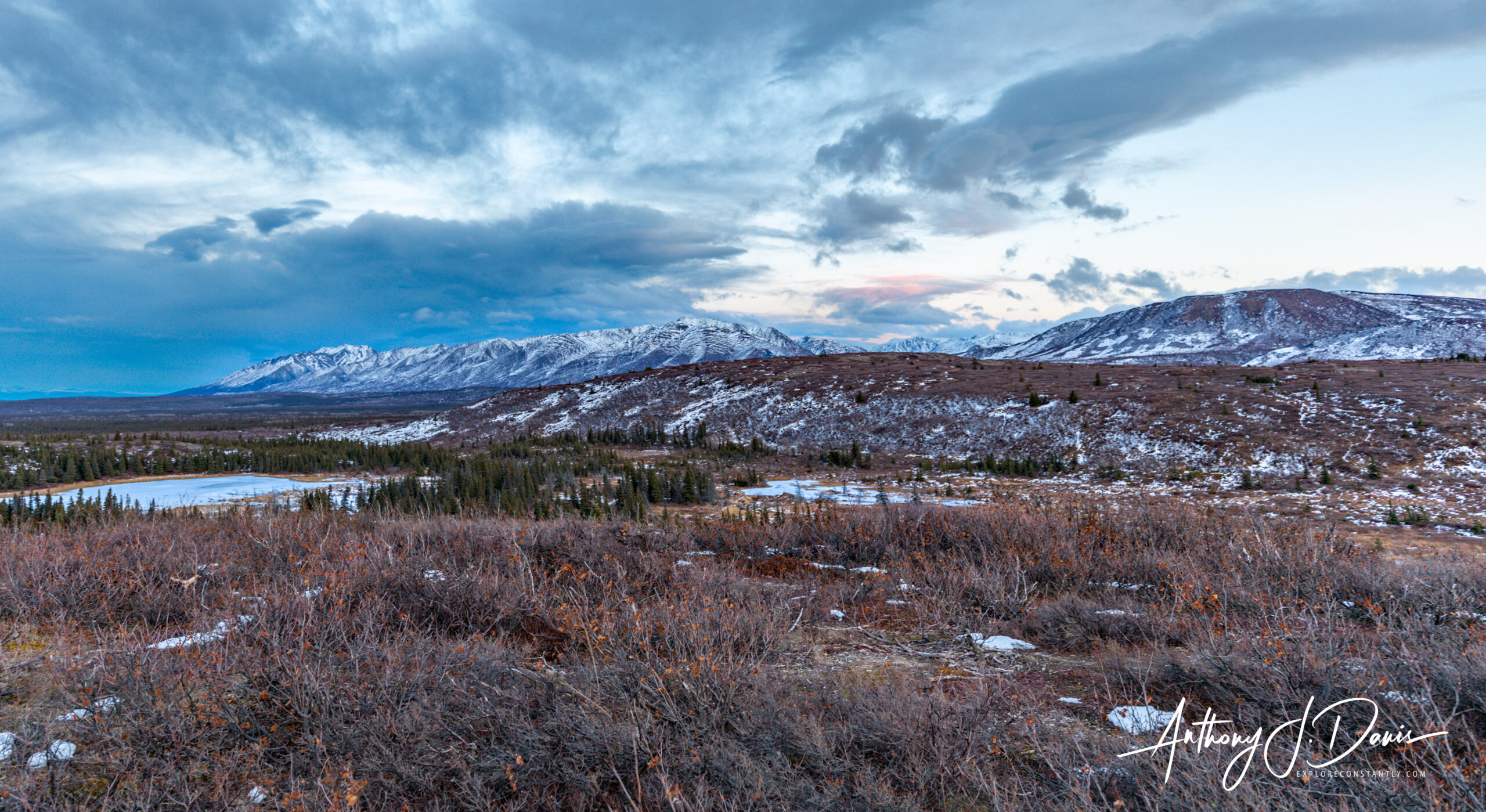
View from Cleary Summit
Cleary Summit View of River
Perhaps our favorite scenic overlook was the top of Murphy Dome. Murphy Dome is the highest point (2877 ft) close to Fairbanks. We were lucky enough to visit Murphy for a really outstanding sunset, and enjoyed the alpen glow across the ridge line and out above Minto Lakes and down to the Chatanika River.
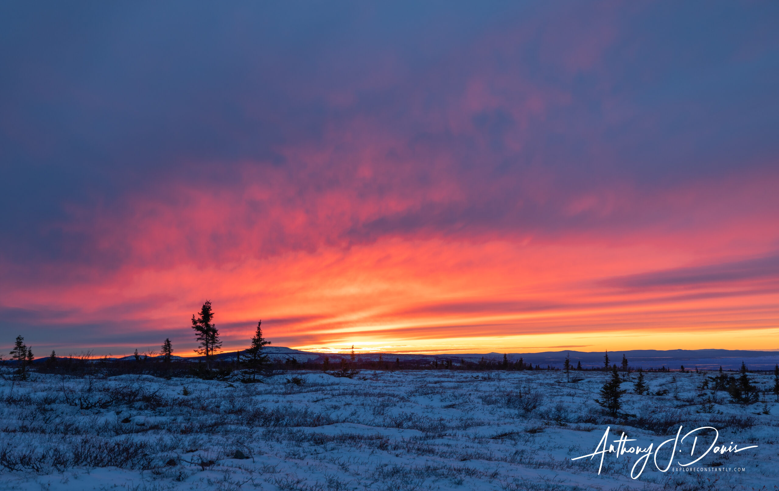
Sunset on Murphy Dome
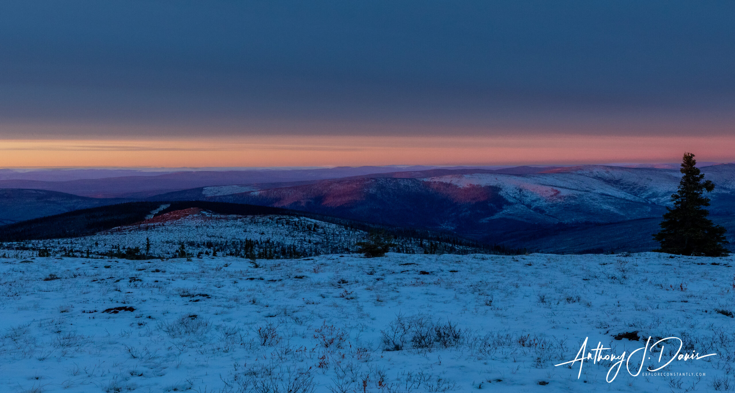
Alpen Glow from Sunset
All-in-all, Alaska never fails to amaze with it’s combination of large unsettled spaces, amazing natural features and wildlife, and shear amount of things to see and do. Fairbanks holds a special place in Alaska’s history and as a jumping off point for many different adventures. It’s well worth adding to your list of places to visit.
0 Comments