
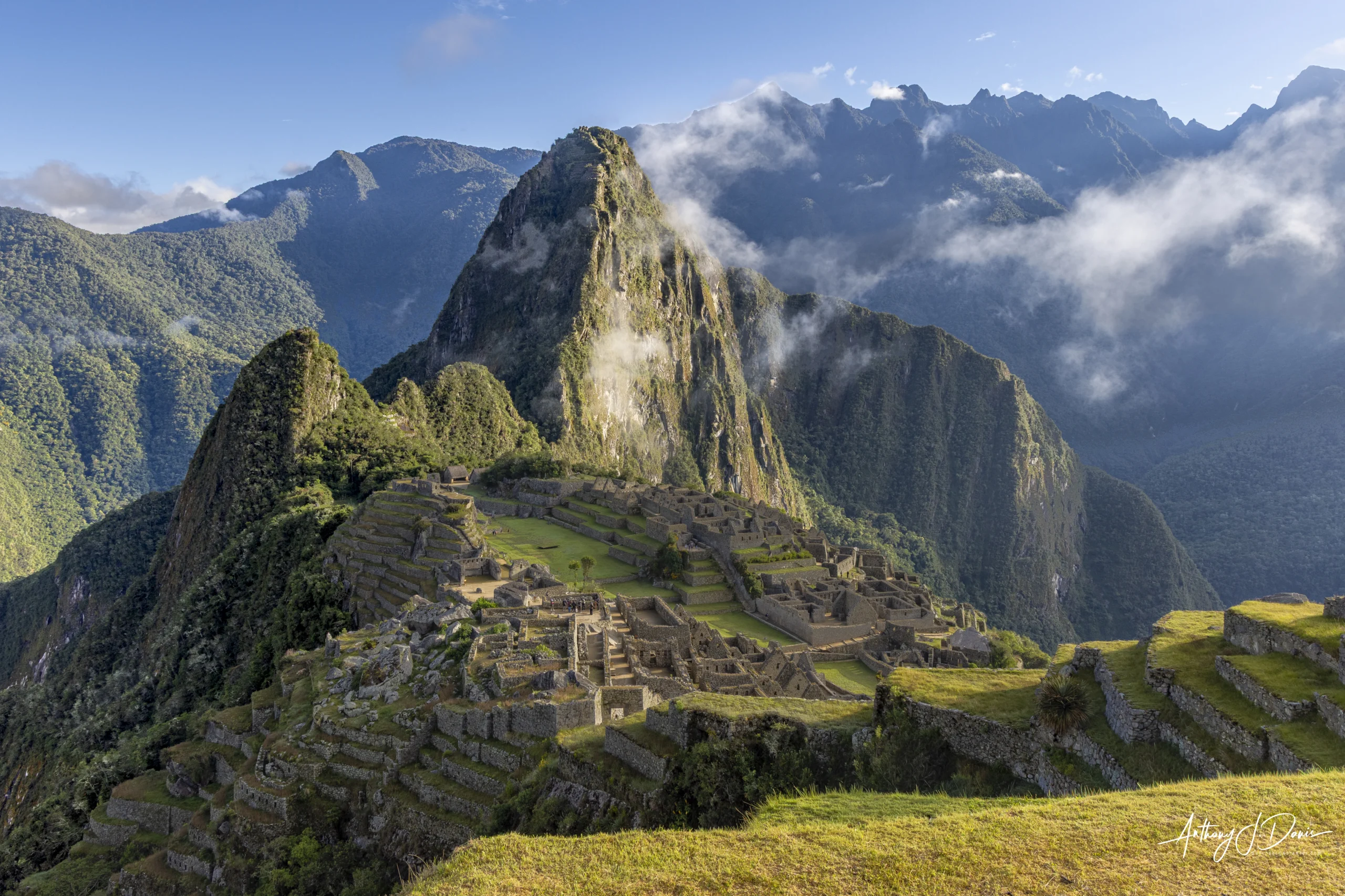

The Inca Trail hike is the most popular way to get to Machu Picchu in Peru. The Inca Trail hike is 26.5 miles (42 km) that features a cumulative elevation gain of roughly 7,063 to 8,822 feet (2,153 to 2,689 meters), with the highest point reaching a staggering 13,828 feet (4,215 meters) at Dead Woman’s Pass. Dead Woman’s Pass isn’t quite as scary as the name makes it seem. It’s called that because when viewed from the valley below, the mountain crests resemble the shape of a woman lying on her back, looking up at the sky.
The first day on the Inca Trail hike is a relatively straight forward day, with 8.7 miles (14 km) of hiking and a climb of about 600 feet (182 meters). The hike starts in Piskacucho at km marker 82 and ends at Ayapata, the first night’s campsite. The first day has the bonus of passing through a couple of small communities, so this is the last chance to buy anything you might have forgotten in your preparation and also to use a nice, clean, flush toilet. Also along the trail you will see your first Inca ruin of the hike. Patallacta is a small site that is an ancient Inca checkpoint for the approach to Machu Picchu. Patallacta was also a significant agricultural town and ceremonial center, featuring extensive terracing on the hillside for farming near the Urubaba River.
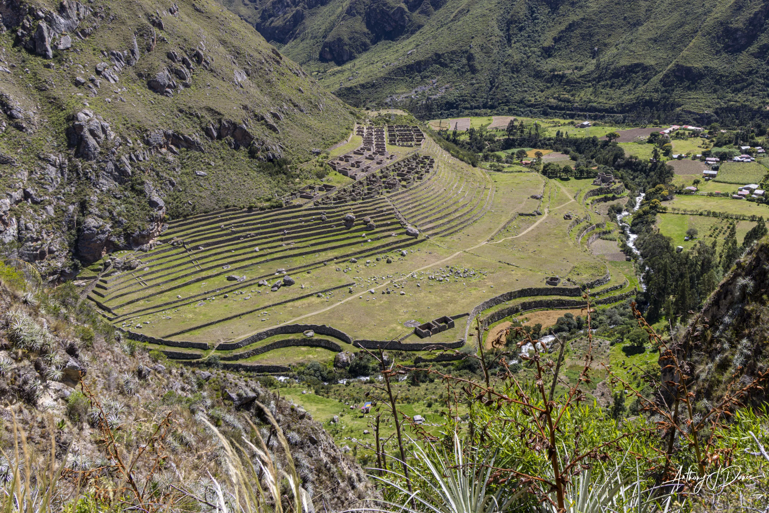
View of Patallacta from the Inca Trail
The second day is the hardest day of the Inca Trail hike and can be pretty challenging if you haven’t prepared or acclimated to the altitude. The hike is 9.94 miles (16 km), but it summits not just one, but the two highest passes on the hike. Dead Woman’s Pass is first and the highest at 13,829 feet (4,215 meters). The 2,950 feet (900 meter) climb to Dead Woman’s Pass is steep and continuous for 3-4 hours. The Inca were great at building, but it didn’t seem like they were super careful about building even or level stone steps. Below is a photo of a section of the climb to Dead Woman’s Pass.

Section of stairs to Dead Woman’s Pass on Inca Trail
Once we made it to the top, the climb was well worth it. The views from the top of Dead Woman’s Pass were simply amazing. We could see all the way to the peak of Huayanay behind us, to the mountain range on the other side of Agua Calientes in front of us.

Huayanay peak through the valley behind Dead Woman’s Pass

Path down from Dead Woman’s Pass with the mountains behind Agua Calientes in the background
Dead Woman’s Pass is quickly followed by Runkuracay at 13,020 feet (4,000 meters). Shortly after Runkuracay Pass you see two large waterfalls cascading down the sides of the valley.

One of the Waterfalls
You pass through the Runkuracay valley in between at 12,073 feet (3,680 meters), so the grand total for the day is almost 4,000 feet (1,200 meters) of climbing and almost 3,000 feet (1,000 meters) of descending ancient, steep, uneven, stone stairs set into the side of the mountain.
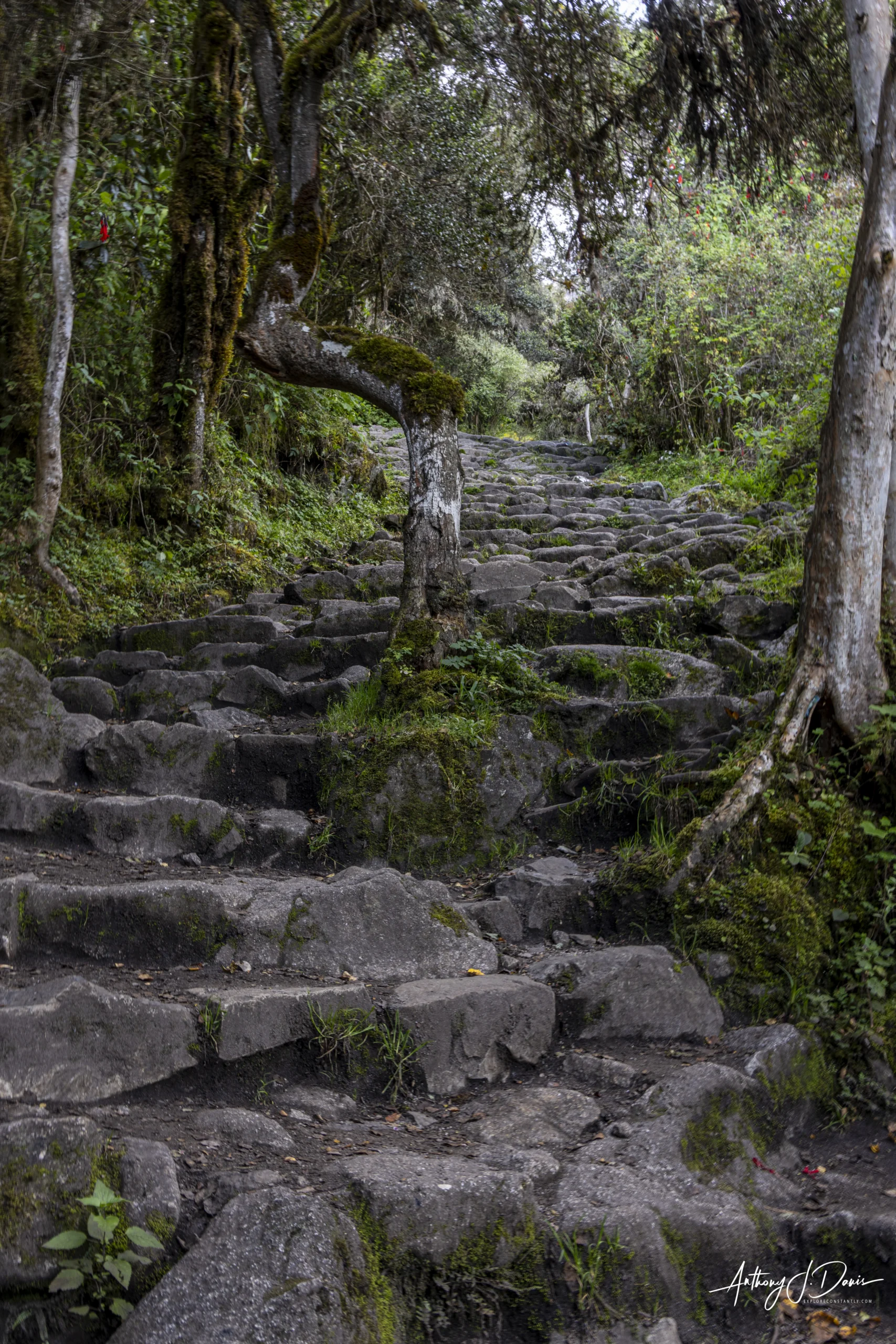
Some of the stone steps on the Inca Trail
An hour’s hike after the second pass you reach the magnificent Inca site, Sayacmarca (another otherwise inaccessible village). From there it’s only about a 20 minute walk to the campsite overlooking a magnificent valley. If you’re lucky you can see the sunset over the Vilcabamba mountain range like we did.
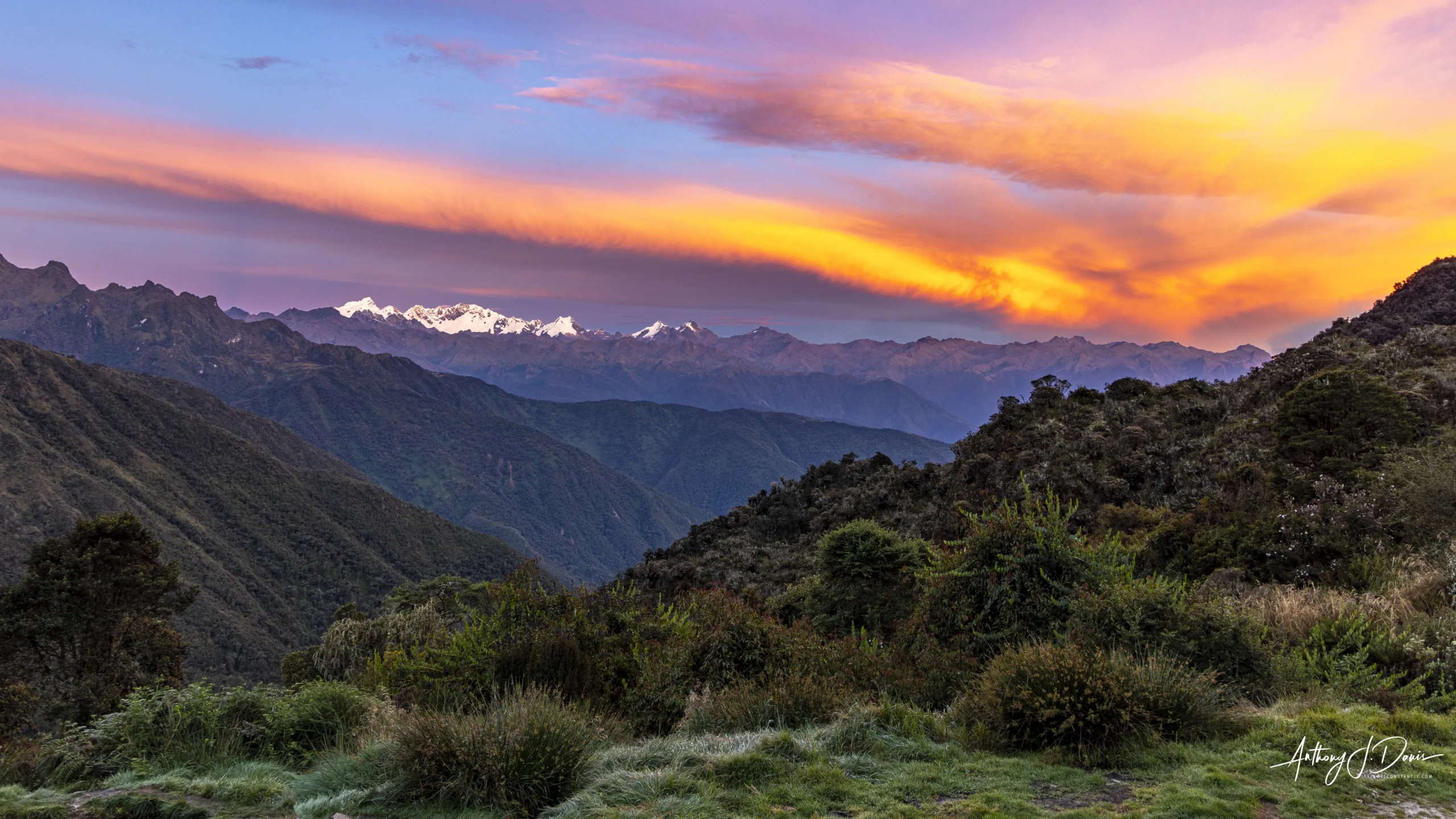
Sunset over the Vilcabamba mountain range on the Inca Trail
The third day is a nice rest after the second day and is a relatively reasonable 6.2 miles (10 km) with only 273 feet (83 meters) of climbing before a 3-4 hour descent of some 3,281 feet (1,000 meters). After your arrival at camp, you’ll spend about an hour and a half touring the Inca ruins of Wiñay Wayna which is nearby. Wiñay Wayna cannot be reached by bus or train, only by hiking. The well preserved site served as an important agricultural production site, a ceremonial center honoring water deities, and an elite resting post for pilgrims making their final approach to Machu Picchu.
The fourth day you’ll get up very early to make an easy one hour walk to the Sun Gate (Intipunku). Intipunku, or “Sun Gate” in Quechua, is an imposing stone gateway that serves as the main entrance to Machu Picchu and into the Sacred Valley of the Incas. Because of its location on a ridge southeast of Machu Picchu, the rising sun would pass through the Sun Gate each year on the summer solstice. The Sun Gate is a wide archaeological site with windows and gates that are held up by terraces, and is the first place that Inca Trail hikers can see the whole Machu Picchu sanctuary.
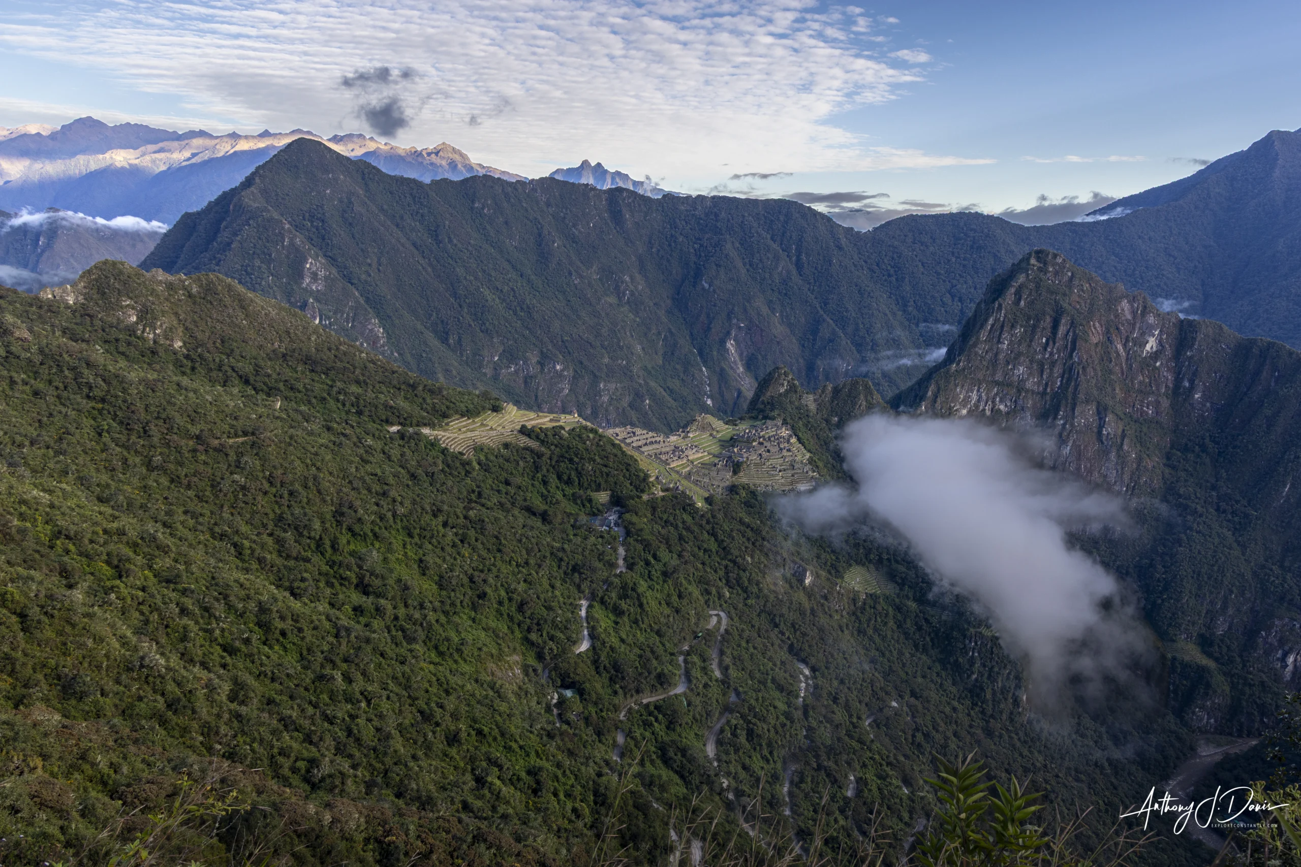
View of Machu Picchu from the Sun Gate
You are required to have a permit for the Inca Trail hike and the most common way to get one of the scarce permits is to book the hike with one of the many travel guides available in Cuzco, Urubamba, or Ollantaytambo. I chose to book with Alpaca Expeditions, the largest and likely most popular option. Alpaca did a really great job with our hike. Our guides Jhymy and Benjamin were very positive and helpful throughout the trip, and Jhymy’s knowledge of Inca history and traditions was simply amazing. His talks at each of the historic sites along the way really helped us get into the spirit of the area and built our understanding of the Inca culture and traditions.

Our Guide Jhymy introducing the Alpaca team
The cooks on the trip were unbelievable and prepared us three hot meals and a happy hour every day of the trip. It was just incredible how good and healthy the food was and how broad the range of choices in the sparse camping conditions. The porters were kind of the miracle of the trip. We had 16 hikers and were supported by 32 porters who could each carry up to 44 pounds (20 kg) of gear each day. This included all the tents, other camping gear, the hiker’s extra supplies, cooking supplies, and everything else for four days and three nights of camping. To make it even more amazing, the porters would break down each camp almost instantly and then pass by us almost at a run as they rushed ahead to get the best sites for our lunch break and night time campsite. It was really incredible to watch them running up and down the steep stone stairs carrying those heavy packs, always with a smile and without a complaint.
The Inca Trail is truly a bucket list kind of adventure and highly recommended. Just make sure you take the preparation and acclimation seriously. The altitude up there is no joke and can have some serious health consequences.

0 Comments