
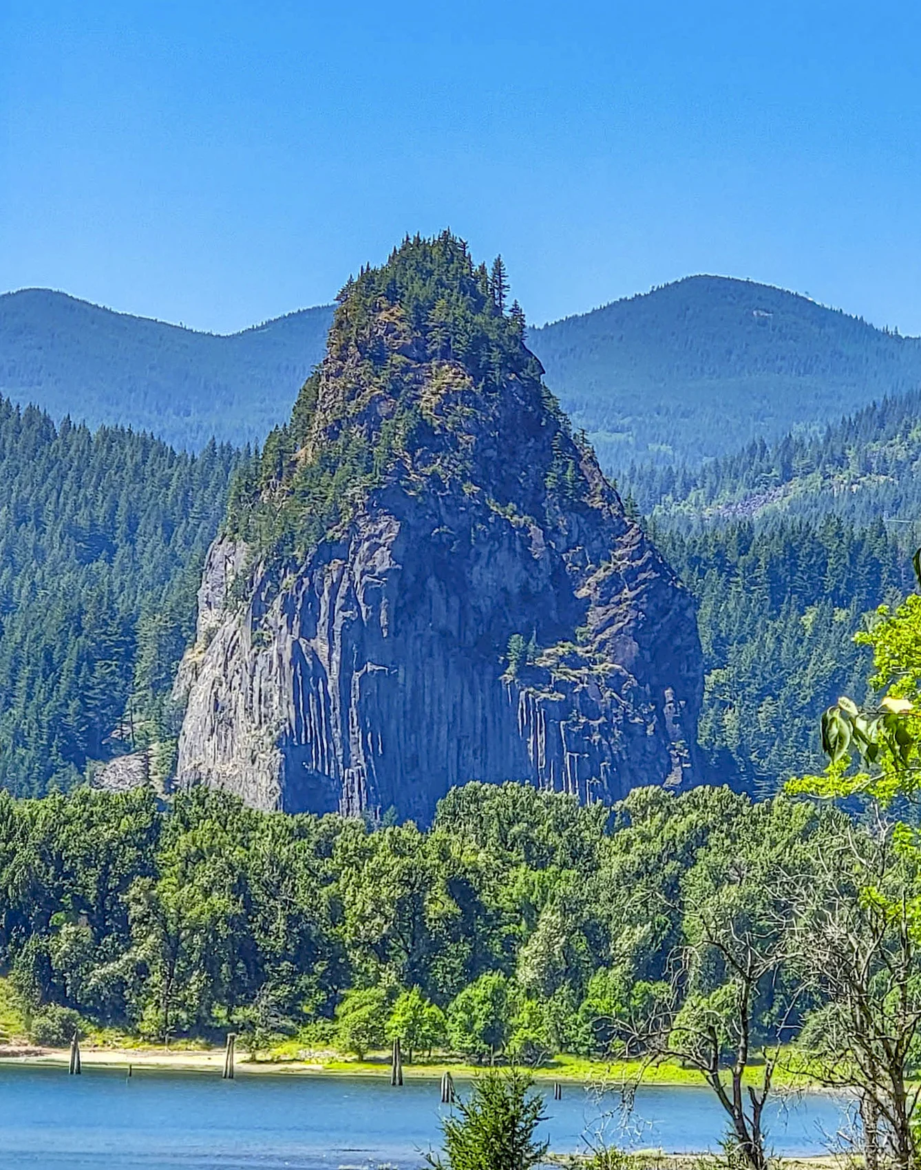

Beacon Rock is an 848-foot (258 m) basalt monolith on the Washington side of the Columbia River Gorge, and there’s a trail to the top of it. Not around it, not to a viewpoint below it — up the face, on a walkway of 52 switchbacks and 22 bridges bolted and cribbed onto the cliff.
It’s roughly 1.8 miles (2.9 km) round trip. We were up in about twenty minutes and back down in twenty more, and it’s one of the most extraordinary pieces of trail engineering in the Northwest.
First thing to know: this is Washington, not Oregon. Beacon Rock State Park sits on the north bank, which means you need a Washington Discover Pass — not the Northwest Forest Pass that covers the Oregon-side trailheads twenty minutes away.
The Basics
- Where: Beacon Rock State Park, State Route 14, Skamania County, Washington
- Height: 848 ft (258 m)
- Trail: About 1.8 miles (2.9 km) round trip
- Elevation gain: Roughly 600–700 ft (183–213 m) from the trailhead
- Grade: Maximum 15 percent — steady, never brutal
- Trail width: About 4 feet (1.2 m), with railings on the exposed sections
- Time: 45 minutes to 1.5 hours round trip
- Fee: Washington Discover Pass required — $10 for one day, $45 annual
- Hours: 8 a.m. to dusk, year round
- Park size: 4,458 acres (1,804 ha) with more than 26 miles (42 km) of roads and trails, including 13 miles (21 km) open to mountain bikes
- Shoreline: 9,500 feet (2,896 m) on the Columbia
- Dogs: Permitted on leash
Two states, two passes, twenty minutes apart. The Oregon-side Gorge trailheads take a Northwest Forest Pass or America the Beautiful; Beacon Rock State Park takes a Discover Pass. If you’re doing both sides in one day — and most people do — you need both.
The Rock Was Nearly Blown Up
This is the part worth knowing before you walk it.
Beacon Rock is the eroded core of an ancient volcano — the hard plug left standing after everything softer washed away. Lewis and Clark noted it in 1805, and it’s long served as a river landmark.
In 1904 it was sold to Charles Ladd, and the intention was to quarry it for jetty rock. Crews had already begun drilling tunnels to place explosives. Small caves on the south side are what’s left of that work.
In 1915, Vancouver geologist Henry J. Biddle bought it for one dollar, with a clause written into the deed requiring that it be preserved.
Then he built the trail. Working with Charles Johnson, Biddle spent $10,000 of his own money — an enormous sum in 1915 — cutting a route up a vertical basalt face. Construction began in October 1915 and finished in April 1918.
Biddle died in 1928. His children approached the state, and on April 14, 1935, Washington accepted a donation of 265 acres including Beacon Rock, Hamilton Mountain, and the land that’s now the campground.
So: a man bought a mountain for a dollar to stop it being dynamited, then spent a fortune building a staircase up it so the public could climb the thing he’d saved. You appreciate that on the way up.
Climbing Beacon Rock
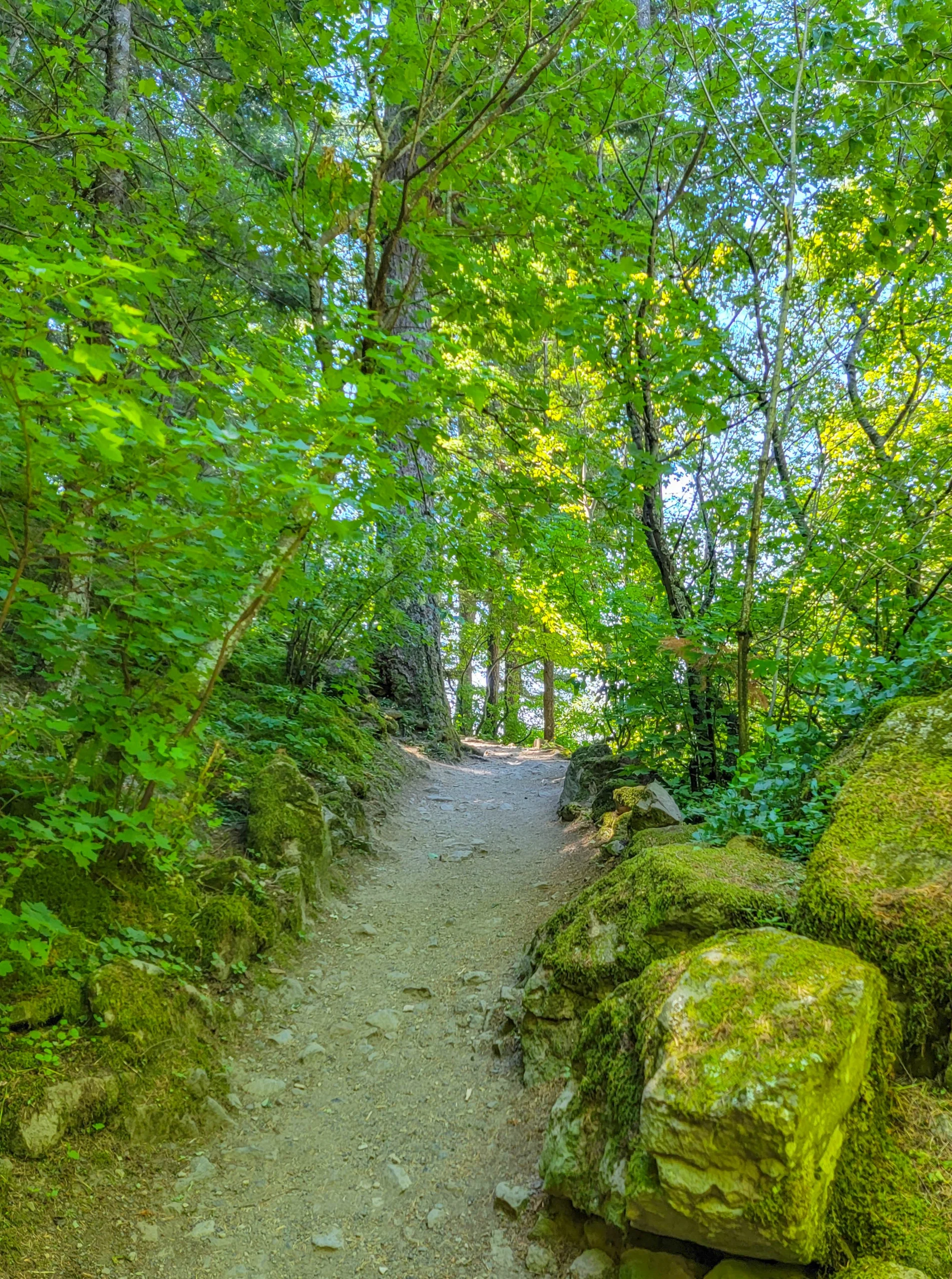
The first stretch is ordinary — dirt path, big mossy boulders, big leaf maple, dappled light. It gives no hint of what follows.
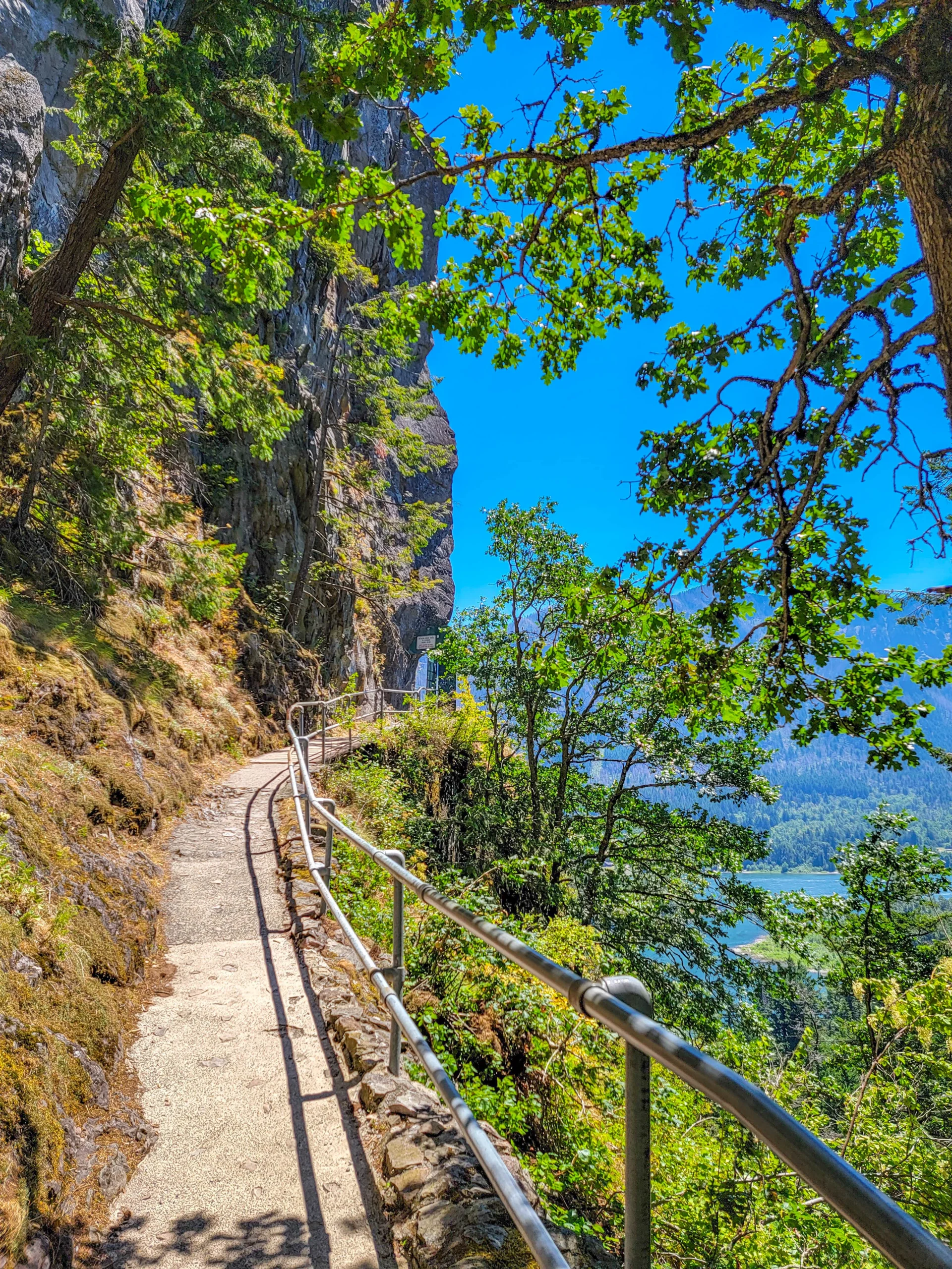
Then the trail turns onto the rock and the whole character changes. The tread narrows to about four feet, a galvanized pipe railing appears on the outside, and the path is cut directly into the basalt with the river dropping away below.
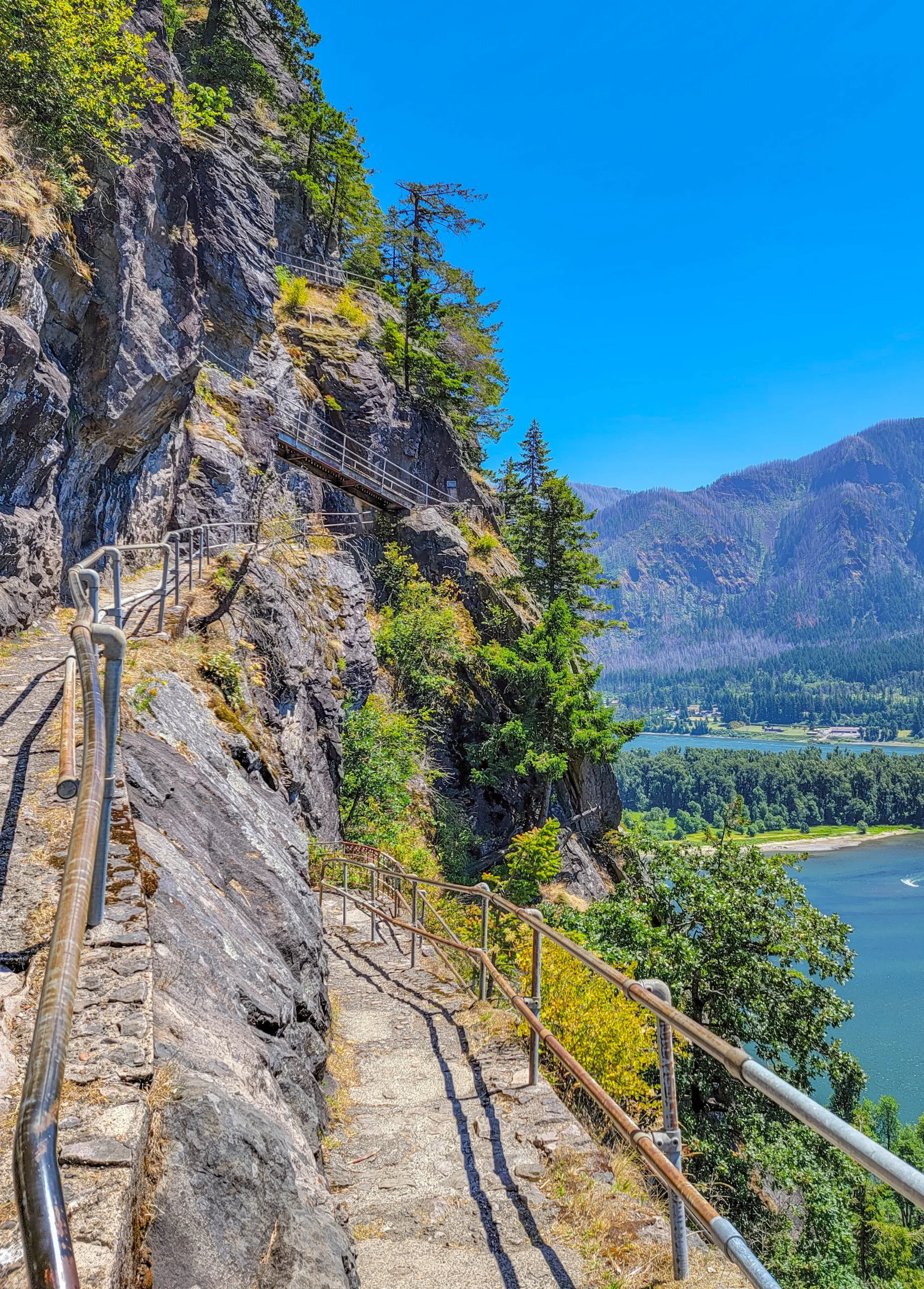
Look up and you can see where you’re going — the next three or four switchbacks stacked overhead, catwalks pinned to the face. Look down and you can see where you were. It’s the rare trail where the whole route is visible at once.
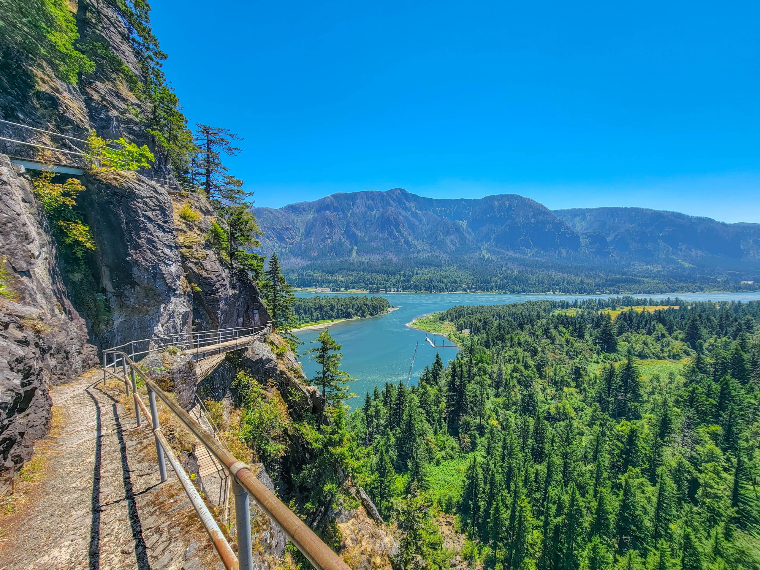
The exposure is real but it’s managed. Railings the whole way on the outside, decking where the rock won’t hold a tread, and a grade that never exceeds 15 percent. Children do this trail. So do people with a serious dislike of heights, though they don’t always enjoy it.
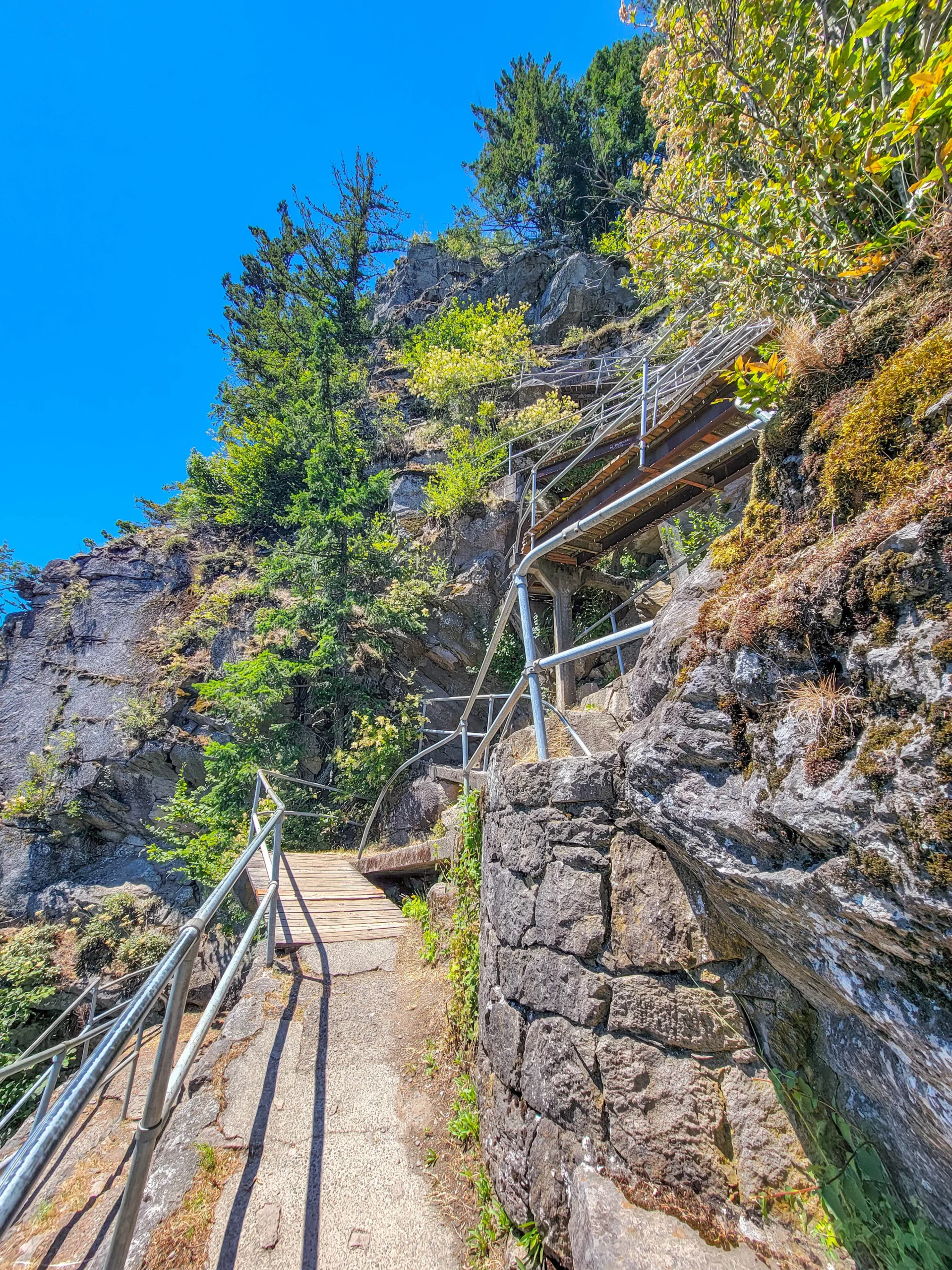
The engineering is the subject. Timber cribbing wedged into the rock, steel struts underneath the walkways, stone retaining walls where the slope needed building out. Some of it is original work maintained since; some has been replaced. All of it was put there by hand on a cliff.
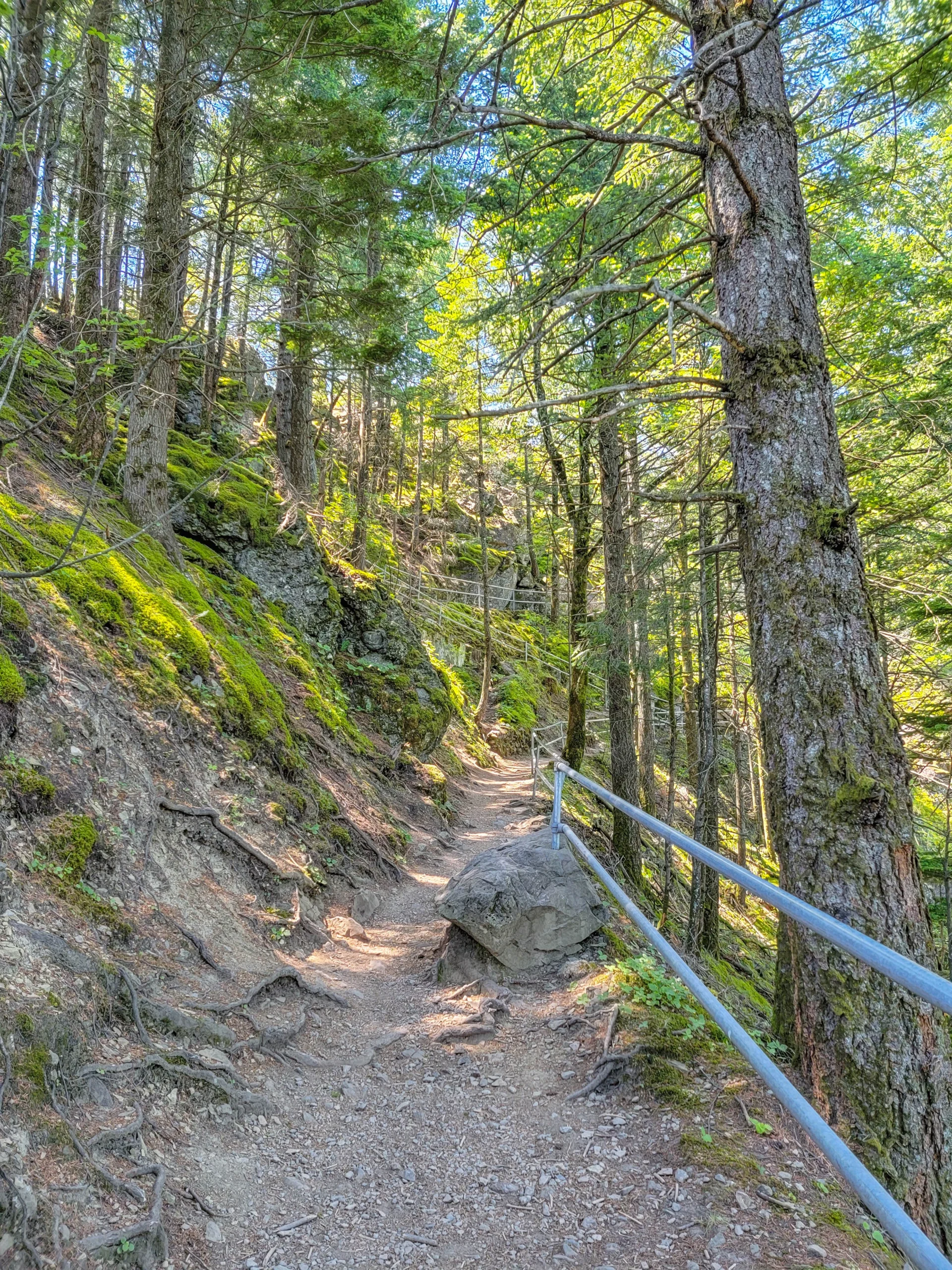
Near the top the trail slips back into trees for a stretch, which is a strange sensation after the exposure.
The Summit
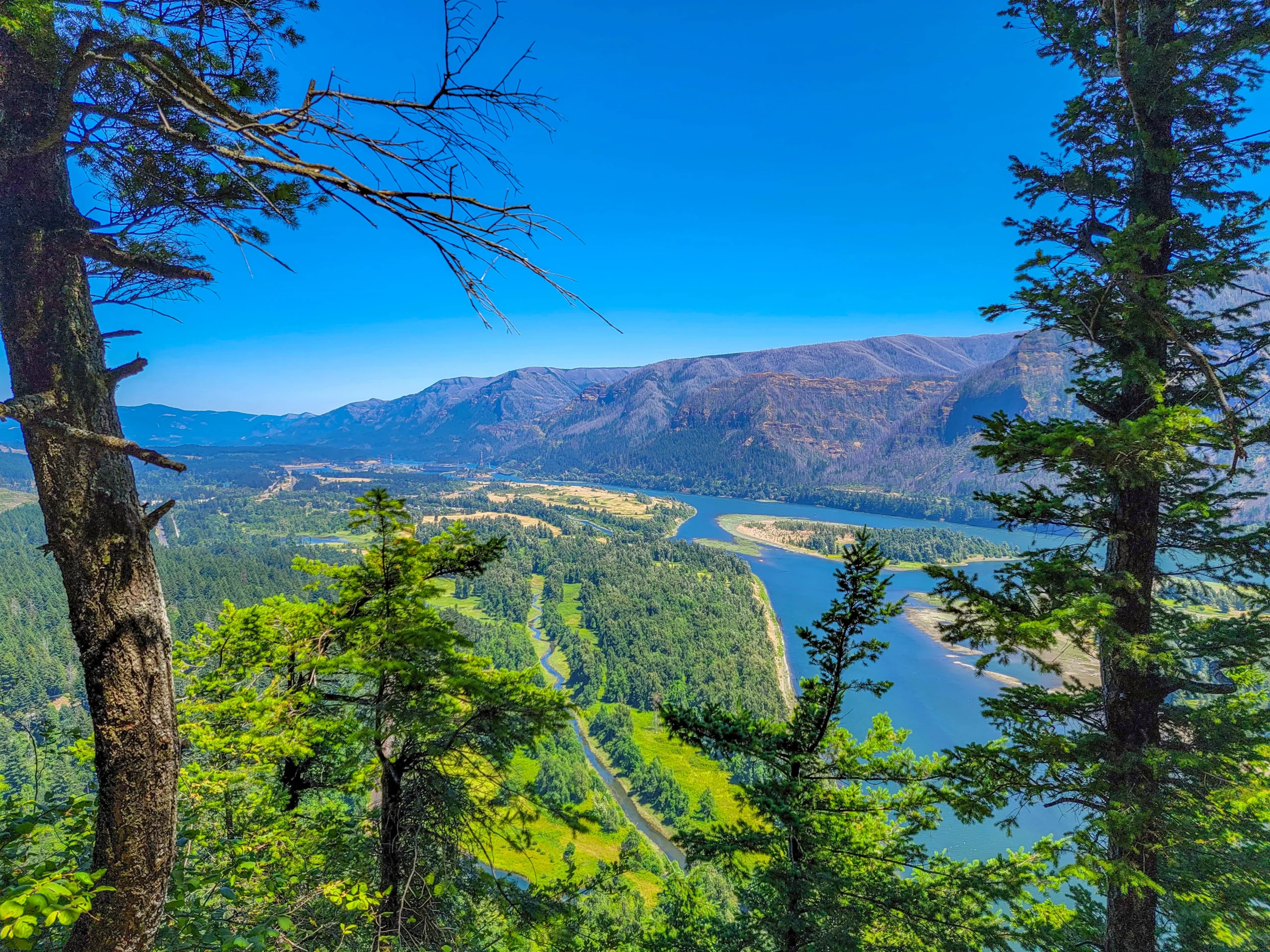
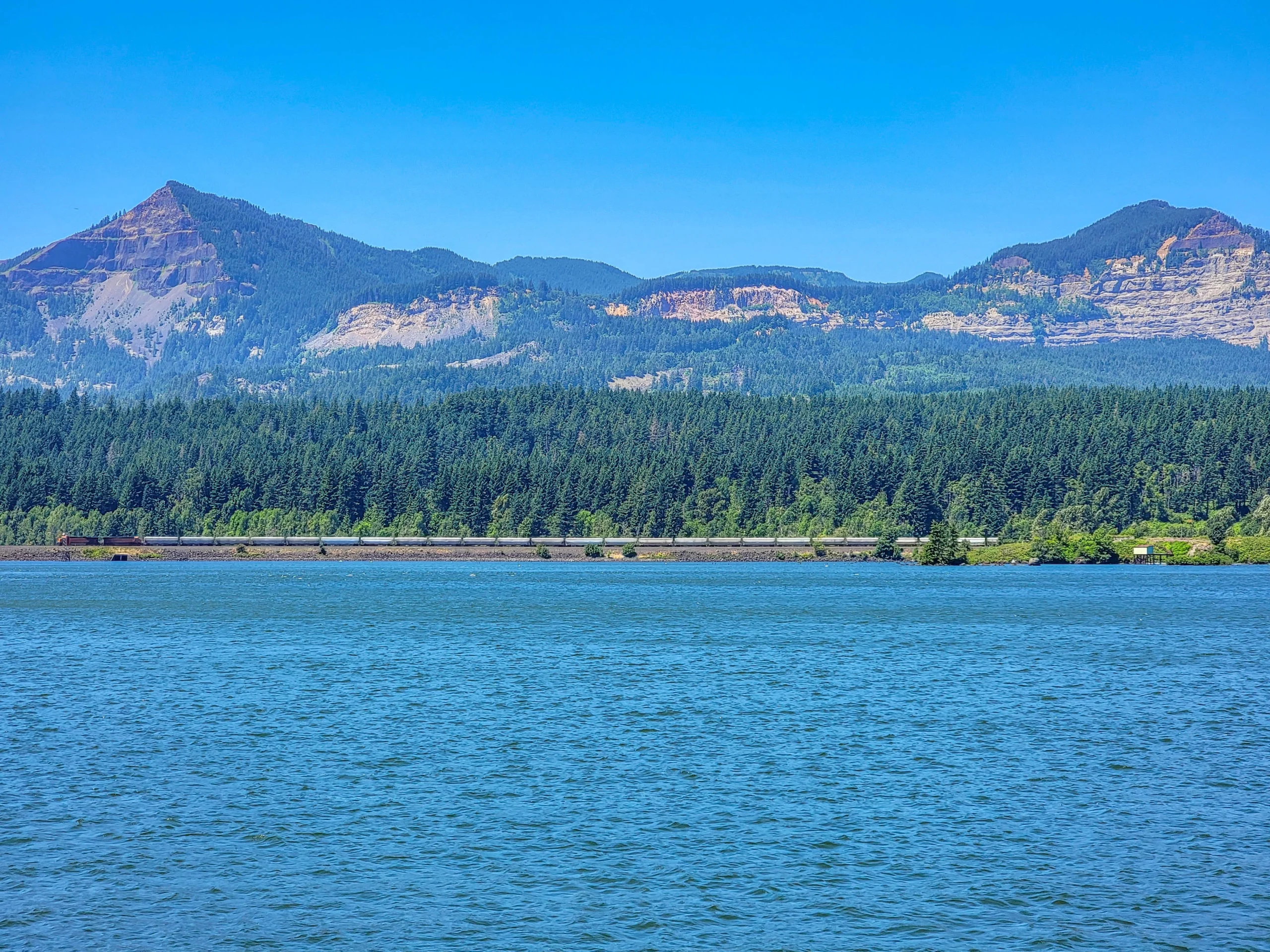
The top is a small rounded dome with a railing, and the view runs both directions down the Gorge — the Columbia braiding around islands, sandbars, the highway and railroad threading the Oregon side, and ridges rolling away east and west.
The burned slopes across the river are the Eagle Creek Fire, which took roughly 50,000 acres of the Oregon side in September 2017. From up here you can see the whole burn scar at once, which you can’t from inside it.
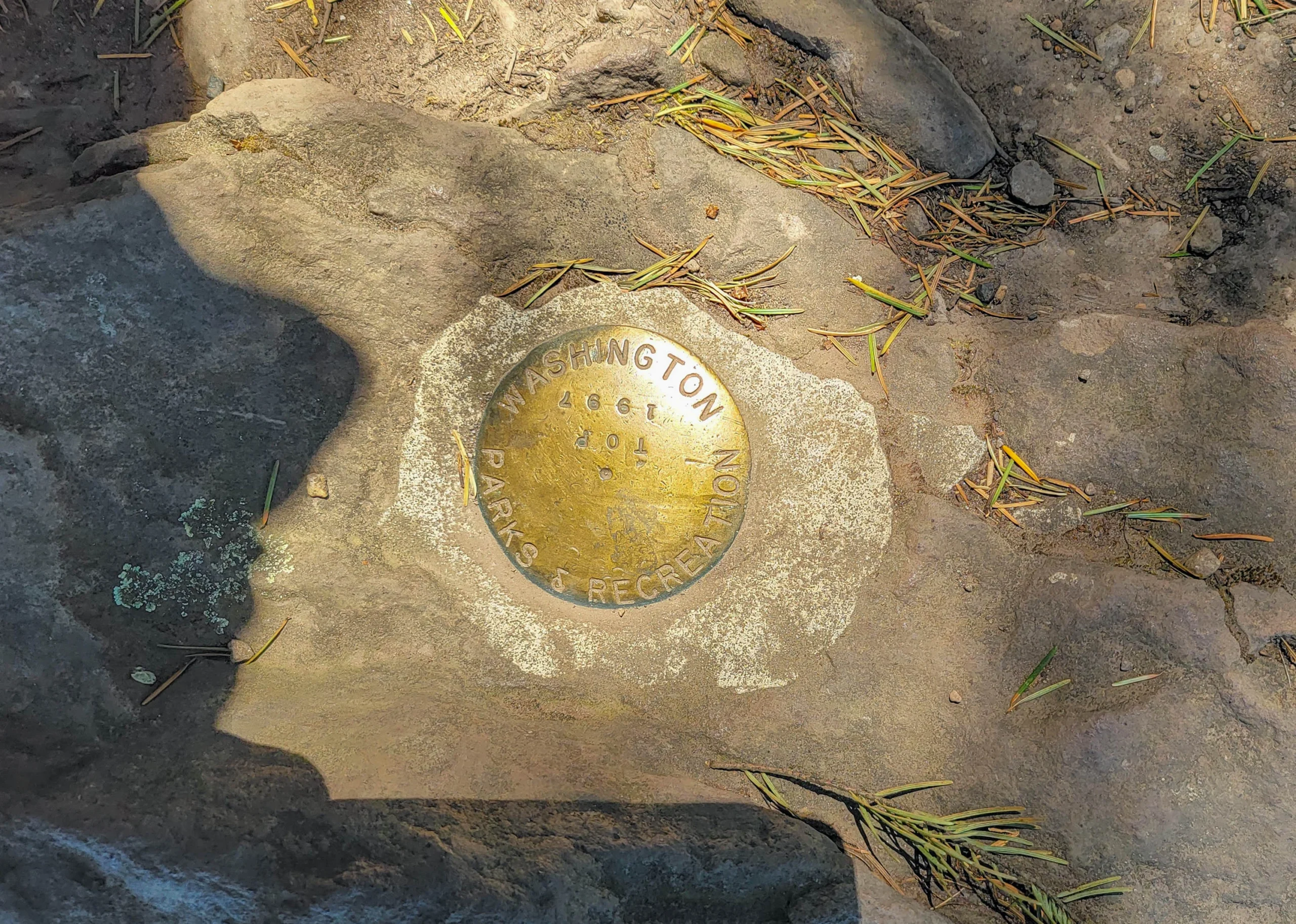
A Washington State Parks brass survey marker is set into the rock at the top — the sort of small official object that makes a summit feel properly arrived at.
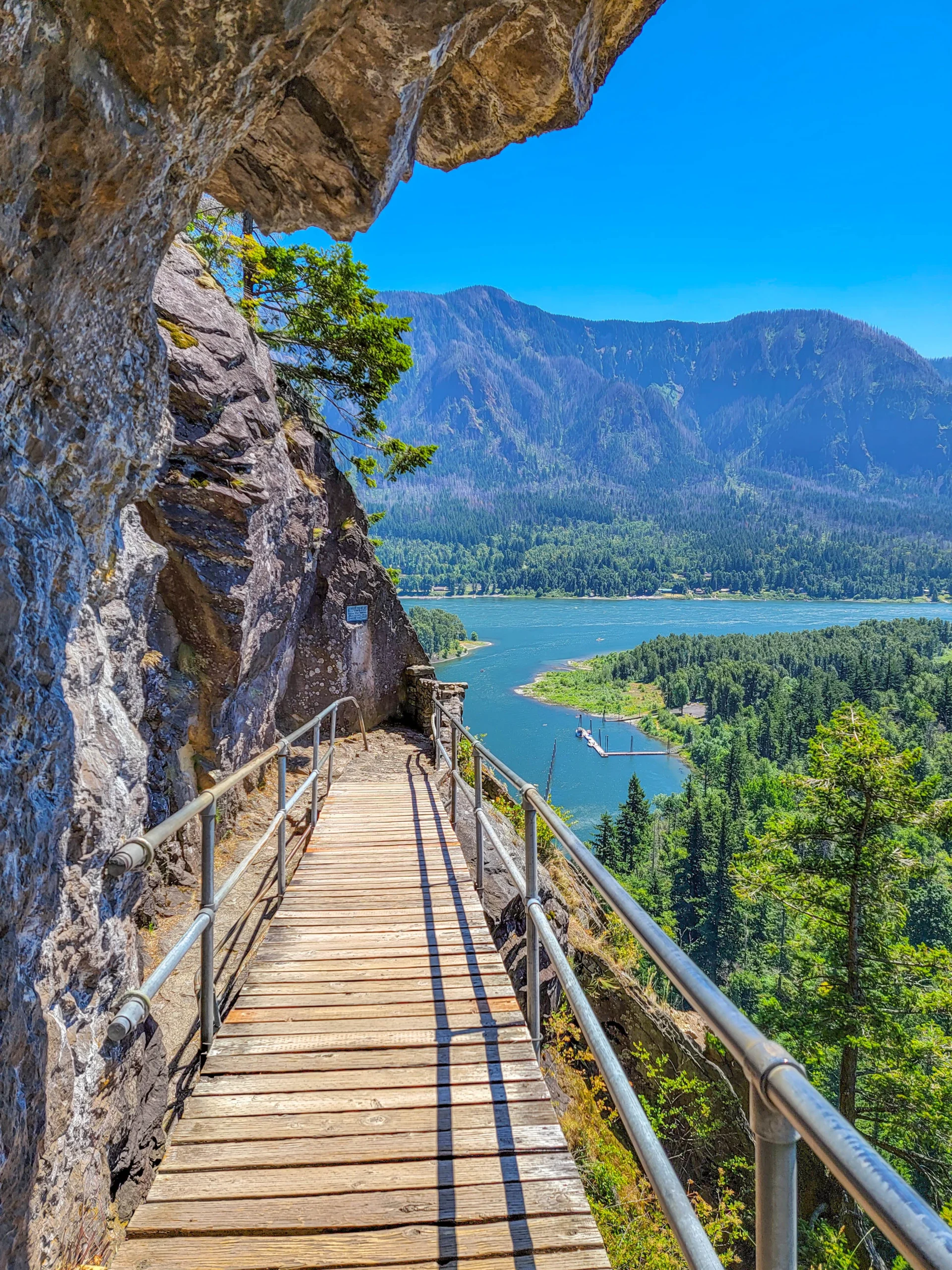
The descent is better than the climb, which is unusual. Going up you watch your feet; coming down you’re facing out, and every switchback delivers the river again from a slightly different angle.
Beacon Rock Is Also a Climbing Crag
Beacon Rock holds some of the best traditional rock climbing in the Northwest, and the access rules are more complicated than the hiking rules.
- The south and southeast faces close every year on February 1 and tentatively reopen in mid-July.
- The northwest face is open year round.
- The east face is permanently closed to protect rare species and cultural and historical resources.
The seasonal closure is for nesting peregrine falcons. Washington State Parks closes climbing routes at Beacon Rock and elsewhere while the birds are on eggs, which is why the reopening date each summer is described as tentative rather than fixed — it depends on the birds.
You don’t need to care about any of this to walk the trail. But it’s worth knowing that the rock you’re climbing the inside of is also a raptor nesting site, and that the closure dates move.
If the Trail Is Too Much
The park has an answer for anyone who can’t or doesn’t want to do the switchbacks.
The Doetsch Walking Path is a paved, flat, 1.2-mile (1.9 km) ADA accessible loop through what used to be the Doetsch family ranch pasture, with interpretive panels covering the area’s natural and human history back to the Ice Age floods.
There’s also Hamilton Mountain from the upper trailhead, which climbs through old-growth Douglas fir past Rodney Falls, Hardy Falls, and the Pool of the Winds — a much longer day and the park’s other serious hike.
The Upper Campground was built by the Civilian Conservation Corps in 1935, the same year the Biddle family donated the land.
Photography Notes
- The catwalks are the shot, not the summit view. Point the camera along the trail rather than out at the river and you get the thing that makes this place different.
- Shoot from across the river too. The monolith only reads as a monolith from a distance — from on it, it’s just a trail.
- Midday is workable here because the exposure is what you’re photographing and the railings give you strong lines regardless of light.
- A wide lens on the switchbacks shows the stacking. A long lens flattens it.
- The summit is small and often busy. Be patient, or shoot the trail instead.
- Watch your footing before your framing on the exposed sections.
Know Before You Go
- Discover Pass required. Washington, not Oregon — $10 for one day or $45 annual. The Oregon-side Gorge passes don’t work here.
- The gate opens at 8 a.m., and the park closes at dusk year round.
- The trail is one-way-ish in width. Four feet with railings means stepping aside to let people pass. Yield uphill.
- No pets off leash, and the exposure makes this a bad trail for an unruly dog.
- Don’t throw anything from the top. People are on switchbacks directly below you.
- Summer weekends are busy and the lot is not large.
- It’s exposed to sun and wind. No water on the trail.
- The park has 26 miles of other trails, including Hamilton Mountain, if you want a longer day.
- Bonneville Dam is ten minutes east on the Oregon side, and free.
Is It Worth It?
Yes, and it’s one of the few hikes where the trail itself is the reason to go.
Eight hundred and forty-eight feet, an hour of your time, and a walkway built by hand onto a cliff face a century ago by a man who bought the rock to stop it being dynamited. The Gorge view at the top is excellent, but you can get Gorge views from a car. You cannot get this anywhere else.
The honest caveats are short. It’s exposed, and if heights genuinely frighten you the railings won’t fix that. It’s popular. And it’s a Discover Pass, which surprises people who’ve spent the morning on the Oregon side.
Do it on the way back from the Oregon waterfalls, allow an hour, and look up at the switchbacks before you start. Then think about 1915.
There are a lot of other things to do in the Columbia River area, read about them in our Columbia River Gorge guide.
For current conditions, fees, and camping, visit the Washington State Parks page for Beacon Rock State Park.
0 Comments