

Columbia River Gorge Guide
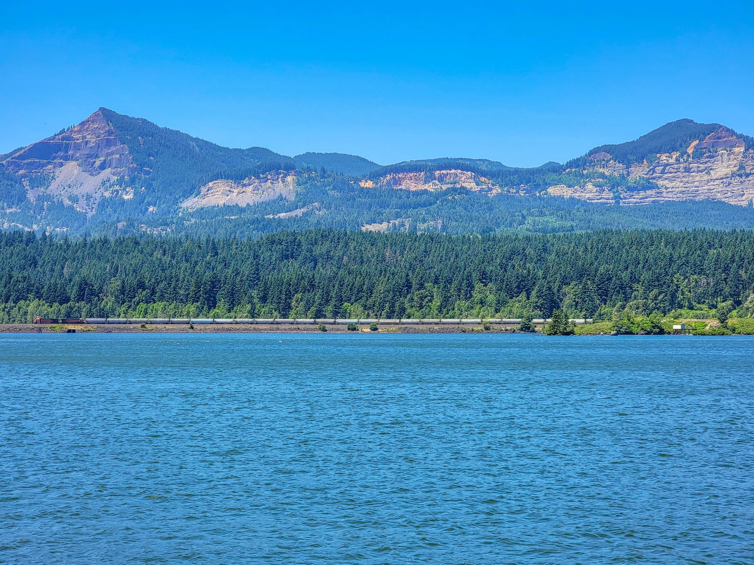
The Columbia River Gorge is an 80-mile (129 km) river canyon cutting through the Cascade Range on the Oregon-Washington border, with basalt walls rising as much as 4,000 feet (1,219 m) above the water. Congress designated 292,500 acres (118,373 ha) of it the Columbia River Gorge National Scenic Area in 1986, and it’s commonly described as having one of the greatest concentrations of high waterfalls anywhere in North America. Plan on a full day for a first visit — a half day if you’re picking one or two stops.
Check the permit before you go. As of the 2026 season, the US Forest Service requires a $2 Timed Use Permit to park at the Multnomah Falls (I-84 Exit 31) lot, daily from 9 a.m. to 6 p.m., May 22 through September 7, booked through Recreation.gov. This replaced the older Waterfall Corridor permit that used to cover Exits 28 through 35. It applies specifically to the Multnomah Falls I-84 lot — the stops in this guide (Horsetail Falls, Wahclella Falls, Bonneville Dam, Beacon Rock) sit outside that zone and don’t require it, but if Multnomah is on your list, book ahead.
We spent the Fourth of July working through the Oregon side of the Gorge in a morning, then crossed to Washington for Beacon Rock in the early afternoon.
The Basics
- Where: Straddles the Oregon-Washington border along the Columbia River, roughly 20 to 45 miles (32–72 km) east of Portland
- Length: 80 miles (129 km)
- Depth: Up to 4,000 feet (1,219 m) of basalt cliff above the river
- Designation: Columbia River Gorge National Scenic Area, established 1986, 292,500 acres (118,373 ha)
- Managed by: The US Forest Service administers the National Scenic Area overall, but individual sites split across agencies — Oregon State Parks, Washington State Parks, and the US Army Corps of Engineers at Bonneville Dam all have their own rules and their own fees
- Main corridor: I-84 on the Oregon side, with the Historic Columbia River Highway running parallel through the waterfall stretch; Washington State Route 14 on the north bank
- Getting there: I-84 east from Portland for the Oregon stops; cross the river at Cascade Locks (Bridge of the Gods, toll) or Hood River for Washington
Two states means two fee systems, and it trips people up constantly. Oregon-side trailheads generally take a Northwest Forest Pass or America the Beautiful pass. Washington-side sites take a Washington Discover Pass — a completely different program that the Oregon pass doesn’t cover. If you’re doing both banks in one day, budget for both.
When to Go
Spring (April–May) brings the heaviest water in the waterfalls, fed by snowmelt, but also the wettest weather. Summer is reliably dry and warm, the trails are at their most crowded, and it’s when the Multnomah Falls permit applies. Fall brings lower water and color in the bigleaf maples along the Historic Highway. Winter is quiet and often the best light for waterfall photography, but check road conditions — the Gorge gets ice storms that Portland doesn’t.
Weekday mornings beat weekend afternoons everywhere in this guide. The small lots at Horsetail Falls and Wahclella Falls fill early on summer weekends, and Beacon Rock’s lot isn’t much bigger.
The Stops
Each of these stops has a more detailed post at the link for each below. This guide has the short version — what it is, what it costs, and how much time to give it.
(1) Horsetail Falls and Wahclella Falls – Oregon

Horsetail Falls drops 176 feet (54 m) right beside the Historic Columbia River Highway — park, cross the road, and you’re there. It’s free and takes ten minutes, or two hours if you climb the trail behind it to Ponytail Falls and loop back on the Oneonta Trail.

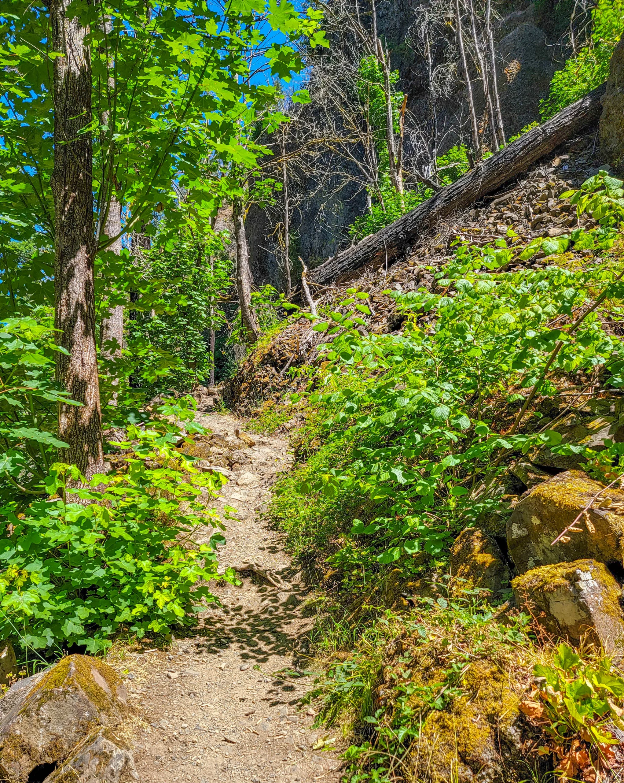
Wahclella Falls is a roughly 2-mile (3.2 km) round trip up Tanner Creek to a two-tier waterfall in a basalt amphitheater, and it’s one of the best short hikes in the Gorge. It requires a Northwest Forest Pass or America the Beautiful pass. The Tanner Creek watershed burned hot in the 2017 Eagle Creek Fire, and the trail is still recovering — check current status before you drive out, since storm damage has closed it more than once in recent years.
They’re about fifteen minutes apart on I-84 and pair naturally into one morning.
Read the full guide: Horsetail Falls and Wahclella Falls
(2) Bonneville Lock and Dam – Oregon
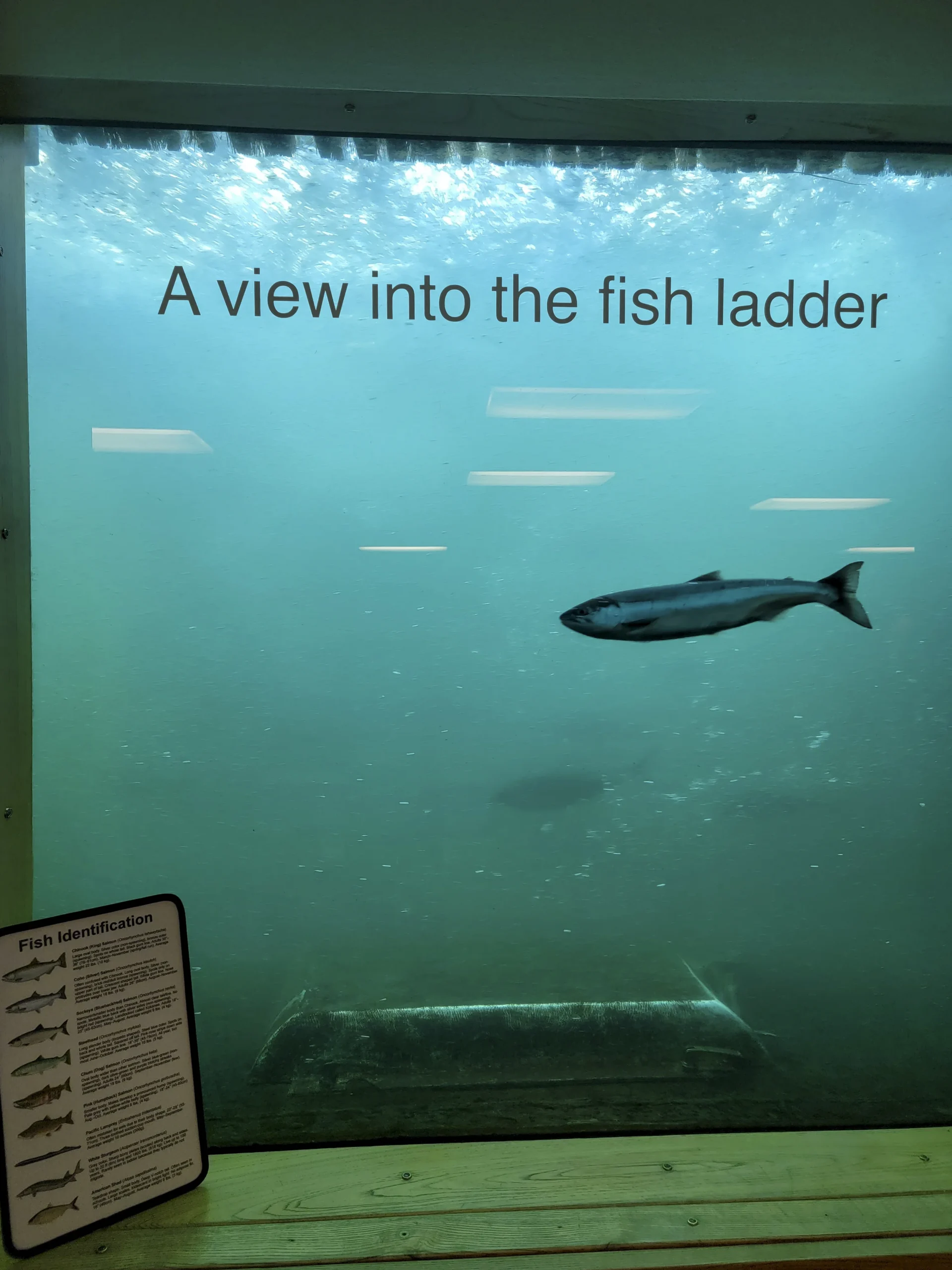
The Bradford Island Visitor Center is free, open daily, and has underwater windows looking straight into a fish ladder — you can sit on a bench and watch salmon, steelhead, shad, and Pacific lamprey climb past the glass. It’s a fifteen-minute detour off I-84 at Exit 40 that a lot of people drive past without knowing it’s there. Give it 30 to 60 minutes, and go in June or September if you want the fish counts at their peak.
Bonneville sits right between the two waterfall trailheads and Beacon Rock, which makes it an easy add rather than a detour.
Read the full guide: Bonneville Lock and Dam
(3) Beacon Rock – Washington

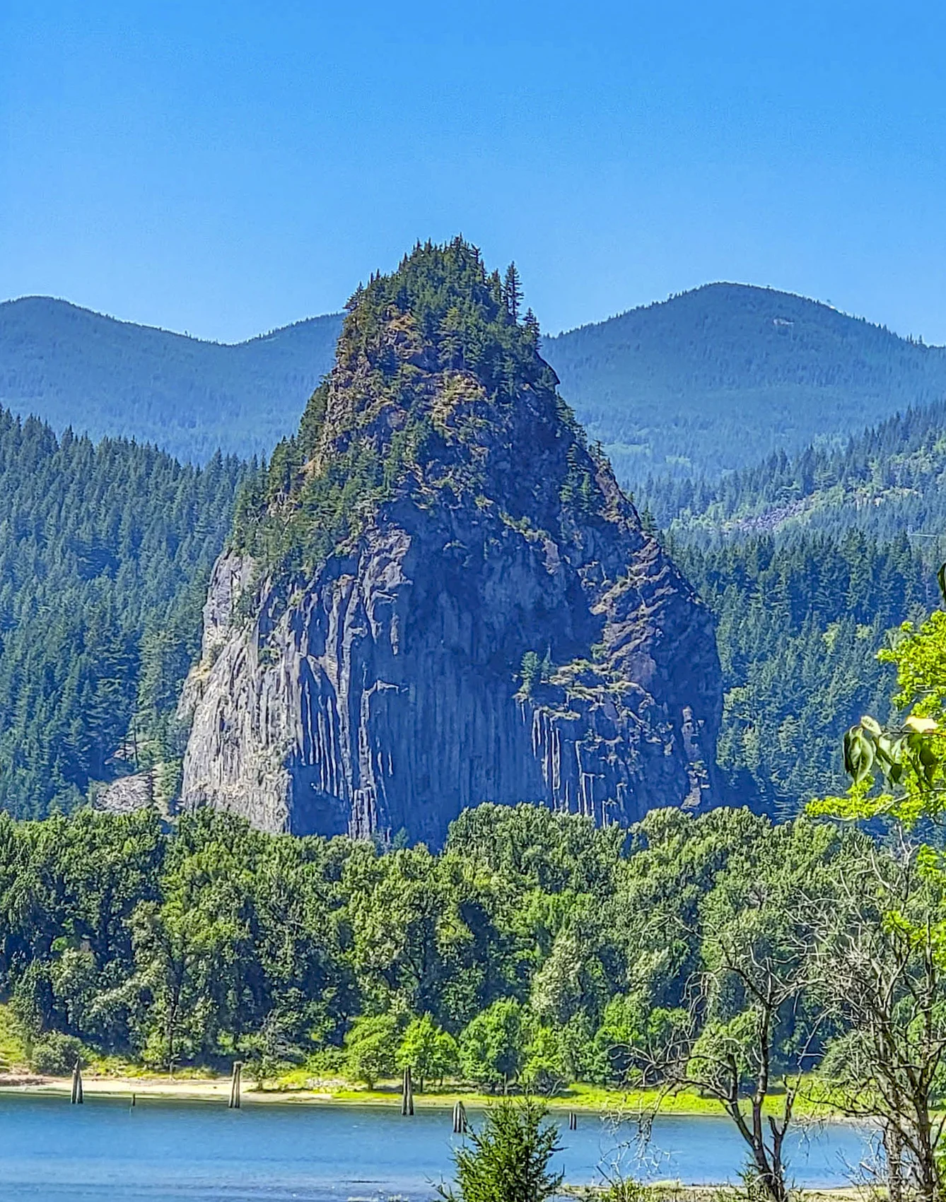
Beacon Rock is an 848-foot (258 m) basalt monolith on the Washington side, and a trail switchbacks straight up its face — 52 switchbacks and 22 bridges bolted and cribbed onto the cliff, built by hand between 1915 and 1918. It’s about 1.8 miles (2.9 km) round trip and takes 45 minutes to 1.5 hours. This is Washington, so it takes a Discover Pass, not the Oregon-side pass — $10 for one day or $45 annual.

The trail itself is the destination here more than the summit view is. It’s one of the most unusual pieces of trail engineering in the Northwest, and from the top you can see the Eagle Creek Fire’s burn scar across the river on the Oregon side, laid out at a distance you can’t get from inside it.
Read the full guide: Beacon Rock
Fees and Permits at a Glance
This is the part that catches people off guard — four stops, four different fee systems.
| Stop | State | Fee | Permit type |
|---|---|---|---|
| Horsetail Falls | Oregon | None | — |
| Wahclella Falls | Oregon | Day pass ~$5 or annual ~$30 | Northwest Forest Pass / America the Beautiful |
| Multnomah Falls (I-84 lot) | Oregon | $2 per vehicle | Recreation.gov Timed Use Permit, May 22–Sept 7, 9 a.m.–6 p.m. |
| Bonneville Lock and Dam | Oregon | None | — |
| Beacon Rock | Washington | $10/day or $45/year | Washington Discover Pass |
None of these passes substitute for each other. A Northwest Forest Pass doesn’t cover Beacon Rock, and a Discover Pass doesn’t cover Wahclella. If your day includes both states, carry both passes or plan to buy on site.
The Eagle Creek Fire Is Still the Story
The Eagle Creek Fire started on September 2, 2017, and burned roughly 50,000 acres of the Gorge, hitting the Tanner Creek watershed above Wahclella Falls especially hard. Standing dead snags on the ridges and dense new growth underneath are visible from both the Wahclella trail and the summit of Beacon Rock, looking across the river.
The practical consequence outlasts the visual one. Land managers have said flash flood, falling tree, and landslide risk stays elevated for up to a decade after a burn like this, which is why the Wahclella corridor keeps closing after big storms even years later. If a guidebook or old blog post describes deep unbroken shade the whole way up Tanner Creek, it predates the fire.
Pairing It With Mount Hood
A lot of itineraries bundle the Gorge with Mount Hood, and the two do connect by road — but they’re separate destinations. The Columbia River Gorge is the river canyon; Mount Hood is a volcano forty miles south of it. The Mount Hood Scenic Byway and Timberline Lodge makes a good second half of the day if you start early, but trying to do the waterfalls, Bonneville, Beacon Rock, and the mountain properly in one day means rushing all of it. Pick a focus.
Photography Notes
- Midday sun is the enemy in the basalt canyons at Horsetail and Wahclella. Overcast light — common in the Gorge — is a genuine advantage here.
- Beacon Rock is the opposite problem. The catwalks and switchbacks are the subject, and the exposure photographs fine at any time of day.
- Bring a polarizer. Wet basalt, waterfall spray, and leaf glare are constant.
- The burned ridges are worth shooting on purpose. Silver snags against new green growth is a striking, underused subject in this corridor.
- The fish ladder windows at Bonneville are hard shooting — thick glass, low light, moving subjects. Press the lens to the glass and turn off the flash.
Know Before You Go
- Book the Multnomah Falls permit ahead if it’s on your list, May 22 through September 7. The other stops in this guide don’t need it.
- Carry both a Northwest Forest Pass (or America the Beautiful pass) and a Washington Discover Pass if your day crosses the river.
- Check trail status before driving to Wahclella. The Tanner Creek watershed burned in 2017 and closes after major storms.
- Small lots fill early. Horsetail Falls, Wahclella Falls, and Beacon Rock all have limited parking that goes on summer weekend mornings.
- Fire restrictions can be in effect in late summer. Check current conditions before any campfire or backcountry plans.
- Bring water and sun protection for Beacon Rock. The trail is exposed with no water source.
- Bonneville Dam is an active federal facility and vehicles may be screened on the way in.
Is It Worth It?
Yes, and it’s an easy yes even if you only manage two of the four stops in this guide.
The Gorge packs a two-tier waterfall in a basalt amphitheater, a dam where you can watch salmon and lamprey through glass, and a mountain you climb the outside of on a switchback staircase, all within about a twenty-minute drive of each other. The honest caveat is logistics: two states, multiple agencies, and a permit system for the most famous single waterfall that doesn’t apply anywhere else nearby. Line up the passes before you go and the rest of the day takes care of itself.
For current alerts, trail closures, and fire restrictions, visit the Forest Service page for the Columbia River Gorge National Scenic Area.

0 Comments