
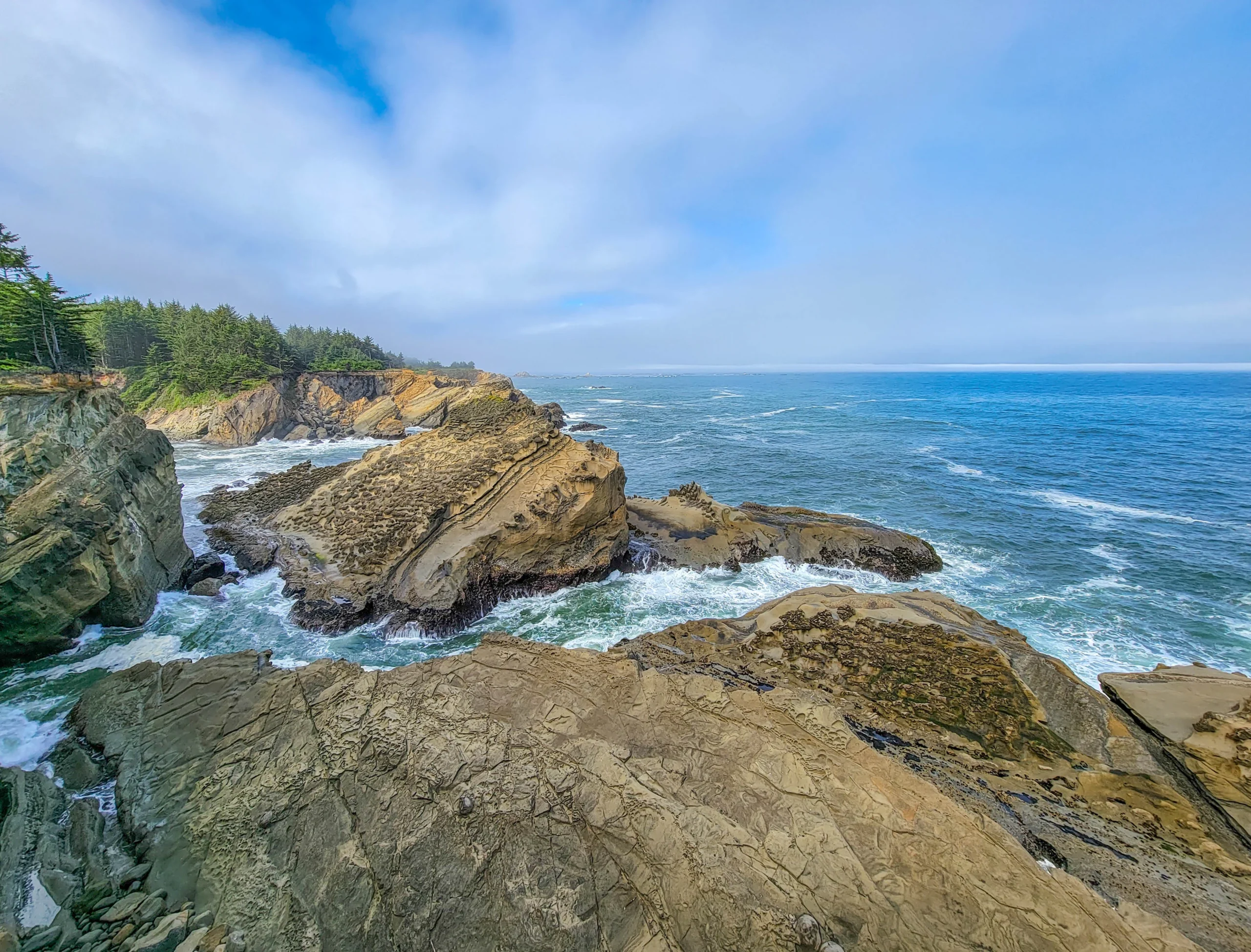

The Cape Arago Scenic Loop is a short coastal drive west of Coos Bay, Oregon, that strings together three state parks in about four miles (6.4 km) — Sunset Bay, Shore Acres, and Cape Arago — plus a sea lion haul-out, a lighthouse you can see but not visit, and some of the best tidepooling on the Oregon coast.
It is the highest concentration of good coastline per mile of driving anywhere in the state. You can see the headline stops in three hours. We started at Bastendorff Beach at 8:22 in the morning and were finished at Cape Arago by 11:19, and that pace felt unhurried.
One thing to sort out before you go: the parking. Most Oregon state parks are free. These three are not, and the rules are stricter than people expect.
The Basics
- Where: Cape Arago Highway, west of Charleston, about 13 miles (21 km) from Coos Bay
- Parking permit: Oregon State Park Pass required — $10 daily or $60 annual. One pass covers all three parks.
- Where the permit applies: anywhere you park inside park boundaries, including pullouts and roadside shoulders, not just the marked lots
- Also accepted: an Oregon Pacific Coast Passport, or your camping receipt from Sunset Bay or any Oregon state park campground
- Hours: day use, dawn to dusk
- Bastendorff Beach: managed by the Bureau of Land Management, Coos Bay District — day use only, no fee
- Time needed: 3 hours for the drive and the short walks; a full day if you hike the connecting trail
- Dogs: permitted on leash in the state parks
Five different land managers in about fifteen miles. BLM at Bastendorff. Oregon State Parks at the three parks. US Fish and Wildlife Service at Simpson Reef and Shell Island, which are part of the Oregon Islands National Wildlife Refuge. An Oregon Department of Fish and Wildlife intertidal Marine Protected Area at Cape Arago, where collecting anything is prohibited without a permit. And the Confederated Tribes of Coos, Lower Umpqua and Siuslaw Indians, who own the lighthouse and the point it stands on.
Nobody puts that on a map, and it determines what you’re allowed to do at each stop.
One Family Named Almost All of It
This is the thread that ties the loop together, and it’s the part most write-ups skip.
Louis J. Simpson was the son of Asa Mead Simpson, a shipping and timber magnate who arrived on Coos Bay in 1855 and founded the town of North Bend. In 1906 and 1907, Louis built an oceanfront summer estate for his wife Cassandra — Cassie — on a promontory west of Coos Bay, and called it Shore Acres.
Cassie died in 1921. Simpson had a stroke in 1939 and went bankrupt in 1940, and the mortgage holders sold the estate to the State of Oregon. The house is long gone. The gardens he planted are now a state park.
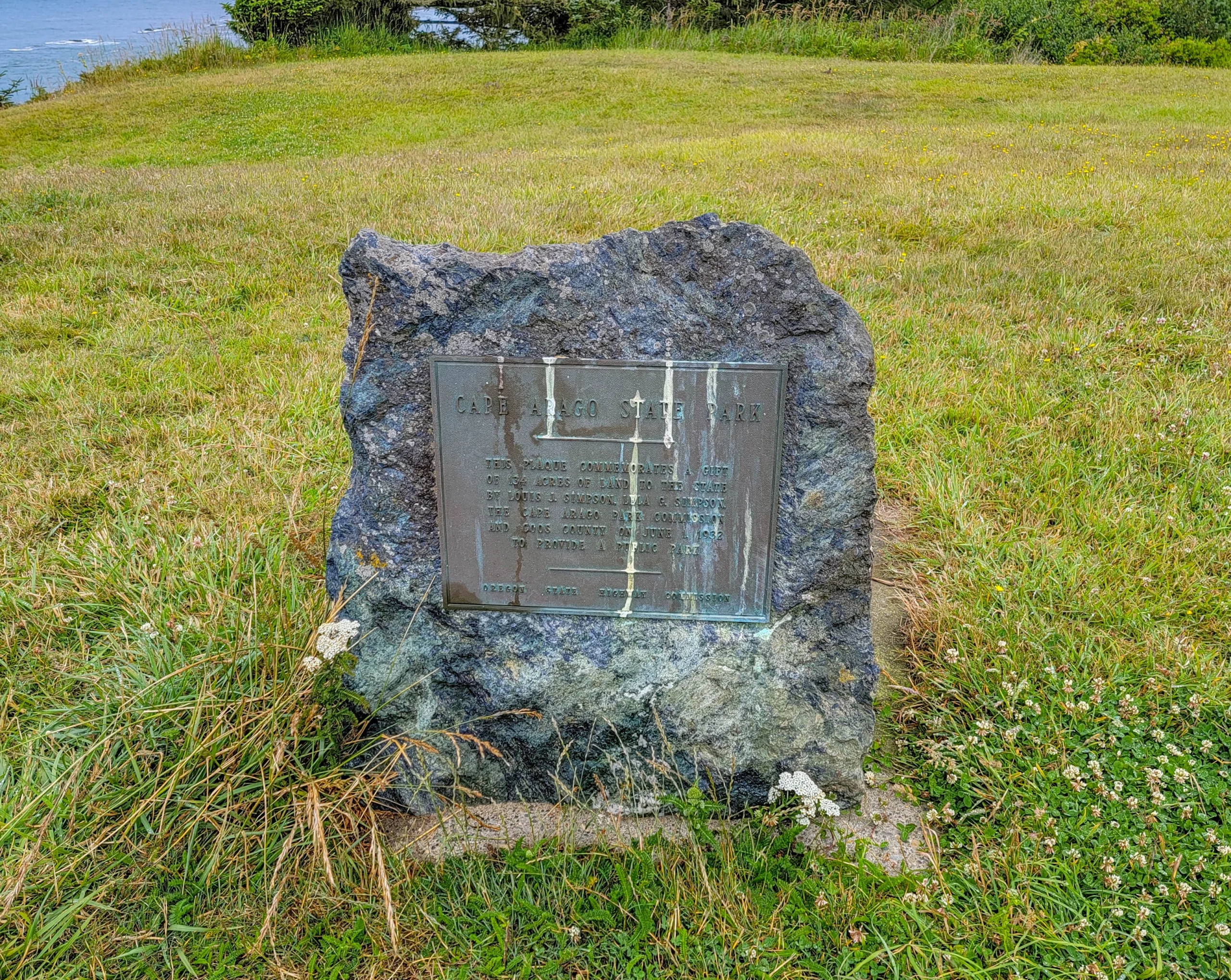
Two miles further down the road, a bronze plaque set into a boulder records the rest of it: 134 acres given to the state by Louis J. Simpson, Lela G. Simpson, the Cape Arago Park Commission and Coos County on June 1, 1932, to provide a public park.
And the offshore reef where the sea lions haul out carries the family name too.
Three stops, one family, and a lumber fortune that ended in bankruptcy and left behind the best stretch of public coastline in southern Oregon.
Driving the Loop
Take the Cape Arago Highway west out of Coos Bay through Charleston. The road runs out along the coast, dead-ends at Cape Arago, and you come back the way you went. It isn’t a loop in the circular sense — it’s an out-and-back that everyone calls a loop.
(1) Bastendorff Beach – Bureau of Land Management
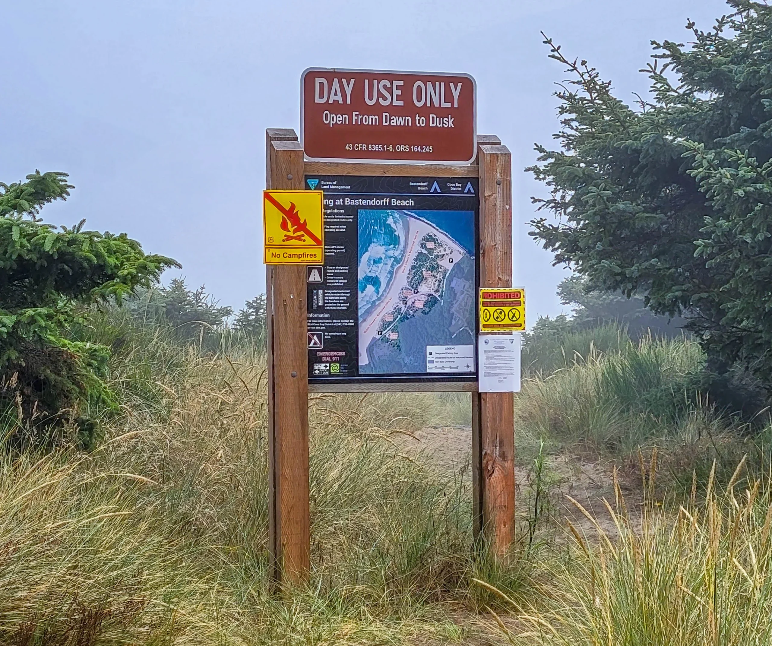
The first stop past Charleston, and the one that catches people off guard on the paperwork: it’s BLM land, not a state park, so your state park pass isn’t what’s operating here and there’s no fee at all.
A long sand beach below a bluff, popular with surfers, with a Coos County campground on the hill above it. Worth ten minutes on the way out if the light is good.
Know Before You Go — Bastendorff Beach
- Open dawn to dusk, year round.
- Open fires are prohibited during fire season, July 1 through September 30. That covers campfires, charcoal, cooking fires, and warming fires. Portable stoves running on liquefied or bottled fuel are still allowed.
- Two universal access vault restrooms, in the middle and south parking areas. There is no running water at the beach.
- Street-legal OHVs are permitted on designated routes on the foredune. Vehicles need a safety flag and an Oregon OHV sticker.
(2) Sunset Bay State Park
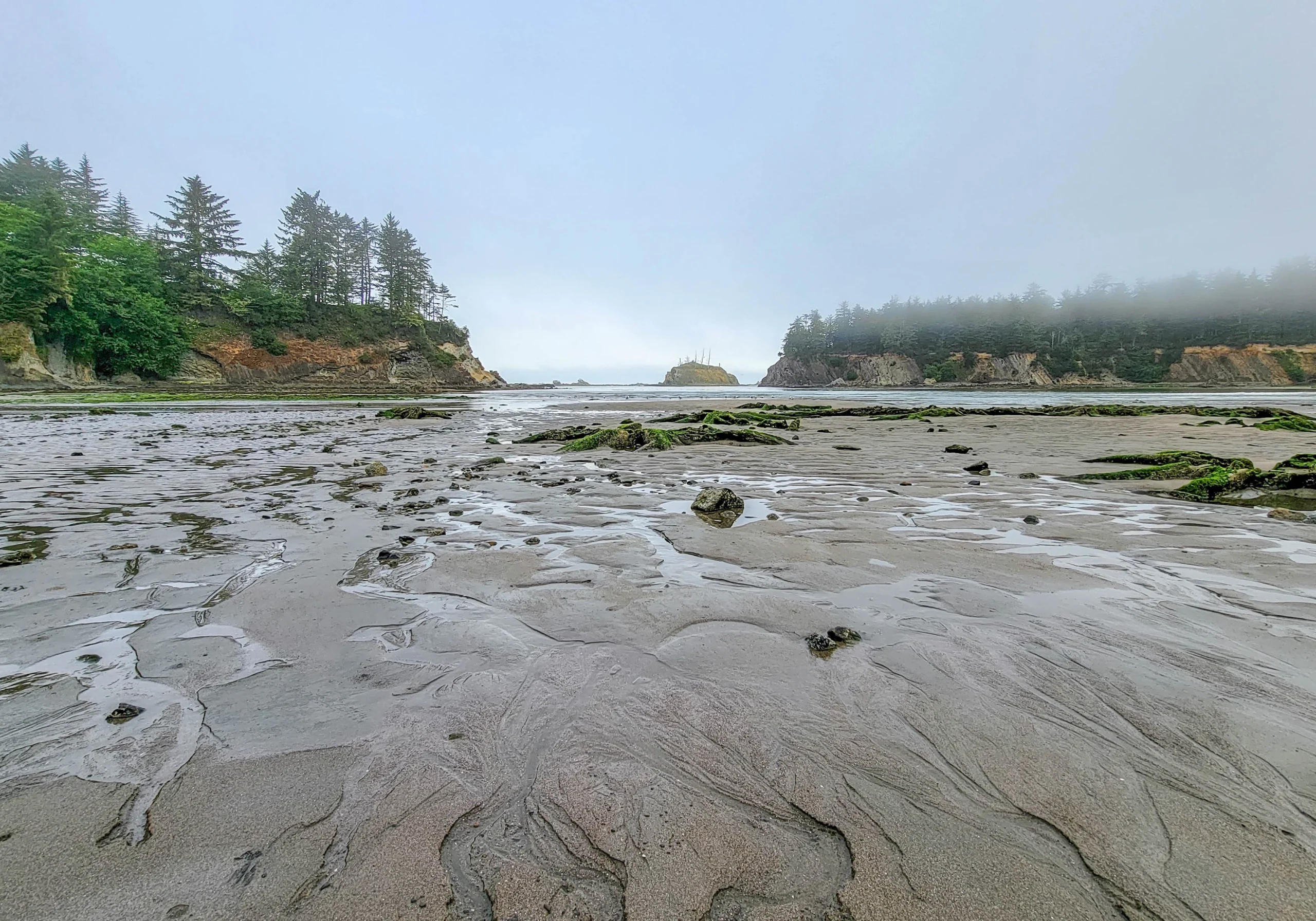
A near-circular cove with a narrow mouth, ringed by sandstone cliffs, holding a shallow protected beach. The geometry is the point — the headlands block the swell, so the water here is calm and warm enough to actually swim in, which is close to unheard of on the Oregon coast.
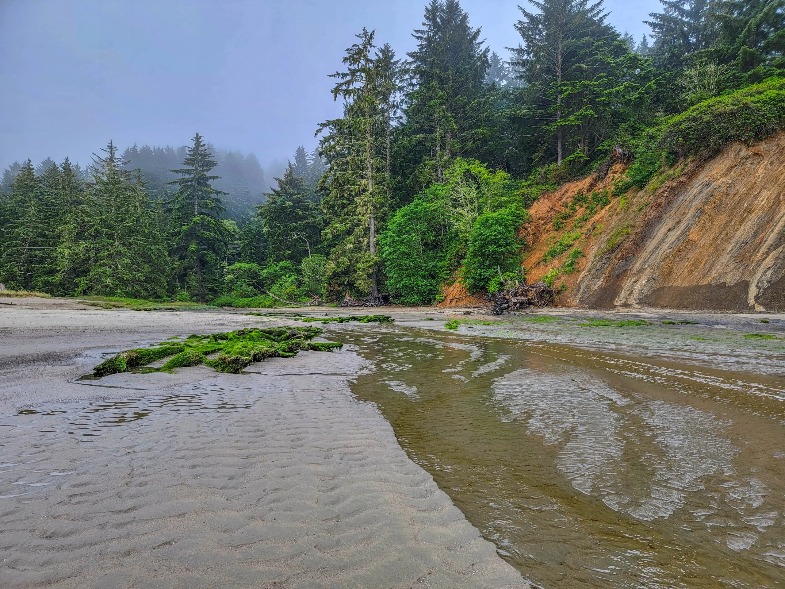
We got there at low tide on a July morning and the bay had drained into a broad flat of wet sand and mossy rock ledges. Come at high tide and it’s a swimming cove; come at low tide and it’s a completely different place.
Sunset Bay has the loop’s only campground — 30 full-hookup sites, 35 electrical, 65 tent sites, and 8 yurts, open year round. Your camping receipt doubles as the parking permit for all three parks, which makes staying here the cheapest way to do the loop.
(3) The Lighthouse Lookout
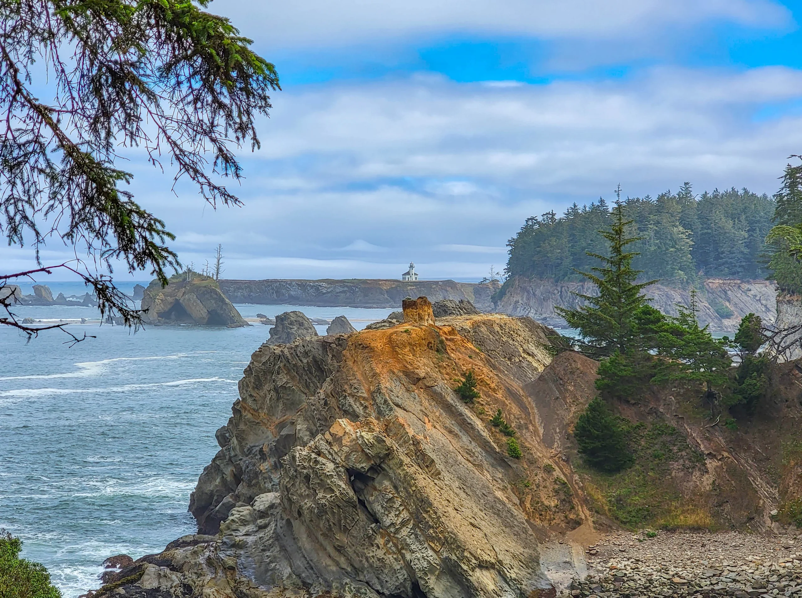
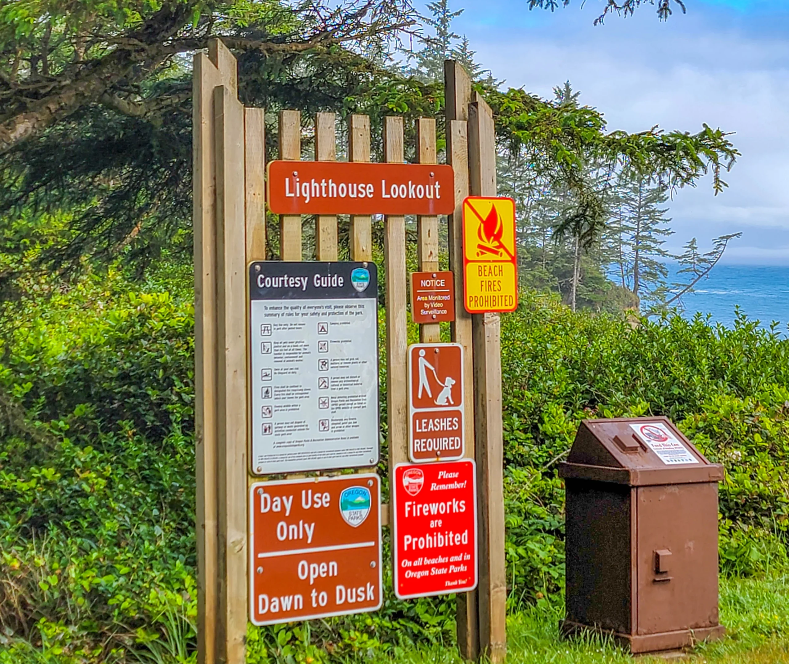
A short signed path off the highway leads to a viewpoint over Gregory Point and the Cape Arago Lighthouse, standing on Chief’s Island just offshore with tilted sandstone strata in the foreground.
You cannot visit the lighthouse, and this viewpoint is the reason the stop exists. In 2013 the Coast Guard transferred roughly 24 acres — the lighthouse, Gregory Point, and Chief’s Island — to the Confederated Tribes of Coos, Lower Umpqua and Siuslaw Indians, under legislation signed in 2008. It’s tribal land, closed to general public access.
A lot of older guides still describe walking out to it. Read the lookout as the destination rather than a consolation prize and the stop makes sense.
(4) Shore Acres State Park
The centerpiece of the loop, 2.5 miles (4 km) south of Sunset Bay, and a 743-acre park built around what’s left of the Simpson estate.
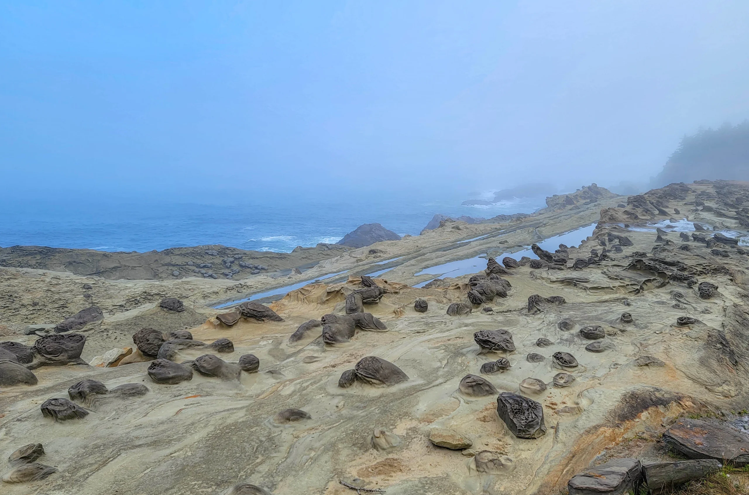
The cliffs are the reason to come. The sandstone here is tilted, layered, and riddled with concretions — harder mineral nodules that erode more slowly than the rock around them and leave the shelf looking hammered and pitted. When a swell is running, the water hits those ledges and goes vertical.
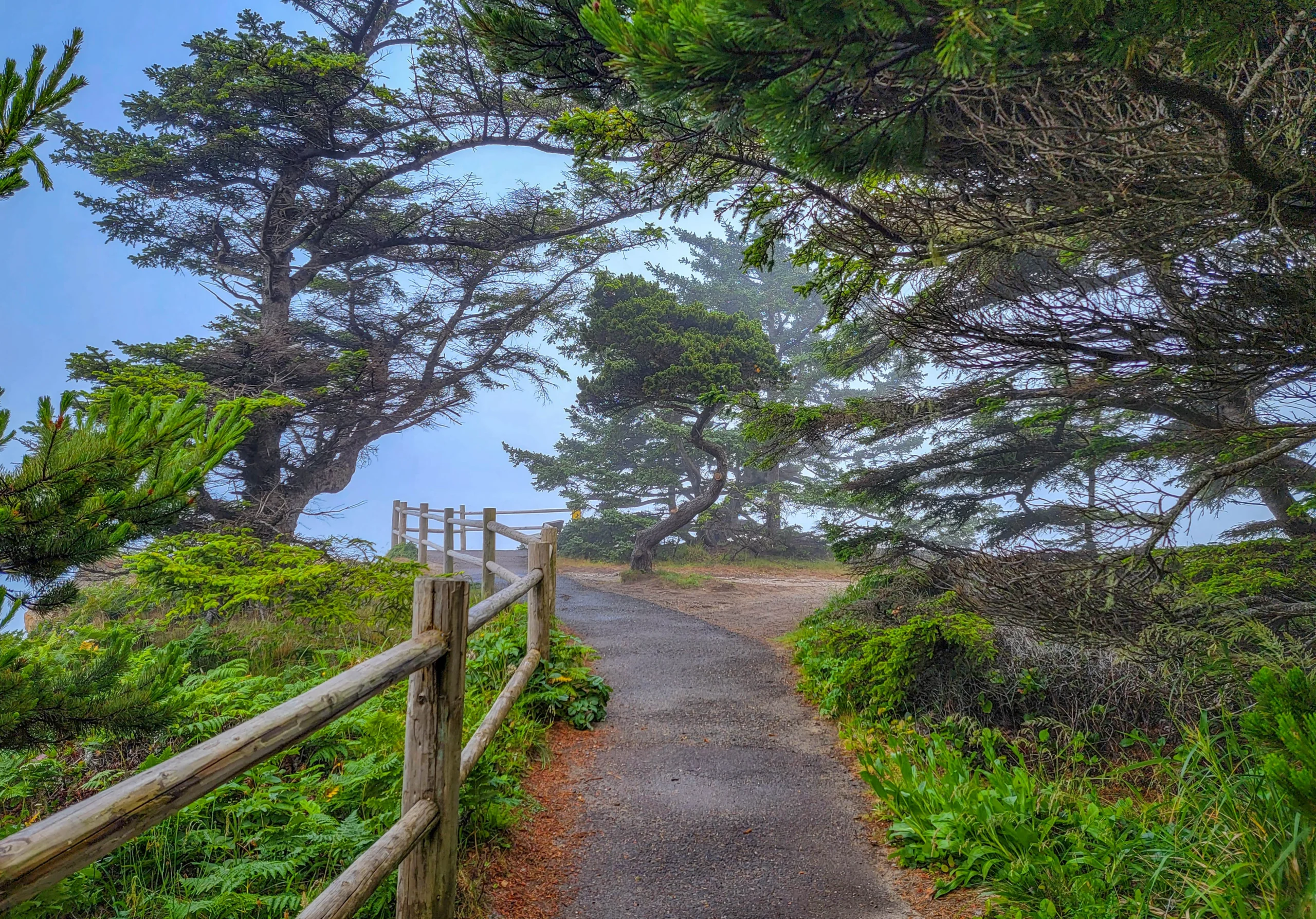
A glass-walled observation shelter sits on the site of the old house, with interpretive panels on the estate and enough shelter to watch weather come in without standing in it. Gray whales pass south from December through February and north from March through May, and the shelter is one of the better places on the coast to look for them.
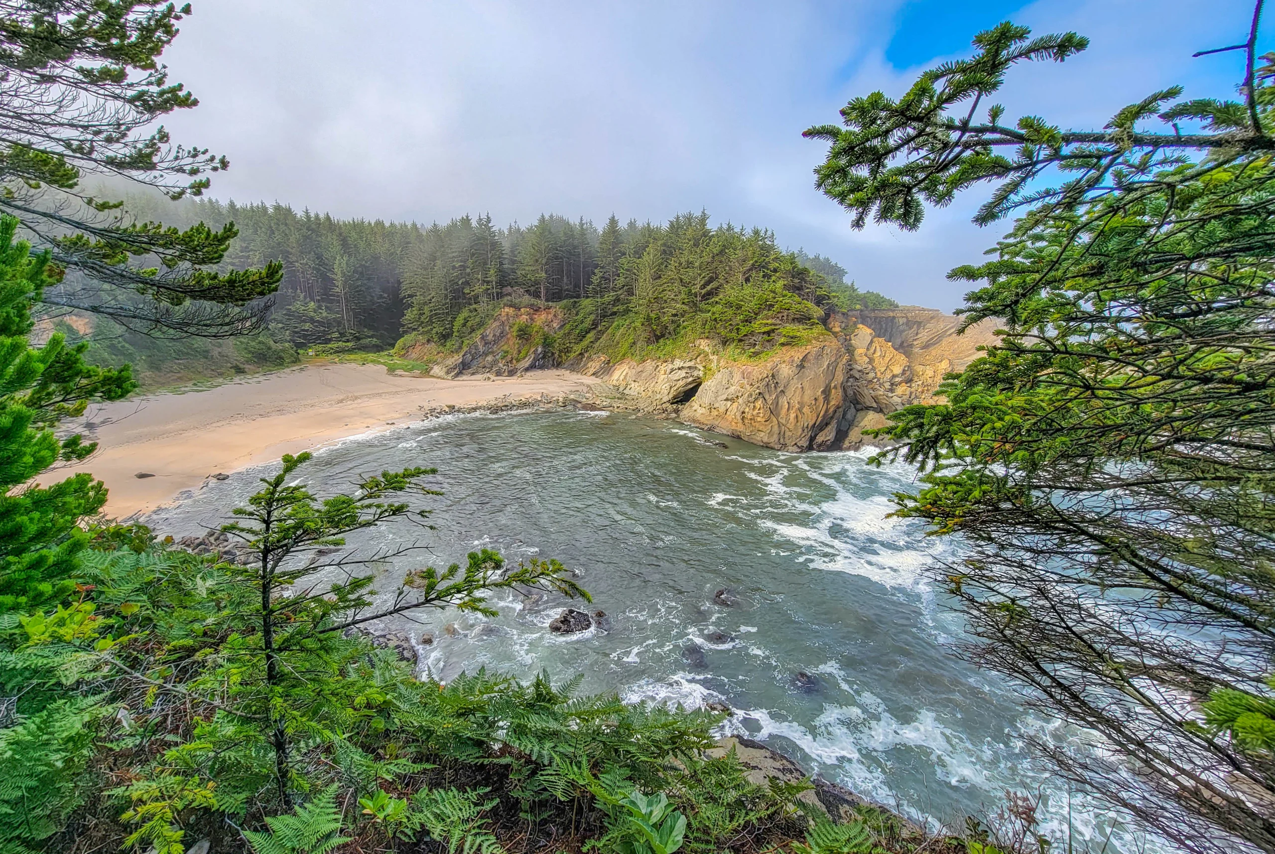
We hit the cliffs in the middle of a morning where fog kept rolling in and pulling back every few minutes. At 9:34 it was blue sky over the sandstone; by 9:39 the cove below was buried. That’s a normal July morning here rather than bad luck.
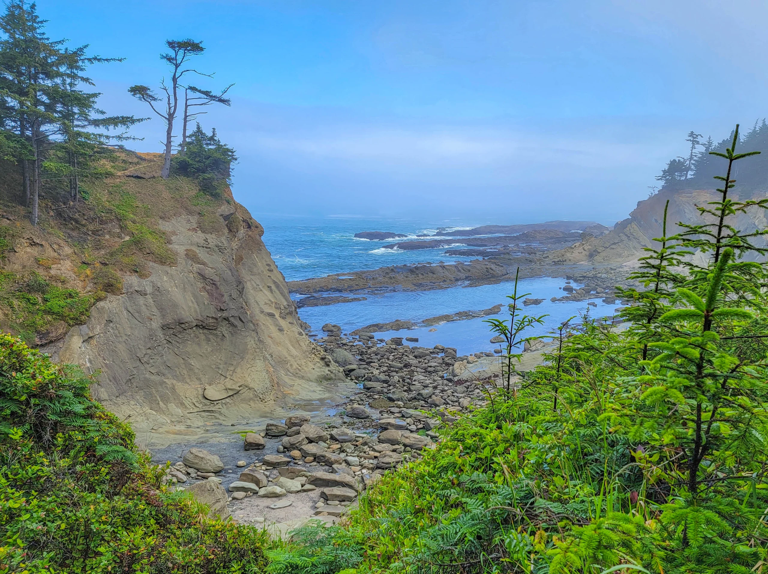
A trail drops from the cliff path to Simpson Beach, a sheltered cove below the park.
What we skipped, and you shouldn’t. Shore Acres holds 7 acres (2.8 ha) of formal gardens — a formal garden, two rose gardens, and an Oriental garden with a lily pond — planted for the estate and maintained since. We walked the cliffs and never went in, which I’d do differently now. From Thanksgiving through New Year’s Eve the gardens carry more than 325,000 holiday lights, put up by volunteers and the Friends of Shore Acres. That’s the park’s biggest single draw and it happens in the darkest, wettest part of the year.
Note: Garden details from park sources — we only walked the coastline.
(5) Simpson Reef and Shell Island Overlook
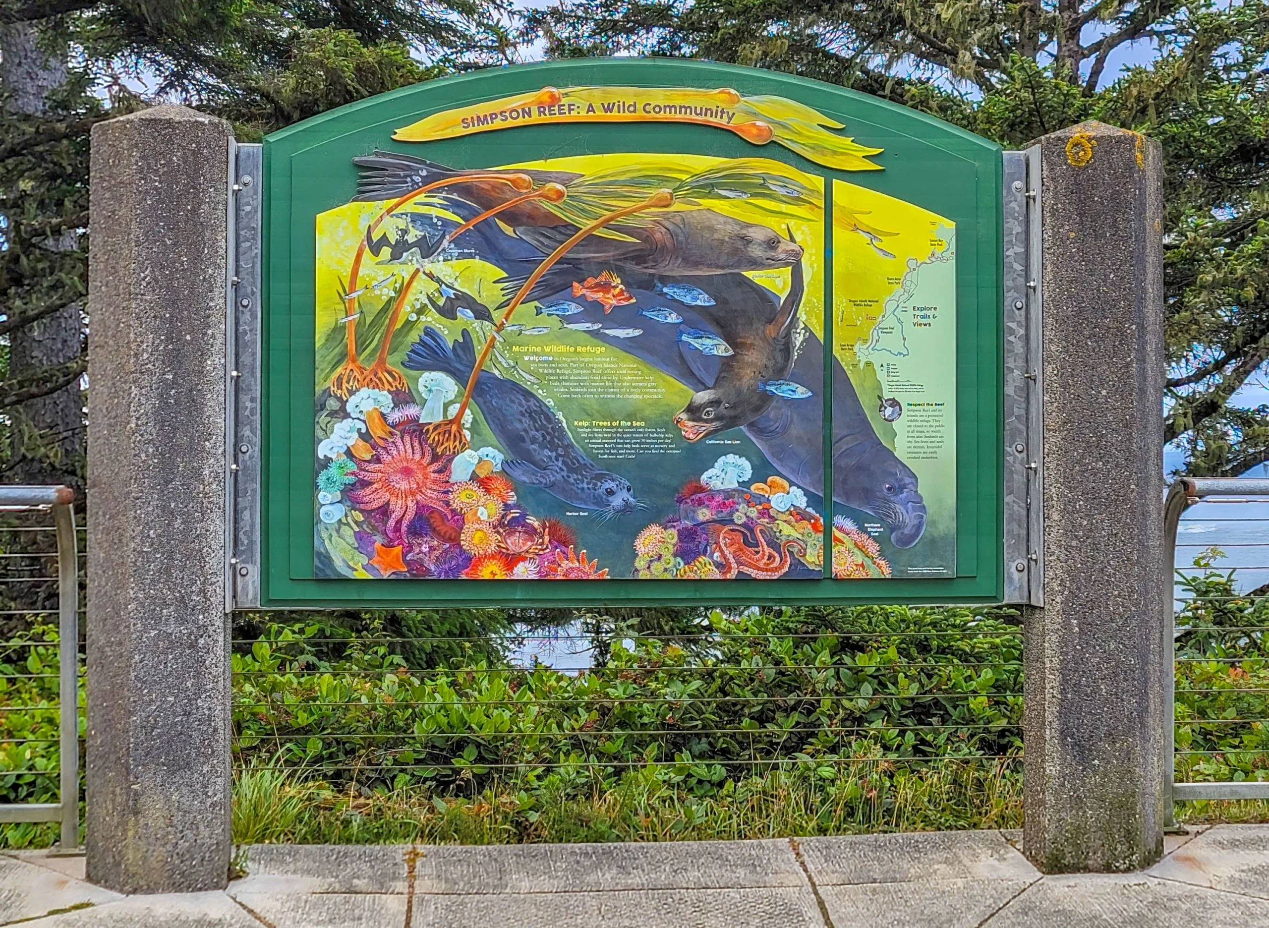
A roadside pullout with benches and interpretive panels, looking out at the largest marine mammal haul-out on the Oregon coast.
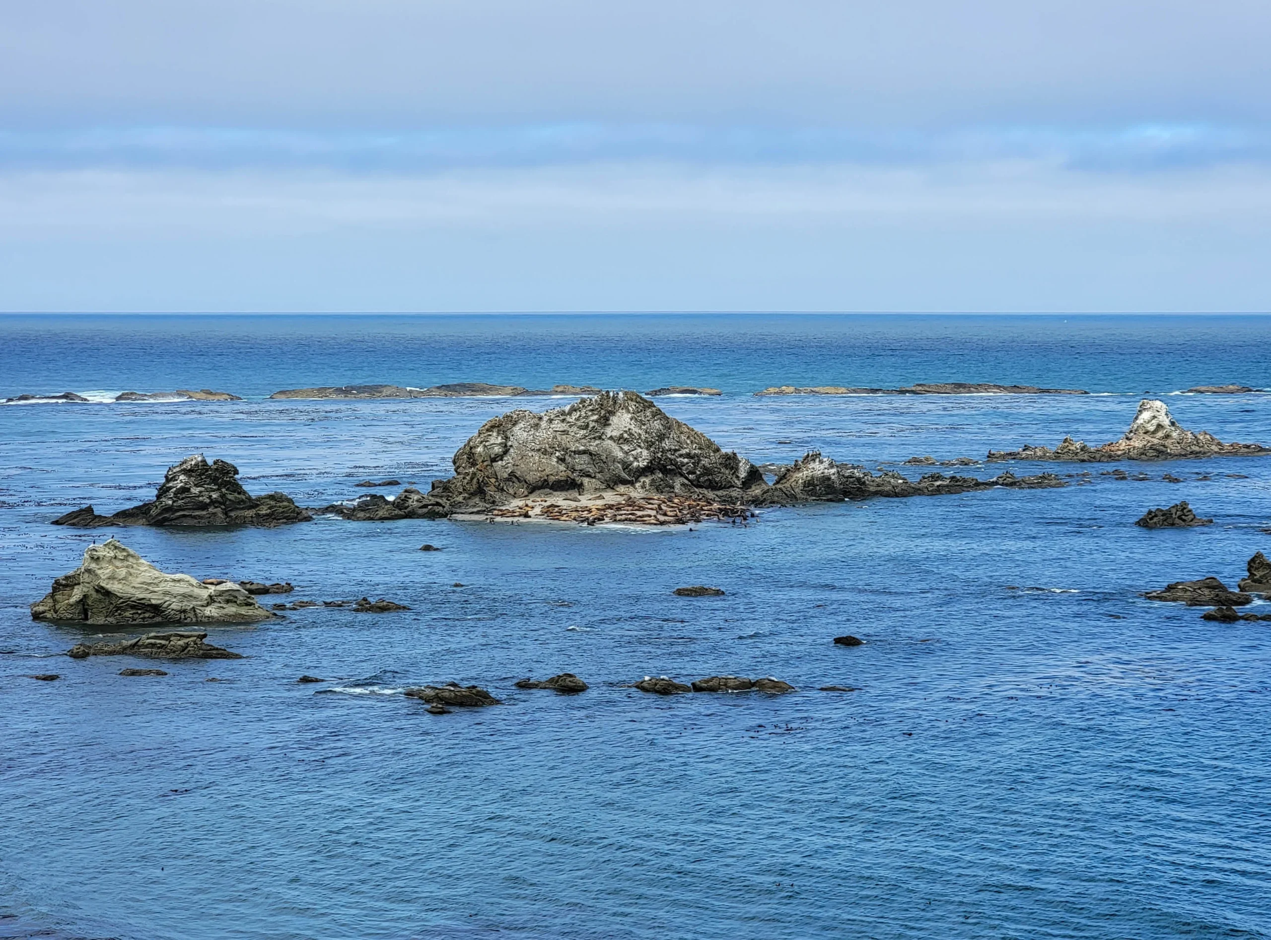
Shell Island and the surrounding reefs hold northern elephant seals, harbor seals, Steller sea lions, and California sea lions, hauled out to breed, give birth, nurse, and sleep. Seabirds work the rocks alongside them — cormorants, murres, and puffins.
You’ll hear it before you see it. The barking carries across the water on a still morning, and it’s the detail nobody mentions.
The islands are part of the Oregon Islands National Wildlife Refuge and are closed to public access at all times. The animals sit roughly a quarter mile (0.4 km) offshore, so bring binoculars or a long lens — without them you’re looking at brown shapes on a rock.
(6) Cape Arago State Park
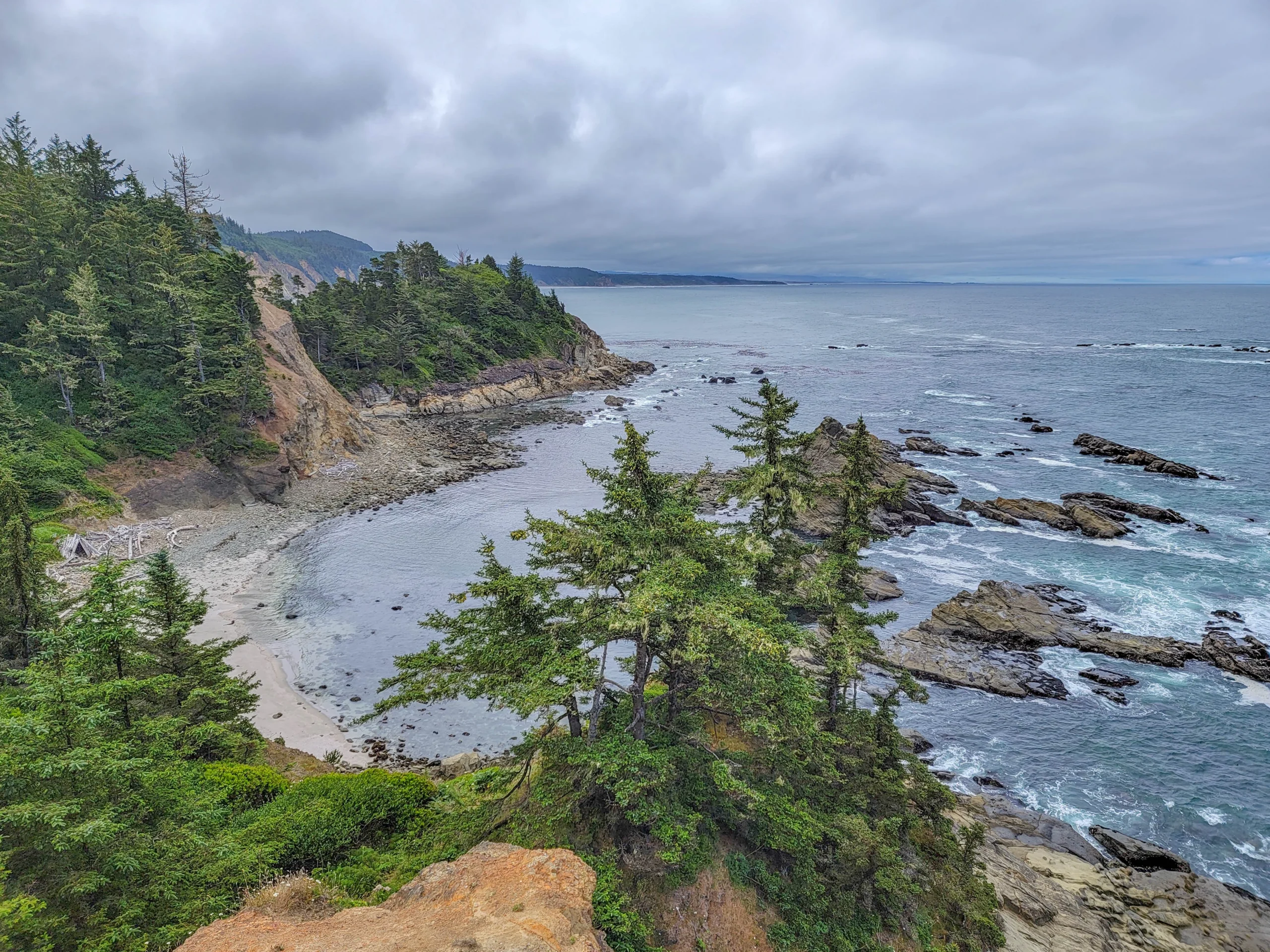
The end of the road, on the 134 acres the Simpsons and Coos County handed over in 1932. Three viewpoints sit along the headland, and two trails drop to coves on either side.
The North Cove trail closes March 1 through June 30 every year to protect harbor seal pups on the beach below. There’s a viewpoint above it that stays open, so you can still see the cove — you just can’t go down. We were there July 7, a week after it reopened.
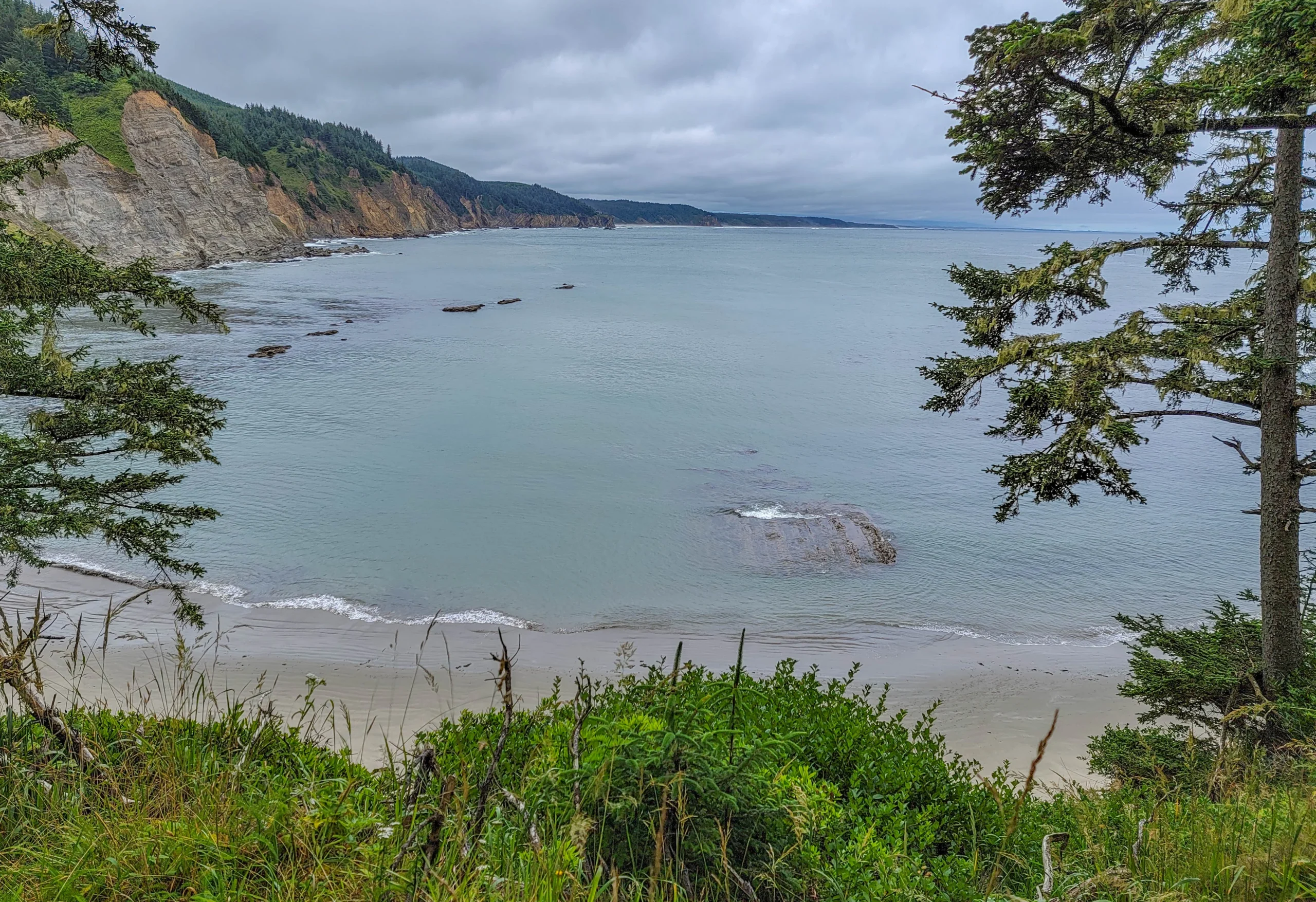
South Cove is where the tidepooling is. A short trail drops to a beach backed by rounded sandstone boulders, and at low tide the shelf between them fills with pools.
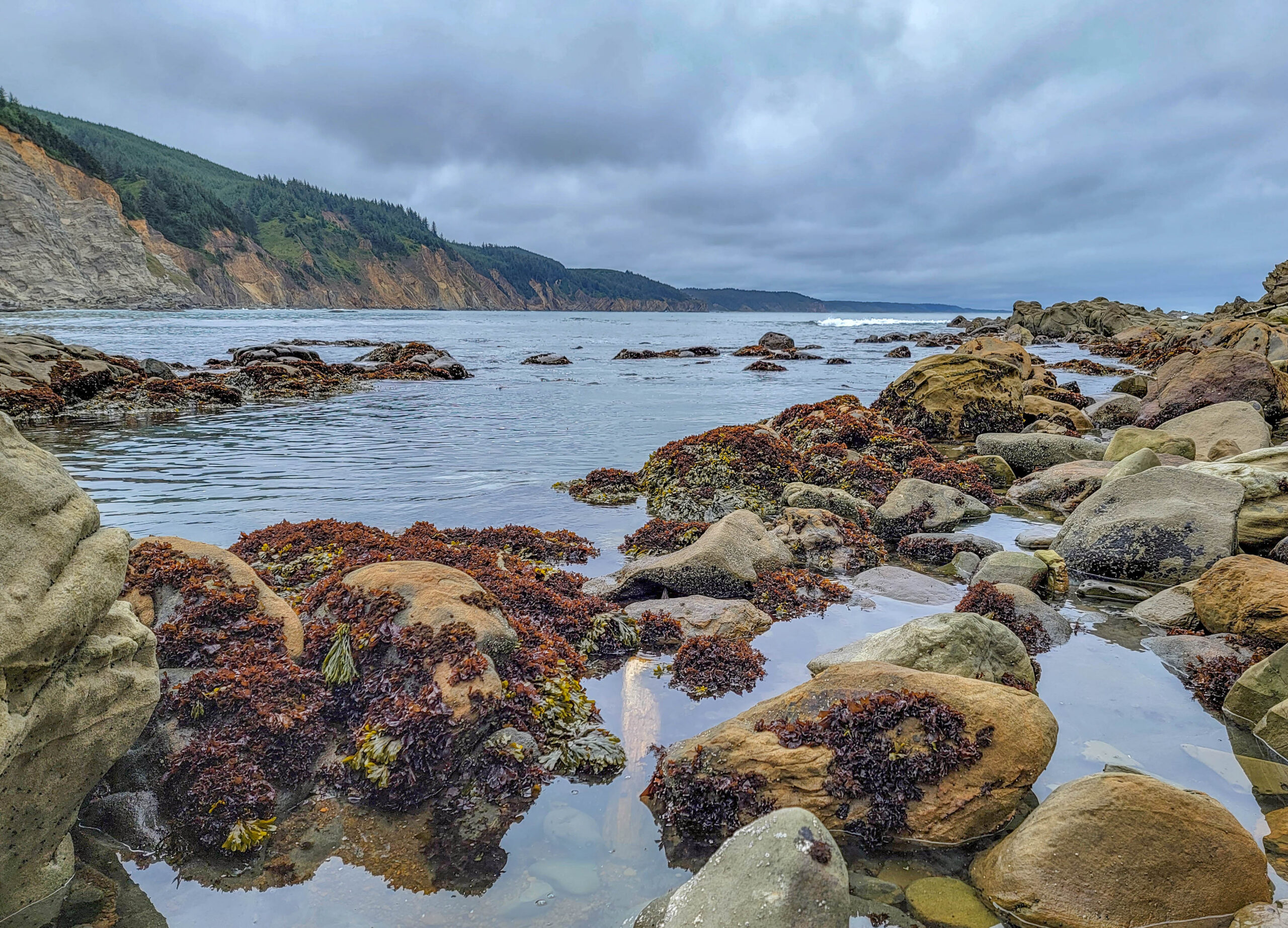
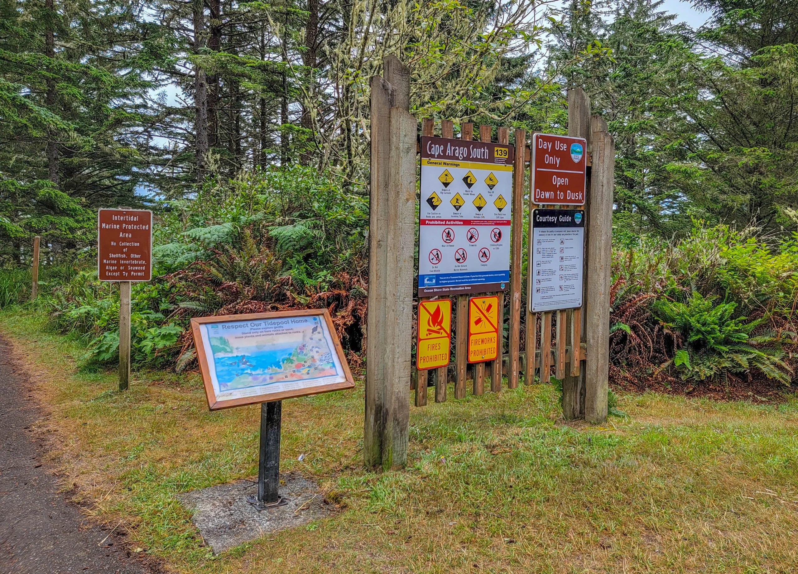
This is a designated intertidal Marine Protected Area. Collecting shellfish, marine invertebrates, algae, or seaweed is prohibited without a permit — the sign at the trailhead spells it out. Look, photograph, put nothing in a bucket.
Hiking the Connecting Trail
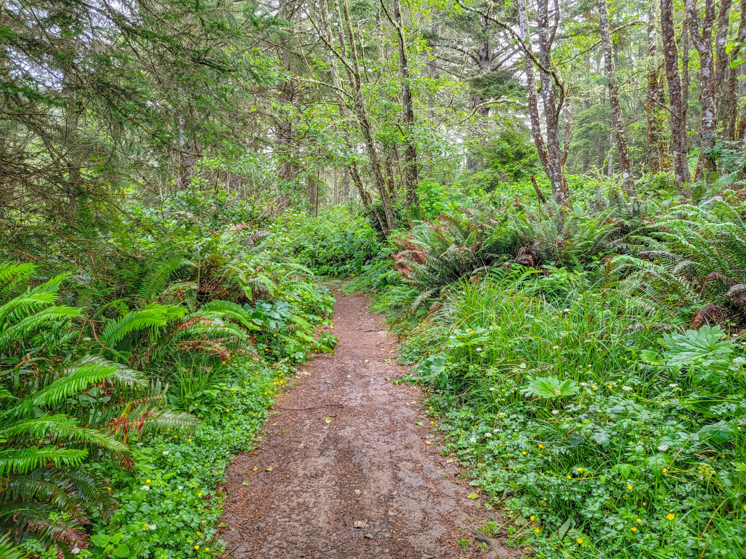
A section of the Oregon Coast Trail links all three parks along the clifftop, and hiking it is a completely different day from driving it.
| Route | Distance | Difficulty |
|---|---|---|
| Sunset Bay to Shore Acres, one way | About 2.5 mi (4 km) | Easy to moderate |
| Sunset Bay to Cape Arago, round trip | About 7.5–8.5 mi (12–13.7 km) | Moderate, roughly 670 ft (204 m) gain |
| Cape Arago South Cove trail | Short, steep descent | Easy |
| Lighthouse Lookout path | Short | Easy |
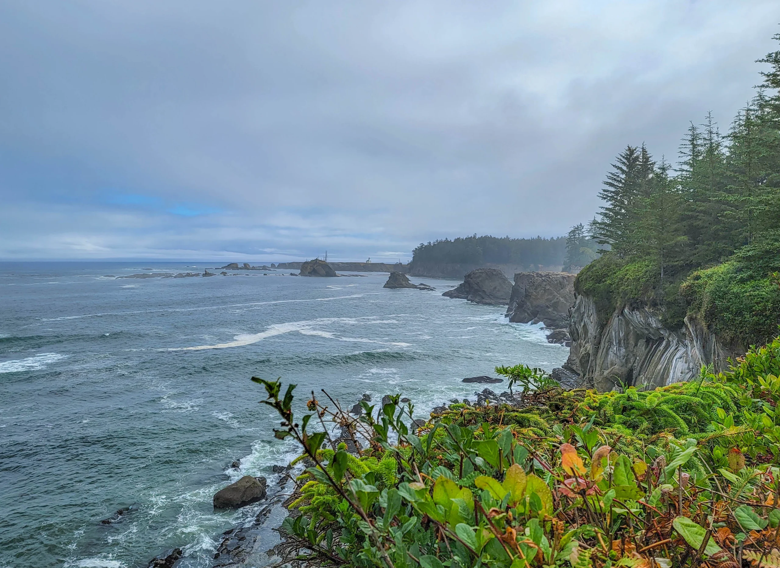
The full round trip runs about 3 to 3.5 hours of walking. Sections cross unfenced clifftop, and the sandstone here undercuts and fails — a trail in the park was closed for part of winter 2026 after a landslide. Check current conditions before you commit to the long version.
Photography Notes
- Fog is the condition, not the exception. Summer mornings here fog in and clear repeatedly. Wait fifteen minutes rather than driving on.
- The concretion shelf at Shore Acres is the most distinctive subject on the loop and it wants side light. Overcast flattens it.
- Bring a long lens for Simpson Reef. At a quarter mile, anything under 300mm gives you a rock with specks on it.
- Low tide transforms Sunset Bay and South Cove. Check a tide table and build the morning around it — the same two stops are unrecognizable at high water.
- A polarizer earns its place on wet sandstone and tidepools.
- The lighthouse view is a long-lens shot across water, and it’s better in flat light than in sun.
Where to Eat and Stay
- Charleston is the closest base — a working fishing village at the mouth of Coos Bay with fresh seafood and not much else. That’s the appeal.
- Coos Bay and North Bend, about 13 miles (21 km) east, have the full range of lodging and restaurants.
- Sunset Bay State Park campground is the best value on the loop: 138 sites plus 8 yurts, open year round, and your receipt covers parking at all three parks. Reserve well ahead for summer.
- Bastendorff Beach County Park has a second campground on the bluff above the beach.
Know Before You Go
- Buy the parking pass. $10 daily or $60 annual, required anywhere you park in the three parks including pullouts. One pass, all three.
- Bastendorff is BLM and free. Different agency, different rules, no permit.
- Check the tide table. Sunset Bay and South Cove are worth timing; the rest of the loop isn’t tide-dependent.
- North Cove at Cape Arago is closed March 1 through June 30 for seal pupping.
- Take nothing from the tidepools. Cape Arago is a Marine Protected Area and collecting requires a permit.
- The cliffs are unstable and mostly unfenced. Stay back from the edges, and check for trail closures after a wet winter.
- Cell service is patchy past Charleston.
- Bring layers. It was 64 degrees and partly cloudy in July, which is a normal summer day here.
Is It Worth It?
Yes, and it’s the most underrated stretch of coast in Oregon.
Four miles of road gets you a swimming cove, a wave-battered sandstone shelf, formal gardens from a vanished estate, the state’s largest sea lion haul-out, a lighthouse on tribal land, and protected tidepools. Nothing else on this coast packs that much variety into that little driving, and on a July morning we had most of it nearly to ourselves.
The honest caveats are small. The parking rule surprises people. The lighthouse is a view rather than a visit. The sea lions need optics you may not have brought. And the fog does what it wants.
Give it a full morning, buy the pass, check the tide, and don’t skip the gardens the way we did.
For current conditions, fees, and closures, visit the Oregon State Parks pages for Sunset Bay, Shore Acres, and Cape Arago.

0 Comments