
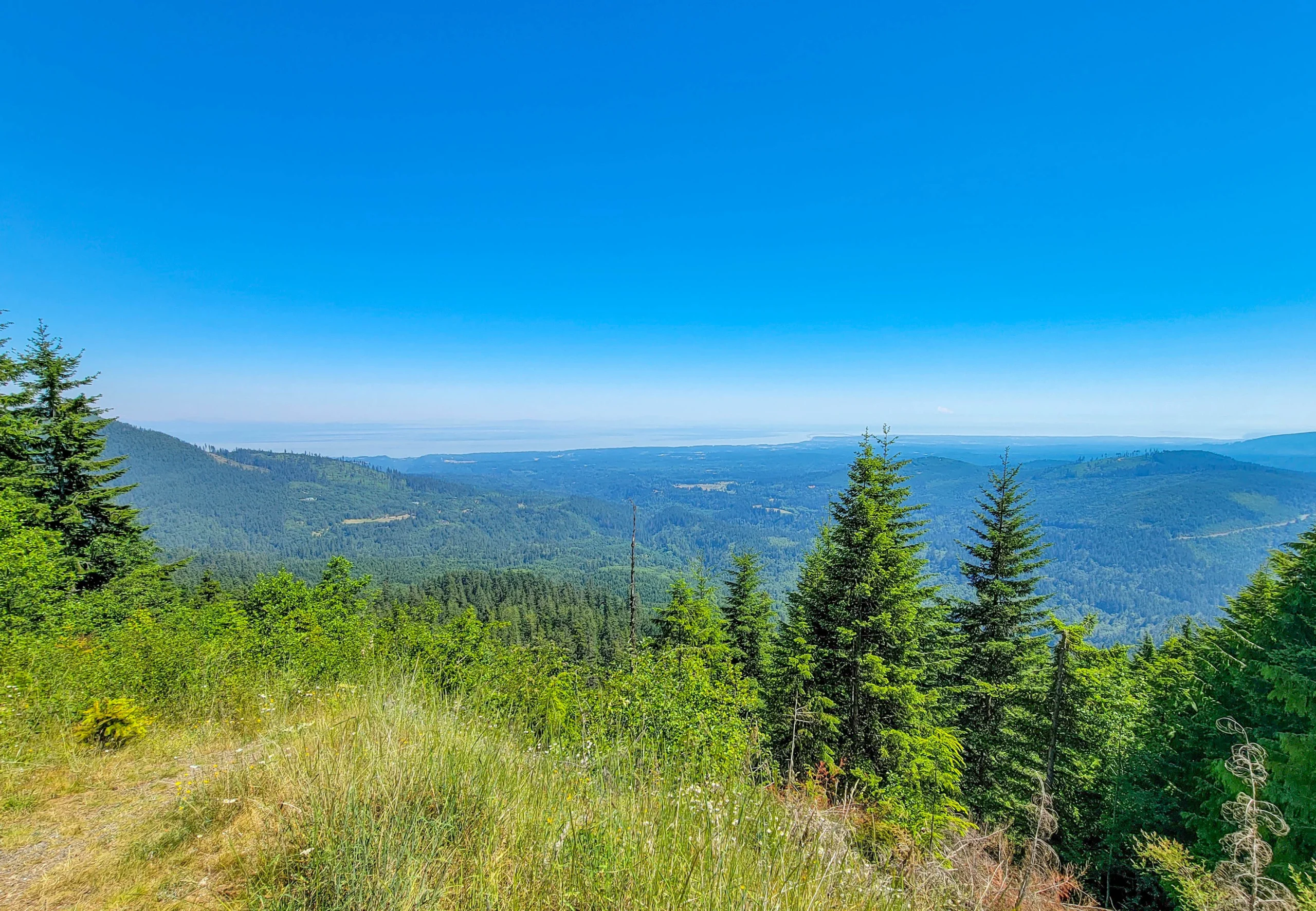

The Olympic Peninsula is the northwest corner of Washington State — a roughly circular block of land bounded by the Pacific on the west, the Strait of Juan de Fuca on the north, and Hood Canal on the east, with Olympic National Park occupying close to a million acres in the middle of it.
US Highway 101 runs a 329-mile (529 km) loop around the whole thing. You can drive it in about eight hours without stopping. Nobody should. Three days is the realistic minimum, and a week wouldn’t be wasted.
What makes the peninsula unusual isn’t any single destination. It’s that the weather and the landscape change completely every thirty miles. The Hoh Rain Forest takes 140 to 170 inches of rain a year. Sequim, ninety miles east in the mountains’ rain shadow, takes 17. Glaciated peaks sit two hours from temperate rainforest, which sits an hour from wild Pacific coastline.
A note on this guide. We spent four days on the peninsula in late June 2021 and covered the north side and the Hood Canal shore. We didn’t reach the Hoh, the Pacific beaches, Lake Quinault, or Cape Flattery — those sections come from official sources and are flagged as such below.
The Basics
- US 101 loop: 329 miles (529 km), about 8 hours of pure driving
- Olympic National Park entrance fee: $30 per vehicle for 7 days; $55 annual
- Washington State Parks: Discover Pass, $45 annual or $10 daily
- Clallam County parks (Salt Creek): free
- Olympic National Forest (Murhut Falls): free, no pass
- Makah Reservation (Cape Flattery): Makah Recreation Pass required
- Getting there: Bainbridge or Kingston ferry from Seattle, or drive around via Tacoma
Four different land managers, four different pass regimes. That’s the peninsula’s defining practical quirk, and it confuses people constantly.
Understanding the Rain Shadow
This is the single most useful thing to understand before you plan, and most guides skip it.
Weather comes off the Pacific from the southwest, hits the Olympic Mountains, and dumps everything it has on the western slopes. By the time the air crosses the range and descends toward the northeast corner, it’s dry.
The numbers are extreme:
| Place | Annual rainfall |
|---|---|
| Hoh Rain Forest (west) | 140–170 inches (356–432 cm) |
| Forks (west) | 120+ inches (305 cm) |
| Sequim (northeast) | About 17 inches (43 cm) |
Ninety miles apart. Sequim grows lavender and has a genuine irrigation history; the Hoh is one of the wettest places in the continental United States.
Use it. If the forecast is grim, drive northeast. If the west side is socked in, Sequim and Port Townsend are often clear. We arrived during the June 2021 heat dome and spent the trip relocating by elevation and aspect rather than canceling anything.
The North Side — Port Angeles and the Strait
The most accessible part of the peninsula and where most first visits happen.
Olympic National Park: Hurricane Ridge, Lake Crescent, and Sol Duc
The park’s north entrance sits 17 miles above Port Angeles at Hurricane Ridge, 5,242 feet (1,598 m), reached by a paved road with three tunnels. West of town, Lake Crescent is a glacially carved lake 624 feet (190 m) deep with water clear enough to see the bottom drop away. South of the highway, the Sol Duc valley holds low-elevation old growth and a 1.6-mile round trip to Sol Duc Falls.
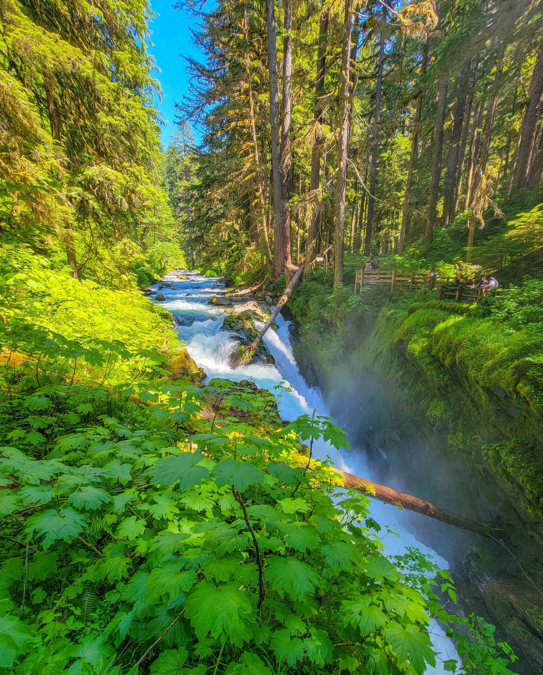
One important current note: the Hurricane Ridge Day Lodge burned down on May 7, 2023 and has no permanent replacement. Temporary trailers only — no café, no indoor space.
Read the full guide: Olympic National Park – Hurricane Ridge & Sol Duc
Salt Creek Recreation Area
Fifteen miles west of Port Angeles, a 196-acre county park with what we found to be the best tidepooling on the West Coast, plus WWII gun emplacements from Camp Hayden and a 5-mile hike up Striped Peak. Day use is free — no Discover Pass, no fee.
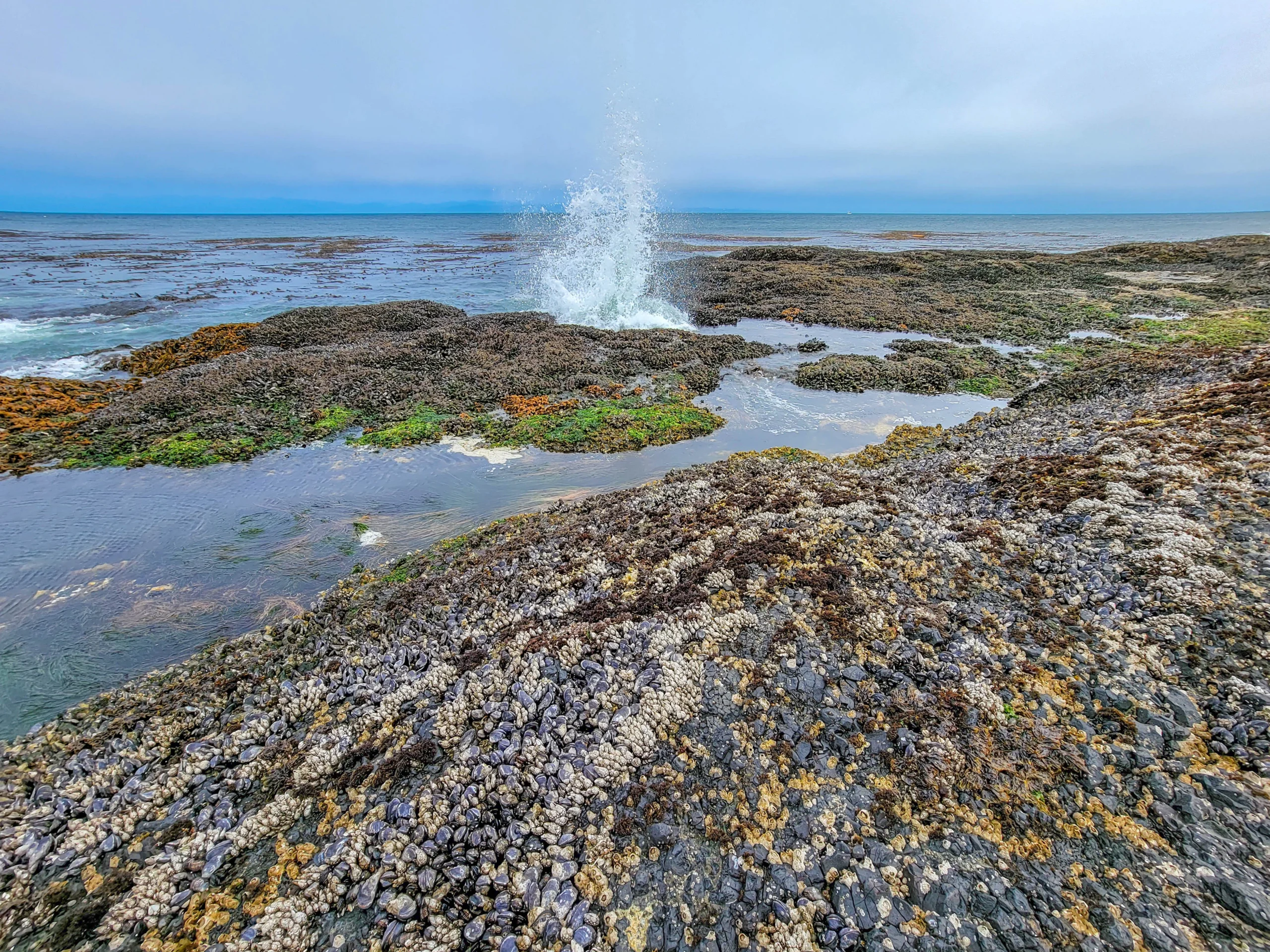
Salt Creek Tide Pools
Timing is everything here. Tidepooling needs a low tide, ideally +1 foot or lower, and there’s no signage telling you when that is.
Read the full guide: Salt Creek Recreation Area
Sequim and the Dungeness Spit
East of Port Angeles in the driest part of the peninsula. Dungeness Spit is the longest natural sand spit in the United States at 5.5 miles (8.9 km), still growing, with a lighthouse at the end and a national wildlife refuge along its length.
Sequim is also lavender country, a direct consequence of the rain shadow.
We didn’t stop here — details from official sources.
Port Townsend
A Victorian seaport at the northeast tip, with an intact nineteenth-century downtown, Fort Worden State Park, and ferry service to Whidbey Island. Often the driest place on the peninsula.
Not visited.
The East Side — Hood Canal
Hood Canal is a long glacial fjord separating the peninsula from the Kitsap Peninsula. Highway 101 runs its western shore, and the mountain drainages coming down to it hold a string of short, good waterfall hikes.
Rocky Brook and Murhut Falls
Two waterfalls about twelve miles apart near Brinnon. Rocky Brook is a 200-foot-plus horsetail fan at the end of a 200-yard walk on private land the owner permits people to cross. Murhut is a two-tier, 130-foot drop at the end of a 1.6-mile round trip in Olympic National Forest, with no pass required.

Murhut Falls
Current status: the Rocky Brook trail is closed for construction through summer 2026. Murhut is open.
Read the full guide: Rocky Brook and Murhut Falls
Also on Hood Canal
Dosewallips and Duckabush river valleys both run west into the park and national forest with longer trails. Lake Cushman and Staircase, at the southern end, give access to the park’s southeast corner.
The West Side — Rainforest and Coast
The part of the peninsula we didn’t reach, and the part most people picture when they think “Olympic.”
Hoh Rain Forest
The signature temperate rainforest, taking 140 to 170 inches (356–432 cm) of rain a year. Sitka spruce and western hemlock hung with club moss, with the Hall of Mosses (0.8 miles) and Spruce Nature Trail (1.2 miles) as the short walks. Reached by an 18-mile road off Highway 101.
The road and the parking are the constraint — the lot fills early in summer, and access has been affected by flooding in recent years. Check status before committing to the drive.
The Pacific Coast Strip
Olympic protects 73 miles of wild coastline, most of it roadless. Ruby Beach, Rialto Beach, and Second Beach are the accessible ones, with sea stacks, drift logs, and tidepools. Rialto’s Hole-in-the-Wall is a 3.3-mile round trip that needs a low tide.
Lake Quinault
The southwest corner, with a historic lodge, another rainforest valley, and several of the largest specimen trees in the country nearby.
Cape Flattery
The northwesternmost point of the contiguous United States, at the end of the peninsula on the Makah Reservation near Neah Bay. A short boardwalk trail leads to viewing platforms over sea caves and Tatoosh Island.
You need a Makah Recreation Pass — sold in Neah Bay, not at the trailhead. It’s tribal land, not park or forest, and it’s a separate permit from everything else on this list.
All four of these are from official sources — we didn’t get to the west side yet.
Best Short Hikes
| Trail | Area | Distance | Difficulty |
|---|---|---|---|
| Sol Duc Falls | Olympic NP | 1.6 mi (2.6 km) | Easy |
| Murhut Falls | Olympic NF | 1.6 mi (2.6 km) | Easy |
| Rocky Brook Falls | Private | 0.2 mi (0.3 km) | Very easy — currently closed |
| Hall of Mosses | Hoh | 0.8 mi (1.3 km) | Easy |
| Marymere Falls | Lake Crescent | 1.8 mi (2.9 km) | Easy |
| Hurricane Hill | Hurricane Ridge | 3.2 mi (5.1 km) | Moderate |
| Cape Flattery | Makah Reservation | 1.5 mi (2.4 km) | Easy |
| Striped Peak | Salt Creek | 5 mi (8 km) | Moderate |
Dogs are not permitted on most Olympic National Park trails. National forest and county park rules are more relaxed — another consequence of the four-agency patchwork.
Photography Notes
- Overcast is the default and it’s the right light for rainforest, waterfalls, and tidepools. Clear days are worse for most of what you came to shoot.
- A polarizer is the most useful thing in the bag — wet rock, tidepools, and foliage all benefit.
- The peninsula’s subjects want different lenses. Wide for forest and falls, long for the Strait and the ridgelines.
- Check the tide chart before any coastal shoot. It governs the beaches as completely as it governs Salt Creek.
- Fog burns off the Strait later than you’d expect. Hurricane Ridge can be clear while Port Angeles is gray, and vice versa.
Where to Base Yourself
- Port Angeles — the practical hub for the north side. Full services, ferry to Victoria, closest to Hurricane Ridge and Lake Crescent.
- Sequim — driest weather on the peninsula, quieter, good for a rain-shadow base.
- Port Townsend — the most appealing town, but a long way from the park’s west side.
- Forks — the west-side base for the Hoh and the beaches. Limited but functional.
- Lake Quinault — the southwest, with the historic lodge.
- Brinnon and Hoodsport — small, on Hood Canal, handy for the waterfalls and the east-side valleys.
Camping is widespread across the park, the national forest, and the state and county parks, but summer sites go early. Reserve through Recreation.gov for federal sites and the relevant county or state system for the rest.
Don’t Do What We Did
We camped on the Kitsap Peninsula, at Poulsbo — across Hood Canal, near the Bainbridge ferry. It’s a good spot with easy access to Seattle, and it is not on the Olympic Peninsula.
The arithmetic caught up with us fast. Poulsbo to the Hood Canal waterfalls is a comfortable hour. But, Poulsbo to Hurricane Ridge is closer to two and a half, each way. We spent one day driving five hours to see a visitor center and a lake, and by the end of the week the trip had turned into more windshield than trail.
If the park is what you came for, sleep west of Hood Canal. Port Angeles, Sequim, or a campground inside the park. The Kitsap side makes sense only if you’re splitting your time with Seattle — which we were, and it’s still the thing I’d change.
Know Before You Go
- The loop is bigger than it looks. Hurricane Ridge to the Hoh is over two hours by road. Don’t plan a day that crosses the peninsula.
- Four agencies, four pass systems. Park fee, Discover Pass, Makah Recreation Pass, and free county and forest sites. Work out which you need.
- Cell service is unreliable to nonexistent outside the towns. Download maps.
- Fill up in Port Angeles, Forks, or Hoodsport. Fuel is sparse in between.
- Fog and rain are the normal condition, and they’re what makes the place what it is. Pack for wet and you’ll enjoy it more.
- Check current road status before every leg. This is landslide, flood, and washout country, and the access roads close with little notice.
Is It Worth It?
The Olympic Peninsula is the most varied landscape you can reach in a single day’s driving anywhere in the United States. Glaciated alpine, temperate rainforest, and wild Pacific coast inside one park, plus a fjord, a rain shadow, and 73 roadless miles of shoreline.
The honest caveats are all about scale and weather. It’s a big loop and you will spend real time driving. Facilities are thin outside the towns. The Hurricane Ridge lodge is gone with no replacement. And it rains — a great deal, in most places, most of the year.
Give it three days minimum. Pick a side rather than trying to circle the whole thing in a weekend, and let the rain shadow decide which side that is.
For current conditions, closures, and fees, visit the National Park Service page for Olympic National Park.

0 Comments